Saint-Cyprien, Dordogne
Saint-Cyprien (French pronunciation: [sɛ̃ sipʁijɛ̃] ⓘ; Occitan: Sent Cibra) is a commune and town in Dordogne, New Aquitaine, southwestern France.
Saint-Cyprien | |
|---|---|
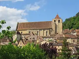 The church in Saint-Cyprien | |
.svg.png.webp) Coat of arms | |
Location of Saint-Cyprien | |
 Saint-Cyprien  Saint-Cyprien | |
| Coordinates: 44°52′14″N 1°02′40″E | |
| Country | France |
| Region | Nouvelle-Aquitaine |
| Department | Dordogne |
| Arrondissement | Sarlat-la-Canéda |
| Canton | Vallée Dordogne |
| Intercommunality | Vallée de la Dordogne et Forêt Bessède |
| Government | |
| • Mayor (2020–2026) | Christian Six[1] |
| Area 1 | 21.5 km2 (8.3 sq mi) |
| Population | 1,538 |
| • Density | 72/km2 (190/sq mi) |
| Time zone | UTC+01:00 (CET) |
| • Summer (DST) | UTC+02:00 (CEST) |
| INSEE/Postal code | 24396 /24220 |
| Elevation | 55–240 m (180–787 ft) (avg. 64 m or 210 ft) |
| 1 French Land Register data, which excludes lakes, ponds, glaciers > 1 km2 (0.386 sq mi or 247 acres) and river estuaries. | |
It serves as the seat of the canton of Vallée Dordogne. It is the most populous commune in the canton. Saint-Cyprien station has rail connections to Bordeaux, Périgueux and Sarlat-la-Canéda.
Population
| Year | Pop. | ±% |
|---|---|---|
| 1962 | 1,617 | — |
| 1968 | 1,649 | +2.0% |
| 1975 | 1,763 | +6.9% |
| 1982 | 1,708 | −3.1% |
| 1990 | 1,593 | −6.7% |
| 1999 | 1,522 | −4.5% |
| 2008 | 1,557 | +2.3% |
Personality
- Joséphine Baker was the godmother of Saint-Cyprien Athletic club "(SCAC) rugby
- Bertrand de Got (1264-1314), Archbishop of Bordeaux, future Pope Clement V, places the monastery of Saint-Cyprien under his jurisdiction.
References
- "Répertoire national des élus: les maires" (in French). data.gouv.fr, Plateforme ouverte des données publiques françaises. 13 September 2022.
- "Populations légales 2020". The National Institute of Statistics and Economic Studies. 29 December 2022.
External links
Wikimedia Commons has media related to Saint-Cyprien (Dordogne).
This article is issued from Wikipedia. The text is licensed under Creative Commons - Attribution - Sharealike. Additional terms may apply for the media files.