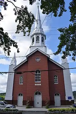
Saint-Léon-de-Standon, Quebec
Saint-Léon-de-Standon is a parish municipality of about 1,000 people in the Bellechasse Regional County Municipality in the Chaudière-Appalaches region of Quebec. The Etchemin River goes through the municipality.
Saint-Léon-de-Standon | |
|---|---|
 | |
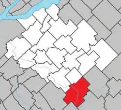 Location within Bellechasse RCM. | |
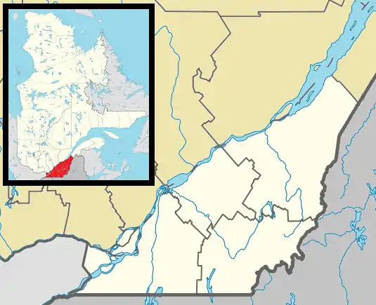 Saint-Léon-de-Standon Location in province of Quebec. | |
| Coordinates: 46°29′N 70°37′W[1] | |
| Country | |
| Province | |
| Region | Chaudière-Appalaches |
| RCM | Bellechasse |
| Constituted | January 1, 1874 |
| Government | |
| • Mayor | Bernard Morin |
| • Fed. riding | Lévis—Bellechasse |
| • Prov. riding | Bellechasse |
| Area | |
| • Total | 136.20 km2 (52.59 sq mi) |
| • Land | 136.88 km2 (52.85 sq mi) |
| There is an apparent contradiction between two authoritative sources | |
| Population (2021)[3] | |
| • Total | 1,042 |
| • Density | 7.6/km2 (20/sq mi) |
| • Pop 2016-2021 | |
| • Dwellings | 678 |
| Postal code(s) | |
| Area code(s) | 418 and 581 |
| Highways | |
| Website | https://www.st-leon-de-standon.com/ |
Demographics
In the 2021 Census of Population conducted by Statistics Canada, Saint-Léon-de-Standon had a population of 1,042 living in 543 of its 678 total private dwellings, a change of -7.5% from its 2016 population of 1,127. With a land area of 136.88 km2 (52.85 sq mi), it had a population density of 7.6/km2 (19.7/sq mi) in 2021.[4]
See also
References
- "Reference number 57071 in Banque de noms de lieux du Québec". toponymie.gouv.qc.ca (in French). Commission de toponymie du Québec.
- "Geographic code 19020 in the official Répertoire des municipalités". www.mamh.gouv.qc.ca (in French). Ministère des Affaires municipales et de l'Habitation.
- https://www12.statcan.gc.ca/census-recensement/2021/dp-pd/prof/details/page.cfm?Lang=E&SearchText=Saint%2Dleon%2Dde%2Dstandon&GENDERlist=1&STATISTIClist=1,4&DGUIDlist=2021A00052419020&HEADERlist=0
- "Population and dwelling counts: Canada, provinces and territories, and census subdivisions (municipalities), Quebec". Statistics Canada. February 9, 2022. Retrieved August 29, 2022.
Places adjacent to Saint-Léon-de-Standon, Quebec | |
|---|---|
| Municipalities | |
|---|---|
| Parishes | |
| |
This article is issued from Wikipedia. The text is licensed under Creative Commons - Attribution - Sharealike. Additional terms may apply for the media files.