St Andrews, Hamilton
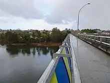
St Andrews is a suburb in north-western Hamilton in New Zealand.[3] One of its main features is an 18-hole golf course[4] built on an old flood plain on the west bank of the Waikato River. This area was regularly flooded before the construction of the Karapiro HEP dam further up river.
St Andrews | |
|---|---|
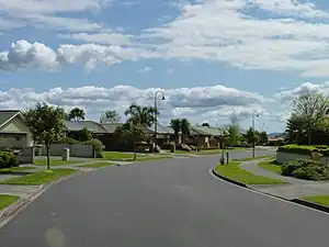 A neighbourhood in St Andrews, Hamilton | |
| Coordinates: 37°45′8.31″S 175°15′19.7″E | |
| Country | New Zealand |
| City | Hamilton, New Zealand |
| Local authority | Hamilton City Council |
| Electoral ward | West Ward |
| Area | |
| • Land | 260 ha (640 acres) |
| Population (June 2022)[2] | |
| • Total | 5,550 |
| Pukete | Flagstaff | Harrowfield |
| Te Rapa |
|
Queenwood |
| Forest Lake | Beerescourt | Chartwell |
Demographics
Saint Andrews covers 2.60 km2 (1.00 sq mi)[1] and had an estimated population of 5,550 as of June 2022,[2] with a population density of 2,135 people per km2.
| Year | Pop. | ±% p.a. |
|---|---|---|
| 2006 | 5,151 | — |
| 2013 | 4,995 | −0.44% |
| 2018 | 5,361 | +1.42% |
| Source: [5] | ||
Saint Andrews had a population of 5,361 at the 2018 New Zealand census, an increase of 366 people (7.3%) since the 2013 census, and an increase of 210 people (4.1%) since the 2006 census. There were 1,929 households, comprising 2,562 males and 2,796 females, giving a sex ratio of 0.92 males per female, with 1,119 people (20.9%) aged under 15 years, 1,071 (20.0%) aged 15 to 29, 2,304 (43.0%) aged 30 to 64, and 870 (16.2%) aged 65 or older.
Ethnicities were 73.5% European/Pākehā, 23.3% Māori, 5.0% Pacific peoples, 11.1% Asian, and 2.4% other ethnicities. People may identify with more than one ethnicity.
The percentage of people born overseas was 19.4, compared with 27.1% nationally.
Although some people chose not to answer the census's question about religious affiliation, 49.9% had no religion, 35.5% were Christian, 1.2% had Māori religious beliefs, 2.7% were Hindu, 0.6% were Muslim, 0.9% were Buddhist and 1.8% had other religions.
Of those at least 15 years old, 861 (20.3%) people had a bachelor's or higher degree, and 771 (18.2%) people had no formal qualifications. 705 people (16.6%) earned over $70,000 compared to 17.2% nationally. The employment status of those at least 15 was that 2,190 (51.6%) people were employed full-time, 519 (12.2%) were part-time, and 204 (4.8%) were unemployed.[5]
| Name | Area (km2) | Population | Density (per km2) | Households | Median age | Median income |
|---|---|---|---|---|---|---|
| Saint Andrews West | 1.01 | 2,880 | 2,851 | 945 | 31.8 years | $31,300[6] |
| Saint Andrews East | 1.59 | 2,481 | 1,560 | 984 | 42.8 years | $39,200[7] |
| New Zealand | 37.4 years | $31,800 |
Education
Hamilton Junior High School is a school catering for years 7–10. It has 103 students.[8]
Hamilton North School is a special school catering for students with intellectual disabilities. It has 165 students.[9]
Both these schools are coeducational. Rolls are as of April 2023.[10]
References
- "ArcGIS Web Application". statsnz.maps.arcgis.com. Retrieved 14 October 2022.
- "Population estimate tables - NZ.Stat". Statistics New Zealand. Retrieved 25 October 2022.
- "Hamilton Map". Hamilton City Council. Archived from the original on 23 September 2010. Retrieved 18 September 2010.
- Investigation continues into tracing Waikato River foam
- "Statistical area 1 dataset for 2018 Census". Statistics New Zealand. March 2020. Saint Andrews West (176400) and Saint Andrews East (176500).
- 2018 Census place summary: Saint Andrews West
- 2018 Census place summary: Saint Andrews East
- Education Counts: Hamilton Junior High School
- Education Counts: Hamilton North School
- "New Zealand Schools Directory". New Zealand Ministry of Education. Retrieved 12 December 2022.