Sajek Valley
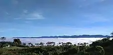
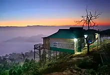
Sajek Valley is one of the most popular tourist spots in Bangladesh situated among the hills of the Kasalong range of mountains in Sajek union, Baghaichhari Upazila in Rangamati District.[3] The valley is 2,000 feet (610 m) above sea level.[4] Sajek Valley is known as the Queen of Hills & Roof of Rangamati.
Sajek Tripuri Valley
সাজেক ত্রিপুরী উপত্যকা | |
|---|---|
| Sajek Union Parishad | |
   From top: Sajek Valley View Sunrise from Konglak Hill Konglak Hill View from Helipad | |
| Nickname: রাঙামাটির ছাদ (Roof of Rangamati)[1] | |
| Coordinates: 23°38.1′N 92°29.4′E | |
| Country | Bangladesh |
| District | Rangamati District |
| Upazilla | Baghaichhari |
| Settlement | 1885 CE[2] |
Origin of name
The name of Sajek Valley came from the Sajek River that originates from Karnafuli river. The Sajek river works as a border between Bangladesh and India.[5]
Location
Sajek is a union located in the north of Chittagong Hill Tracts. It's under Baghaichori Upazila in Rangamati hill district, it is situated 67 kilometres (42 mi) north-east from Khagrachhari town and 95 kilometres (59 mi) north from Rangamati city. The border of Bangladesh and Mizoram of India is 8 kilometres (5.0 mi) east from Sajek.[3]
Nature
Sajek valley is known for its natural environment and is surrounded by mountains, dense forest, and grassland hill tracks. Many small rivers flow through the mountains among which the Kachalong and the Machalong are notable. On the way to Sajek valley, one has to cross the Mayni range and the Mayni river. The road to Sajek has high peaks and falls.[3]
People and culture
The native people of Sajek valley are ethnic minorities. Among them Chakma, Marma, Tripuri, Pankho, Kaibarta, Lushai and other indigenous communities are mentionable. Women seem to be more involved in economic activities here. Tea stalls, food joints and roadside marketplaces are dominated by women. Picking fruits and vegetables early in the morning is a common trade here. They are not fluent in Bengali, but the young population speak some English.[5]
Gallery
.jpg.webp) Sajek, Rangamati
Sajek, Rangamati Chander Gari
 Sajek at Night
 View from Sajek, Rangamati
 Runmoy resort at Sajek Valley
 A resort at Sajek Valley
 Konglak Hill
 View from Sajek Valley
 Sunrise from Konglak Hill or Konglak Haphong
 Road from Baghaichhari to Sajek Valley
 Sajek River
 View from Helipad
 View of Konglak Hill or Konglak Haphong
 Helipad
 View of Sajek Valley
 View of Konglak Hill
 Sajek Valley from Konglak Hill
 Sunrise from Helipad