San Pedro Valley
The San Pedro Valley of western Cochise County, Arizona, is a 50-mile-long (80 km), mostly north–south valley, trending northwesterly. The San Pedro River drains from the state of Sonora, Mexico, through Benson, Arizona, and the southeast of the Rincon Mountains.[1][2][3]
| San Pedro Valley | |
|---|---|
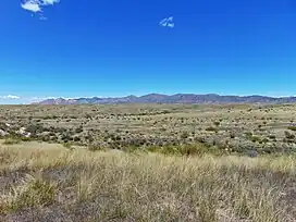 Prairie in the San Pedro Valley near Tombstone, Arizona. The Dragoon Mountains are in the background. | |
 San Pedro Valley | |
| Length | 50 mi (80 km) |
| Geography | |
| Country | United States, Mexico |
| State | Arizona, Sonora |
| Communities | |
| Borders on | |
| Coordinates | 31°38′9″N 110°10′21″W |
| River | San Pedro River |
The coordinates for Charleston, Arizona, south center of the valley are 31°38′9″N 110°10′21″W.[4][5][6]
References
- San Pedro Valley blm.gov
- "Depth to Bedrock in the Upper San Pedro Valley, Cochise County, southeastern Arizona". pubs.usgs.gov.
- "San Pedro River". The Nature Conservancy.
- U.S. Geological Survey Geographic Names Information System: Charleston (historical)
- Sherman, James E.; Barbara H. Sherman (1969). "Charleston". Ghost Towns of Arizona (First ed.). University of Oklahoma Press. pp. 26–29. ISBN 0806108436. Retrieved 2009-07-15.
- Varney, Philip (2005). "Tombstone Territory Ghosts". In Stieve, Robert (ed.). Arizona Ghost Towns and Mining Camps: A Travel Guide to History (10th ed.). Phoenix: Arizona Highways Books. p. 124. ISBN 1932082468.
This article is issued from Wikipedia. The text is licensed under Creative Commons - Attribution - Sharealike. Additional terms may apply for the media files.