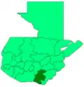
Cuilapa
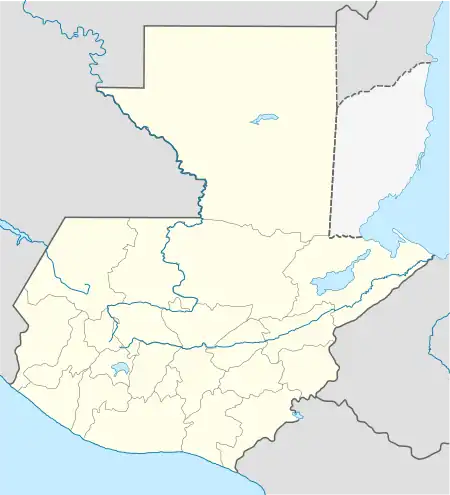
Cuilapa, also known as Santa Rosa Cuilapa, is a town, with a population of 41,359 (2018 census),[3] in Guatemala. It serves as the capital of the department of Santa Rosa and as the administrative seat for the surrounding municipality of Cuilapa.[4]
Cuilapa | |
|---|---|
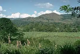 Cuilapa-Barbarena volcanic field | |
 Cuilapa Location in Guatemala 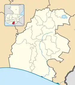 Cuilapa Cuilapa (Santa Rosa Department) | |
| Coordinates: 14°17′N 90°18′W | |
| Country | |
| Department | |
| Government | |
| • Mayor (2016-2020) | Esvin Fernando Marroquín Túpas |
| Area | |
| • Total | 72 sq mi (187 km2) |
| Population (2018 census)[2] | |
| • Total | 41,359 |
| • Density | 570/sq mi (220/km2) |
| Climate | Aw |
Cuilapa marks the geographic center of the Americas.[5]
History
1913 earthquake
On Saturday 8 March 1913, an magnitude 6.4 earthquake hit Santa Rosa, destroying its department capital, Cuilapa.[6] Both the initial quake and the aftershocks destroyed a lot of private homes, and also the cathedral and the prison, leaving behind significant human losses; similar destruction occurred at Barberena, Cerro Redondo, Llano Grande and El Zapote.[6] Fraijanes, Pueblo Nuevo Viñas, Coatepeque and Jalpatagua were also affected.[6] Around Cuilapa, there were landslides and road blockades, and even a long crack was reported at Los Esclavos hill.[6]
Climate
Cuilapa has a tropical savanna climate (Köppen: Aw).
| Climate data for Amatitlán | |||||||||||||
|---|---|---|---|---|---|---|---|---|---|---|---|---|---|
| Month | Jan | Feb | Mar | Apr | May | Jun | Jul | Aug | Sep | Oct | Nov | Dec | Year |
| Average high °C (°F) | 28.4 (83.1) |
28.8 (83.8) |
29.8 (85.6) |
29.7 (85.5) |
29.3 (84.7) |
28.2 (82.8) |
29.0 (84.2) |
28.7 (83.7) |
28.0 (82.4) |
28.0 (82.4) |
27.9 (82.2) |
27.8 (82.0) |
28.6 (83.5) |
| Daily mean °C (°F) | 22.7 (72.9) |
22.9 (73.2) |
23.9 (75.0) |
24.3 (75.7) |
24.4 (75.9) |
23.9 (75.0) |
24.3 (75.7) |
24.1 (75.4) |
23.7 (74.7) |
23.3 (73.9) |
22.9 (73.2) |
22.5 (72.5) |
23.6 (74.4) |
| Average low °C (°F) | 17.0 (62.6) |
17.1 (62.8) |
18.0 (64.4) |
19.0 (66.2) |
19.5 (67.1) |
19.6 (67.3) |
19.6 (67.3) |
19.5 (67.1) |
19.4 (66.9) |
18.7 (65.7) |
17.9 (64.2) |
17.2 (63.0) |
18.5 (65.4) |
| Average rainfall mm (inches) | 2 (0.1) |
3 (0.1) |
11 (0.4) |
50 (2.0) |
226 (8.9) |
374 (14.7) |
302 (11.9) |
287 (11.3) |
353 (13.9) |
255 (10.0) |
61 (2.4) |
8 (0.3) |
1,932 (76) |
| Source: Climate-Data.org[7] | |||||||||||||
Geographic location
Cuilapa is surrounded by Santa Rosa Department municipalities, except by East where it borders Jutiapa:[8]
Places adjacent to Cuilapa | ||||||||||||||||
|---|---|---|---|---|---|---|---|---|---|---|---|---|---|---|---|---|
| ||||||||||||||||
Notes and references
References
- "Alcaldes electos en el departamento de Santa Rosa". Municipalidades de Guatemala (in Spanish). Guatemala. 7 September 2015. Archived from the original on October 30, 2015. Retrieved 30 October 2015.
- Citypopulation.de Population of departments and municipalities in Guatemala
- Citypopulation.de Population of cities & towns in Guatemala
- Escalante Herrera 2007.
- "Viaje a Guatemala". Prensa Libre. Guatemala. Archived from the original on 29 July 2012. Retrieved 30 October 2015.
- Ambraseys & Adams 2001, pp. 72–73
- "Climate: Cuilapa". Climate-Data.org. Retrieved 21 August 2015.
- "Municipios del departamento de Santa Rosa". SEGEPLAN (in Spanish). Guatemala. Archived from the original on July 7, 2015. Retrieved 30 October 2015.
Bibliography
- Ambraseys, Nicholas; Adams, Robin A. (2001). The Seismicity of Central America; a descriptive catalogue 1898-1995. World Scientific. p. 309. ISBN 9781860942440.
- Escalante Herrera, Marco Antonio (2007). "Breve información del municipio de Cuilapa". Pbase (in Spanish). Guatemala. Archived from the original on February 2, 2009. Retrieved 30 October 2015.