Santpoort-Noord
Santpoort-Noord (Dutch pronunciation: [sɑntpoːrt noːrt]) or North Santpoort is a village in the municipality of Velsen in the Dutch province of North Holland. It lies about 6 km (3.7 mi) north of Haarlem.
Santpoort-Noord | |
|---|---|
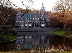 Castle Duin and Kruidberg | |
 Santpoort-Noord Location in the Netherlands 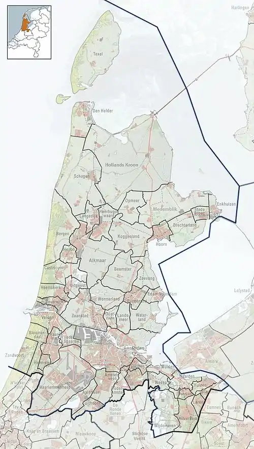 Santpoort-Noord Location in the province of North Holland in the Netherlands | |
| Coordinates: 52°25′21″N 4°37′34″E | |
| Country | Netherlands |
| Province | North Holland |
| Municipality | Velsen |
| Area | |
| • Total | 7.03 km2 (2.71 sq mi) |
| Elevation | 1.2 m (3.9 ft) |
| Population (2021)[1] | |
| • Total | 7,240 |
| • Density | 1,000/km2 (2,700/sq mi) |
| Time zone | UTC+1 (CET) |
| • Summer (DST) | UTC+2 (CEST) |
| Postal code | 2071[1] |
| Dialing code | 023 |
Santpoort developed in the dunes near the Brederode Castle. In 1870, a flower bulb settlement developed near Santpoort. In 1926, the settlement was divided in Santpoort-Noord and Santpoort-Zuid. Santpoort became a commuter's town in the 20th century.[3]
Railway station
In 1957, Santpoort Noord railway station opened on the Haarlem to Uitgeest railway line. Between 1953 and 1983, there was also a railway line to IJmuiden.[4]
References
- "Kerncijfers wijken en buurten 2021". Central Bureau of Statistics. Retrieved 2 May 2022.
- "Postcodetool for 2071AD". Actueel Hoogtebestand Nederland (in Dutch). Het Waterschapshuis. Retrieved 2 May 2022.
- Ronald Stenvert & Saskia van Ginkel-Meester (2006). "Santpoort-Noord" (in Dutch). Zwolle: Waanders. Retrieved 2 May 2022.
- "station Santpoort Noord". Stationsweb (in Dutch). Retrieved 2 May 2022.
External links
 Media related to Santpoort-Noord at Wikimedia Commons
This article is issued from Wikipedia. The text is licensed under Creative Commons - Attribution - Sharealike. Additional terms may apply for the media files.