Sapahar Upazila
Sapahar (Bengali: সাপাহার) is an upazila of Naogaon District[1] in the Division of Rajshahi, Bangladesh.
Sapahar Upazila
সাপাহার | |
|---|---|
 Sapahar Upazila Location in Bangladesh | |
| Coordinates: 25°7.5′N 88°34.9′E | |
| Country | |
| Division | Rajshahi Division |
| District | Naogaon District |
| Government | |
| • Chairman | Shahjahan Mandal |
| Area | |
| • Upazila | 244.49 km2 (94.40 sq mi) |
| • Metro | 8.3 km2 (3.2 sq mi) |
| Population (2011 census) | |
| • Upazila | 161,791 |
| • Density | 660/km2 (1,700/sq mi) |
| Time zone | UTC+6 (BST) |
| Postal code | 6560 |
| Website | Official Map of Sapahar |
Geography
_Bangladesh.svg.png.webp)
Sapahar is located at 25.1250°N 88.5819°E. It has 19,770 house holds and total area 244.49 km2.
Sapahar Upazila is bounded by Tapan CD Block in Dakshin Dinajpur district, West Bengal, India, on the north, Patnitala Upazila on the east, Porsha Upazila on the south, and Bamangola CD Block, in Malda district, West Bengal, on the west.[1][2][3] Main river Punarbhaba at Patari village and Jabai Beel are notable.
Demographics
According to 2011 Bangladesh census, Sapahar had a population of 161,792. Males constituted 50.25% of the population and females 49.75%. Muslims formed 93.26% of the population, Hindus 4.87%, Christians 0.46% and others 1.42%. Sapahar had a literacy rate of 42.19% for the population 7 years and above.[4]
Economy
Most of the people of the Sapahar Upazila depends on agriculture for a living. The main corps are paddy, wheat, mustard, and vegetables.[1]
Points of interest
- Jobay Beel
Administration
Sapahar Thana was formed in 1979. It was turned into an upazila in 1985.[1]
The Upazila is divided into six [union parishad]]s: Aihai, Goala, Pathari, Sapahar, Shiranti, and Tilna. The union parishads are subdivided into 151 mauzas and 232 villages.[5]
Town profile
Sapahar Sadar Town covers an area of 8.4 square kilometres (3.2 sq mi).[1] The town area consists of ward no. 1, 2, 4 and partially 3. According to the census of 2011, It has a population of 12696. About 2924 households are situated here.
Education
Tertiary educational institutions in Sapahar include:
- Sapahar Government College
- Chowdhury Chan Mohammad Women College
- Bhioil Degree College
- Tilna Degree College
- Dighirhat Degree College
- Sapahar Technical And Business Management College
High schools
- Al-Helal Islami Academy & College, Sapahar, Naogaon
- Sapahar Pilot High School, Naogaon
- Sapahar Govt. Girls High School
- Zaman Nagor Girls High School
- Dangapara High School
- Shironty Moinakuri High School
- Tilna ML High School
- Tilna Girls High School
- Jobay High School
- Aihai High School
- Tiloni-Patari High School
- Mirapara High School
- Bhioil High School
- Kalmudanga High School
- Goala High School
- Nischinta Pur High School
- Khottapara High School
- Koch Kurulia High School
- Teghoria B.L High School
- Tatoir Bakharpur High School
- Asharanda High School
- Chalkgopal High School
Gallery
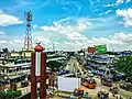 জিরো পয়েন্ট
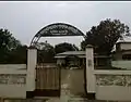 Public Library
 Academic Building
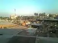 Town area
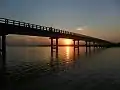 Jobay Bridge
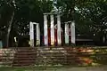 Upazila Chattar Shaheed Minar
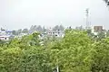 Sapahar Town
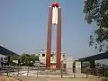 Central Liberation War Monument
References
- Md. Mukhlesur Rahman (2012). "Sapahar Upazila". In Sirajul Islam and Ahmed A. Jamal (ed.). Banglapedia: National Encyclopedia of Bangladesh (Second ed.). Asiatic Society of Bangladesh.
- "Tehsil Map of Dakshin Dinajpur". CD Block/ Tehsil. Maps of India. Retrieved 15 November 2018.
- "Tehsil Map of Maldah". CD Block/ Tehsil. Maps of India. Retrieved 15 November 2018.
- "Bangladesh Population and Housing Census 2011: Zila Report – Nagaon" (PDF). Table P01 : Household and Population by Sex and Residence, Table P05 : Population by Religion, Age group and Residence, Table P09 : Literacy of Population 7 Years & Above by Religion, Sex and Residence. Bangladesh Bureau of Statistics (BBS), Ministry of Planning, Government of the People’s Republic of Bangladesh. Retrieved 9 December 2018.
- "District Statistics 2011: Naogaon" (PDF). Bangladesh Bureau of Statistics. Archived from the original (PDF) on 13 November 2014. Retrieved 14 July 2014.
Capital: Naogaon | ||
| Upazilas | ||
| Constituencies | ||
| Attractions and sites | ||
| History | ||
| Inhabited areas | ||
| Rivers and transport | ||
| Educational institutions |
| |
