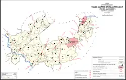
Sarojaninagar
Sarojaninagar, also spelled Sarojini Nagar, is a community development block in Lucknow district, Uttar Pradesh, India.[1] It is part of the tehsil of Lucknow and it includes 90 villages.[1] As of 2011, its population was 224,045, in 40,923 households.[1]
Sarojaninagar is also the name of two wards of Lucknow, together making up 32 mohallas of the city.[2]
Demographics
As of 2011, the sex ratio of Sarojaninagar block is 903 females for every 1000 males, with 53% of block residents (117,745) being male and 47% (106,300) being female.[1] The sex ratio in the 0-6 age group was 920.[1] Members of scheduled castes made up 37.2% of the Sarojaninagar block population, and members of scheduled tribes made up 0.11%.[1] The literacy rate of Sarojaninagar block in 2011 was 73.0% (81.1% among males and 64.1% among females).[1]
In 2011, Sarojaninagar block's workforce consisted of 74,661 people (33.3% of the overall block population).[1] More men (59,508, or 50.5%) were workers than women (15,153, or 14.3%).[1] A plurality of workers were employed in agriculture — 23.53% were cultivators who owned or leased their own land, and another 26.26% were agricultural labourers who worked someone else's land for wages.[1] A further 6.25% were household industry workers, and the remaining 43.96% were other workers.[1]
Demographic history
The 1961 census recorded Sarojininagar block as having a total population of 107,880 people (57,375 male and 50,505 female), in 22,327 households and 22,022 physical houses.[3]
The 1981 census recorded Sarojininagar as the most heavily industrialised of Lucknow district's development blocks, with 56 registered industrial firms.[4] At the time, it comprised 106 villages, including 94 gram sabhas and 13 nyaya panchayats.[4]
Land use
Sarojaninagar block covers an area of 30,526.9 hectares, of which 58.2% (17,770.8 hectares, not counting fallow land) is farmland as of 2011.[1] Most of this farmland is irrigated: 16,054.8 hectares, or 90.3% as of the same year.[1] Irrigation is mostly by tanks or lakes.[1] Areas under non-agricultural use made up 3,537.4 hectares as of 2011, or about 11.6% of the total land area.[1] Land considered barren and unsuitable for cultivation covered 1219 hectares.[1] As of 2011, 1,027 hectares in this block are covered by forests.[1]
Villages
Sarojaninagar block comprises the following 90 villages:[1]
| Village name | Total land area (hectares) | Population (in 2011) |
|---|---|---|
| Maunda | 588.4 | 4,987 |
| Dhighiya | 190.6 | 1,457 |
| Sadrauna | 402.6 | 3,886 |
| Pyare Pur | 184.2 | 1,912 |
| Kaliya Khera | 164.9 | 1,453 |
| Alinagar Sonhara | 503.4 | 588 |
| Anora | 338.1 | 1,511 |
| Samda Khera | 142.5 | 952 |
| Palenhada | 293.6 | 1,240 |
| Behta | 462.4 | 3,638 |
| Khurrampur | 156.2 | 1,420 |
| Chakoli | 317.8 | 1,942 |
| Andhpur Umrao | 83.7 | 684 |
| Piparsand | 1,298.6 | 4,336 |
| Lonha | 612 | 3,365 |
| Bhadoi | 243.2 | 1,573 |
| Mavaipadhiyana | 326.2 | 2,565 |
| Amavan | 827.6 | 2,301 |
| Ramdas Pur | 156 | 941 |
| Sahijanpur | 462 | 1,858 |
| Godoli | 322.2 | 1,789 |
| Ain | 976.6 | 5,052 |
| Nanmau | 210.7 | 1,746 |
| Sadulla Nagar | 223.4 | 1,918 |
| Terwa | 285.6 | 2,180 |
| Narainpur | 304.5 | 2,596 |
| Darab Nagar | 166.6 | 1,161 |
| Saidpur Puhri | 199.2 | 1,178 |
| Haroni | 282.8 | 2,446 |
| Hulas Khera | 121.4 | 462 |
| Bhatgoan Pande | 122.7 | 787 |
| Mirzapur Lutova | 92.3 | 386 |
| Bahdanamau | 40.8 | 350 |
| Rahimnagar Padhiyana | 1,020 | 7,851 |
| Latif Nagar | 302.8 | 3,263 |
| Bhat Goan | 981.3 | 7,131 |
| Garhi Chunoti | 424.5 | 3,817 |
| Andhpurdev | 260.5 | 1,096 |
| Aorava | 243.9 | 1,604 |
| Ramchora | 250.4 | 2,258 |
| Dadoopur | 125.9 | 1,406 |
| Khandedev | 527.6 | 3,639 |
| Bhokapur | 248.6 | 1,081 |
| Benti | 636.2 | 4,520 |
| Sarai Sahjadi | 252.9 | 2,328 |
| Bani | 183.5 | 1,741 |
| Pahar Pur | 182.3 | 2,050 |
| Banthra Sikander Pur | 703.8 | 10,989 |
| Miranpur Pinvat | 304.7 | 4,656 |
| Natkur | 679.8 | 5,091 |
| Bijnor | 751.6 | 14,105 |
| Rasoolpur Iduria | 131.2 | 536 |
| Alinagar Khurd | 127.8 | 772 |
| Ashraf Nagar | 258.4 | 2,202 |
| Ahmadpur Urf Kamlapur | 122.9 | 1,272 |
| Noorpur Bhadarsa | 327 | 1,204 |
| Chandraval | 242.4 | 2,057 |
| Saraiya | 144.8 | 932 |
| Shahpur Majhgaon | 131.6 | 782 |
| Kuroni | 725.2 | 4,640 |
| Jahanabad | 43.9 | 454 |
| Kishunpur Kodia | 151.1 | 1,749 |
| Khasarwara | 178.2 | 1,314 |
| Dhawapur Khasarwara | 107.7 | 846 |
| Bibipur | 292.9 | 1,963 |
| Memora | 194.2 | 2,842 |
| Neeva | 518.5 | 2,679 |
| Khatola | 470.2 | 1,280 |
| Makhdoompur Kaithi | 342 | 1,405 |
| Ratoli | 161.5 | 924 |
| Bhagu Khera | 177.8 | 1,160 |
| Jaitikhera | 565.2 | 2,806 |
| Mati | 1,172.3 | 5,833 |
| Parvar Pashchim | 921 | 5,341 |
| Parvar Poorab | 481.1 | 2,280 |
| Kalli Poorab | 312.6 | 2,963 |
| Birura | 139.5 | 827 |
| Baraulikhalilabad | 167.2 | 1,531 |
| Sevai | 248.3 | 2,665 |
| Devamau | 61.4 | 983 |
| Gusval Kala | 122.5 | 1,197 |
| Malak | 84.8 | 3,627 |
| Harihar Pur | 284.3 | 3,668 |
| Muzaffar Nagar Ghusval | 224.4 | 1,497 |
| Ardonamau | 203.2 | 922 |
| Ahmamau | 444.2 | 3,427 |
| Yusufnagar | 124.4 | 1,392 |
| Hasanpur Khevali | 210.9 | 2,338 |
| Nijampur Majhigaon | 210.5 | 2,210 |
| Barauna | 516.7 | 4,329 |
References
- "Census of India 2011: Uttar Pradesh District Census Handbook - Lucknow, Part A (Village and Town Directory)". Census 2011 India. pp. 30–63, 166–183. Retrieved 19 April 2021.
- "Ward_suchna_english" (PDF). Lucknow Municipal Corporation. Retrieved 16 June 2021.
- Census 1961: District Census Handbook, Uttar Pradesh (38 - Lucknow District) (PDF). Lucknow. 1963. pp. L-Li of section "Lucknow Tehsil". Retrieved 16 June 2021.
{{cite book}}: CS1 maint: location missing publisher (link) - Census 1981 Uttar Pradesh: District Census Handbook Part XIII-A: Village & Town Directory, District Lucknow (PDF). 1982. pp. 4, 6. Retrieved 16 June 2021.