Saroma, Hokkaido
Saroma (佐呂間町, Saroma-chō) is a town in the Okhotsk Subprefecture, Hokkaido, Japan.
Saroma
佐呂間町 | |
|---|---|
Town | |
 Saroma Town Hall | |
 Flag  Seal | |
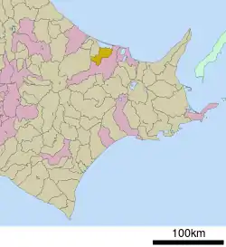
 Location of Saroma in Hokkaido (Okhotsk Subprefecture) | |
 Saroma Location in Japan | |
| Coordinates: 44°00′58″N 143°46′46″E | |
| Country | Japan |
| Region | Hokkaido |
| Prefecture | Hokkaido (Okhotsk Subprefecture) |
| District | Tokoro |
| Government | |
| • Mayor | Akio Kawane |
| Area | |
| • Total | 404.99 km2 (156.37 sq mi) |
| Population (January, 2013) | |
| • Total | 5,617 |
| • Density | 14/km2 (36/sq mi) |
| Time zone | UTC+09:00 (JST) |
| City hall address | 3-1, Eidai-chō, Saroma-chō, Tokoro-gun, Hokkaidō 093-0502 |
| Climate | Dfb |
| Website | www |
| Symbols | |
| Flower | Rhododendron dauricum (Purple Azalea) |
| Mascot | Soluckky (そらっきー) |
| Tree | Tilia maximowicziana Shirasawa (Linden) |
The name comes from the Ainu place name Saro-oma-pet, meaning place of many miscanthus reeds.[1]
As of January, 2013, the town has a population of 5,617 and a population density of 14 persons per km². The total area is 404.99 km².
History
Saroma was established in 1894 as part of the Japanese expansion into Hokkaido. The first permanent Japanese settler was Jingorou Suzuki, who homesteaded near present-day Hamasaroma, on Saroma Lake. The following decade saw the establishment of a city hall, a railroad, agricultural zoning, and the building of roads. In 1914, the Saroma area was established as Tofutsu Village. The name changed the next year to Saroma Village.
In the early Shōwa period (1930s), additional railroad connections were built to Saroma and several hundred households moved to the area. In 1948, Saroma High School was opened as a night school. 1953 saw Saroma become an official town, with the establishment of a town song and official seal. In 1955, the population reached 15,656.[2] The following year, Saroma merged with neighboring Wakasa Village.
The 1960s and 70s saw greater development in Saroma, with the beginning of full-time operation at Saroma High School in 1962 and construction of a proper road over Rukushi Pass to Kitami in 1968. In 1972, the Morinaga Corporation opened a butter factory in central Saroma. The population in 1975 was 9,307.
In 1980, Saroma and the city of Palmer, Alaska became official sister cities. With the privatization of Japan Railways in 1987, the Yūmō Line through Saroma was closed, and replaced with a bus service paralleling the former train routes. The following year the Saroma Tunnel was opened through Rukushi pass, allowing year-round access to the nearby city of Kitami. 1994 marked the 100th anniversary of the town, which was celebrated with the building of a memorial park and park golf course.
On November 7, 2006, a tornado struck the town, killing nine people and injuring twenty-six more.[3]. Floods also hit the town the same year, causing widespread damage but no injuries. Saroma gained easier access to neighboring communities with a new tunnel to Engaru completed in 2002, and in 2009 with the 4.1 km New Saroma Tunnel to Kitami.
Climate
The areas of the town near Lake Saroma do not experience a large temperature range compared to inland areas, which have colder winters and hotter summers.
| Saroma Town | ||||||||||||||||||||||||||||||||||||||||||||||||||||||||||||
|---|---|---|---|---|---|---|---|---|---|---|---|---|---|---|---|---|---|---|---|---|---|---|---|---|---|---|---|---|---|---|---|---|---|---|---|---|---|---|---|---|---|---|---|---|---|---|---|---|---|---|---|---|---|---|---|---|---|---|---|---|
| Climate chart (explanation) | ||||||||||||||||||||||||||||||||||||||||||||||||||||||||||||
| ||||||||||||||||||||||||||||||||||||||||||||||||||||||||||||
| ||||||||||||||||||||||||||||||||||||||||||||||||||||||||||||
| Climate data for Saroma, 1991–2020 normals, extremes 1976–present | |||||||||||||
|---|---|---|---|---|---|---|---|---|---|---|---|---|---|
| Month | Jan | Feb | Mar | Apr | May | Jun | Jul | Aug | Sep | Oct | Nov | Dec | Year |
| Record high °C (°F) | 9.9 (49.8) |
11.7 (53.1) |
17.1 (62.8) |
30.9 (87.6) |
39.5 (103.1) |
34.4 (93.9) |
36.7 (98.1) |
36.8 (98.2) |
33.4 (92.1) |
28.2 (82.8) |
22.0 (71.6) |
16.2 (61.2) |
39.5 (103.1) |
| Average high °C (°F) | −2.6 (27.3) |
−2.2 (28.0) |
2.5 (36.5) |
10.2 (50.4) |
16.9 (62.4) |
20.2 (68.4) |
23.9 (75.0) |
24.9 (76.8) |
21.6 (70.9) |
15.3 (59.5) |
7.5 (45.5) |
0.1 (32.2) |
11.5 (52.7) |
| Daily mean °C (°F) | −8.5 (16.7) |
−8.4 (16.9) |
−2.9 (26.8) |
4.2 (39.6) |
10.3 (50.5) |
14.2 (57.6) |
18.2 (64.8) |
19.4 (66.9) |
15.6 (60.1) |
9.0 (48.2) |
2.1 (35.8) |
−5.4 (22.3) |
5.6 (42.2) |
| Average low °C (°F) | −15.6 (3.9) |
−16.3 (2.7) |
−9.5 (14.9) |
−1.8 (28.8) |
3.8 (38.8) |
8.9 (48.0) |
13.6 (56.5) |
14.8 (58.6) |
10.1 (50.2) |
2.9 (37.2) |
−3.2 (26.2) |
−11.7 (10.9) |
−0.3 (31.4) |
| Record low °C (°F) | −34.3 (−29.7) |
−35.4 (−31.7) |
−30.8 (−23.4) |
−18.1 (−0.6) |
−5.7 (21.7) |
−2.1 (28.2) |
3.5 (38.3) |
4.5 (40.1) |
−0.5 (31.1) |
−5.6 (21.9) |
−16.7 (1.9) |
−27.5 (−17.5) |
−35.4 (−31.7) |
| Average precipitation mm (inches) | 39.3 (1.55) |
27.5 (1.08) |
28.3 (1.11) |
42.0 (1.65) |
57.6 (2.27) |
69.7 (2.74) |
109.3 (4.30) |
138.1 (5.44) |
123.5 (4.86) |
90.2 (3.55) |
52.5 (2.07) |
52.1 (2.05) |
830.1 (32.67) |
| Average snowfall cm (inches) | 150 (59) |
124 (49) |
103 (41) |
34 (13) |
3 (1.2) |
0 (0) |
0 (0) |
0 (0) |
0 (0) |
1 (0.4) |
23 (9.1) |
121 (48) |
559 (220.7) |
| Average precipitation days (≥ 1.0 mm) | 10.9 | 8.8 | 9.4 | 9.1 | 10.0 | 10.5 | 11.7 | 12.1 | 11.5 | 10.1 | 9.8 | 10.4 | 124.3 |
| Average snowy days (≥ 1 cm) | 10.3 | 9.2 | 7.5 | 2.3 | 0.3 | 0 | 0 | 0 | 0 | 0 | 1.6 | 8.1 | 39.3 |
| Mean monthly sunshine hours | 90.6 | 110.2 | 149.6 | 163.6 | 176.2 | 160.3 | 158.0 | 152.5 | 154.8 | 149.0 | 117.1 | 96.8 | 1,678.5 |
| Source 1: JMA[5] | |||||||||||||
| Source 2: JMA[6] | |||||||||||||
Healthcare
Saroma's primary healthcare provider is Clinic Saroma, a limited service healthcare facility run by the Sendai-based Keishōkai Medical Corporation.[7] The clinic opened in April 2013 in the facility of the former Saroma Kōsei Clinic, while construction of a new adjacent replacement facility beginning soon after. This new modern facility opened in April 2015 and features 19 hospital beds, daily outpatient services, a full MRI machine.
Prior to the opening of newly constructed Clinic Saroma facility, many Saroma residents relied healthcare facilities in Engaru and Kitami due to a lack of healthcare facilities in Saroma. The 2010s saw the availability of healthcare in Saroma steadily decrease. The town previously had a full hospital managed by Kōsei Hospitals of Japan Agriculture, but in 2012 the facility was downgraded to a clinic. Oda Clinic also closed at the same time, leaving Saroma with no full care facility.
Saroma Town provides free subsidized healthcare for all school age children in the town.
Education
There are five public schools in Saroma.[8]
Saroma Town Board of Education manages education in town from preschool through compulsory education grades 1-9. The superintendent is Kenichi Kagawa. Saroma High School (北海道佐呂間高等学校) (grades 10-12) is managed by Hokkaido Prefecture.
Municipal schools in Saroma:
- Saroma Junior High School (佐呂間中学校)
- Saroma Elementary School (佐呂間小学校)
- Hamasaroma Elementary School (浜佐呂間小学校)
- Wakasa Elementary School (若佐小学校)
There are also three preschools, one associated with each of the elementary schools.
Mascot

Saroma's mascot is Momo-chan (ももちゃん). She is a cheerful pumpkin. She carries a scallop shell all the time as good luck. She is unveiled in 1994.[9]
International relations
 Palmer, Alaska, United States
On October 28, 1980, Saroma and Palmer agreed to a bilateral sister relationship to promote cultural exchange and support a home-stay program for their residents. The relationship began with a friendship formed between Mr. Mutsuhiro Ishiguro,[10] an English teacher at Saroma High School, and Palmer resident Edward Holmes. They met over their ham radios, and over time formed a friendship.[10] Mr. Holmes eventually visited Saroma, which then led to a delegation from Saroma to Palmer, where they signed the sister city accords. Since that time, additional relationships have formed under the auspices of the town connection.
- Saroma High School with Palmer High School, established 1991
- Saroma Elementary School with Pioneer Peak Elementary, established 1991
- Saroma Junior High School with Palmer Junior Middle School and Colony Middle School, established 2003
- Saroma Elementary School with Sherrod Elementary School, established 2018
- Saroma Christian Church with Palmer Presbyterian Church[11]
The sister city relationship is managed by the Palmer Saroma Kai (パーマ・サロマ会).[12]
References
- Akagi Sanpei (赤木 三兵), Journey of Hokkaidō Place Names—Notes on Ainu Language Place Names (北海道 地名の旅—アイヌ語地名解, Hokkaidō Chimei no Tabi — Ainugo Chimei Kai), page 56
- "Saroma Town Historical Population Data (Japanese)". Saroma Town. Retrieved 2011-04-14.
- "Deadly Tornado Hits Japanese Town". Sky News Website. Sky News. November 7, 2006. Retrieved 2008-12-02.
- "気象庁|過去の気象データ検索".
- 観測史上1~10位の値(年間を通じての値). JMA. Retrieved February 16, 2022.
- 気象庁 / 平年値(年・月ごとの値). JMA. Retrieved February 16, 2022.
- Holland, Sean. "News from Saroma." Palmer, Alaska-Saroma, Japan Sister City News. City of Palmer. Summer 2013. p. 5/6. Retrieved on March 12, 2017.
- "Palmer Alaska Saroma Japan." Palmer, Alaska-Saroma, Japan Sister City News. City of Palmer. Fall 2012. p. 6/6. Retrieved on March 12, 2017.
- "佐呂間町イメージキャラクタ「ももちゃん」". Saroma.
- "Sister City Program." City of Palmer. Retrieved on March 13, 2017.
- "Palmer and Saroma Sister City Churches." Palmer, Alaska-Saroma, Japan Sister City News. City of Palmer. Spring 2014. p. 6/6. Retrieved on March 12, 2017.
- "国際交流(パーマ高校短期留学)." Saroma High School (北海道佐呂間高等学校). Retrieved on March 13, 2017.
External links
 Media related to Saroma, Hokkaidō at Wikimedia Commons
- Official Website (in Japanese)