Sengge Zangbo
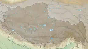
Sengge Zangbo,[1][2] Sengge Khabab[3] (Tibetan: སེང་གེ་ཁ་འབབ།, Wylie: seng ge kha 'bab) or Shiquan He (Chinese: 獅泉河; pinyin: Shīquán Hé) is a river in the Ngari Prefecture in the Tibet Autonomous Region, China that is the source stream of the Indus river, one of the major trans-Himalayan rivers of Central and South Asia. The river rises in the mountain springs north of the Manasarovar lake,[4] and 300 km (190 mi) downstream joins the Gar Tsangpo river near the village of Tashigang. Although it is thereafter called the Indus internationally,[5] the Tibetans continue to regard the combined river to be Sênggê Zangbo as it flows into Ladakh.
| Sengge Zangbo Sengge Khabab, Shiquan He | |
|---|---|
 Confluence of Gar Tsangpo and Sengge Zangbo | |
| Etymology | "Lion River" |
| Native name | སེང་གེ་ཁ་འབབ། (Standard Tibetan) |
| Location | |
| Country | China |
| State | Tibet Autonomous Region |
| Region | Ngari Prefecture |
| Physical characteristics | |
| Source | |
| • location | Kailas Range, Gêgyai County, Tibet, China |
| • coordinates | 31°18′44″N 81°48′42″E |
| • elevation | 5,469.8 m (17,946 ft) |
| Mouth | |
• location | Gar Valley (Indus Valley) |
• coordinates | 32.4409°N 79.7121°E |
• elevation | 4,300 metres (14,100 ft) |
| Length | 300 km (190 mi) (approx.) |
| Basin features | |
| Progression | Indus River |
The town of Shiquanhe, the administrative headquarters of the Ngari Prefecture, is located in the lower valley of Sengge Zangbo, and is named after the river.

The Sengge Zangbo drains an area of 27,450 square kilometres (10,600 sq mi), and covers a length of 430 kilometres (270 mi). Main tributaries include Gar Tsangpo. Other tributaries include the Langqu River, the Chizuo Tsangpo River, and the Charinongqu River.[6]
References
- "Scientist finds new origin of Indus River". China Daily. 21 October 2010.
- Mayhew, Bradley; Kohn, Michael; Mccrohan, Daniel; Bellezza, John Vincent (2011), Tibet, Lonely Planet, p. 164, ISBN 9781741792188 – via archive.org
- Chodag, Tibet, the Land and the People (1988), p. 153.
- Sering, Senge (April 2010), "China builds dam on Indus near Ladakh" (PDF), Journal of Defence Studies, 4 (2): 136–139
- I︠U︡sov, Physical Geography of Tibet (1959), p. 80.
- Zheng, Tianliang; Deng, Yang; Lin, He; Xie, Yanhua; Pei, Xiangjun (April 2022). "Hydrogeochemical controls on As and B enrichment in the aqueous environment from the Western Tibetan Plateau: A case study from the Singe Tsangpo River Basin". Science of the Total Environment. 817: 152978. Bibcode:2022ScTEn.817o2978Z. doi:10.1016/j.scitotenv.2022.152978. ISSN 0048-9697. PMID 35016932. S2CID 245859130.
the [Singe Tsangpo River] has many tributaries originating from alpine lakes or glaciers, including the Langqu River, Chizuo Tsangpo River, Charinongqu River
Bibliography
- Chodag, Tiley (1988), Tibet, the Land and the People, translated by Bkras-gliṅ Dbaṅ-rdor (Brag-gdoṅ); W. Tailing, New World Press, ISBN 9787800050725
- I︠U︡sov, B. V. (1959), Physical Geography of Tibet, U.S. Joint Publications Research Service