Senmaya, Iwate
Senmaya (千厩町, Senmaya-chō) is a town located in Higashiiwai District, Iwate Prefecture, Japan. The name translates as 'one thousand stables' although today there are no horses or stables remaining.
Senmaya
千厩町 | |
|---|---|
Former municipality | |
 Flag  Emblem | |
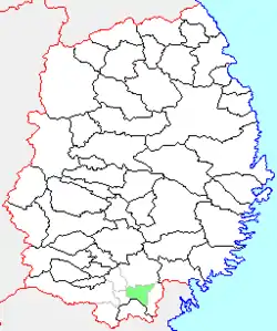 Location of Senmaya in Iwate Prefecture | |
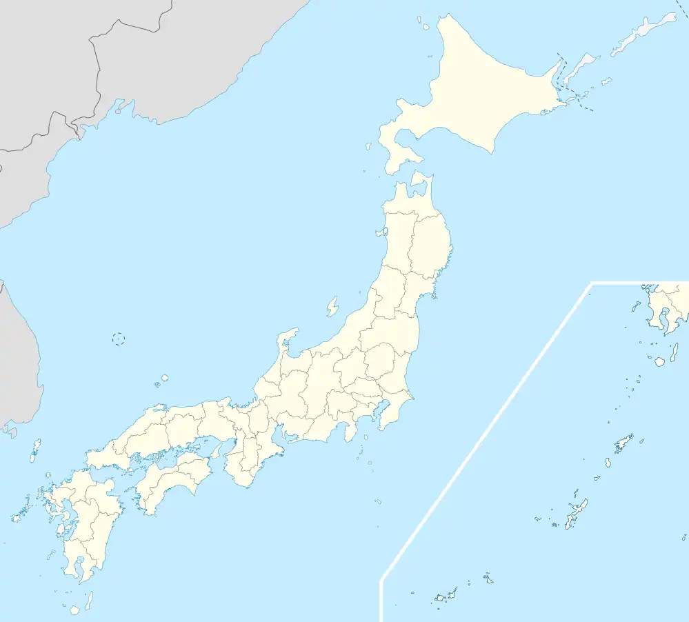 Senmaya Location in Japan | |
| Coordinates: 38°56′13″N 141°19′53″E | |
| Country | Japan |
| Region | Tōhoku |
| Prefecture | Iwate Prefecture |
| District | Higashiiwai |
| Merged | September 20, 2005 (now part of Ichinoseki) |
| Area | |
| • Total | 89.84 km2 (34.69 sq mi) |
| Population (September 1, 2005) | |
| • Total | 12,969 |
| • Density | 144.36/km2 (373.9/sq mi) |
| Time zone | UTC+09:00 (JST) |
| Climate | Cfa |
| Symbols | |
| Bird | Japanese bush warbler |
| Flower | Lilium auratum |
| Tree | Pinus densiflora |
Senmaya village was created on April 1, 1889 with the establishment of the municipalities system. It was raised to town status on April 1, 1898. On September 30, 1956, Senmaya annexed the neighboring villages of Iwashimizu, Okutama and Konashi. On September 20, 2005, Senmaya, along with the towns of Daitō and Higashiyama, the villages of Kawasaki and Murone (all from Higashiiwai District), and the town of Hanaizumi (from Nishiiwai District), was merged into the expanded city of Ichinoseki and no longer exists as an independent municipality.
As of September 2005, the town had an estimated population of 12,969 and a population density of 144.36 persons per km². The total area was 89.84 km².
Climate
| Climate data for Senmaya (1991−2020 normals, extremes 1976−present) | |||||||||||||
|---|---|---|---|---|---|---|---|---|---|---|---|---|---|
| Month | Jan | Feb | Mar | Apr | May | Jun | Jul | Aug | Sep | Oct | Nov | Dec | Year |
| Record high °C (°F) | 14.4 (57.9) |
17.6 (63.7) |
22.3 (72.1) |
30.8 (87.4) |
33.0 (91.4) |
34.0 (93.2) |
36.0 (96.8) |
36.4 (97.5) |
35.4 (95.7) |
27.9 (82.2) |
23.8 (74.8) |
20.6 (69.1) |
36.4 (97.5) |
| Average high °C (°F) | 3.3 (37.9) |
4.4 (39.9) |
8.6 (47.5) |
15.0 (59.0) |
20.4 (68.7) |
23.6 (74.5) |
27.0 (80.6) |
28.3 (82.9) |
24.5 (76.1) |
18.6 (65.5) |
12.3 (54.1) |
5.9 (42.6) |
16.0 (60.8) |
| Daily mean °C (°F) | −0.9 (30.4) |
−0.2 (31.6) |
3.2 (37.8) |
8.8 (47.8) |
14.3 (57.7) |
18.3 (64.9) |
22.0 (71.6) |
23.2 (73.8) |
19.3 (66.7) |
13.0 (55.4) |
6.6 (43.9) |
1.4 (34.5) |
10.8 (51.3) |
| Average low °C (°F) | −5.1 (22.8) |
−4.7 (23.5) |
−2.1 (28.2) |
2.5 (36.5) |
8.4 (47.1) |
13.7 (56.7) |
18.3 (64.9) |
19.4 (66.9) |
15.2 (59.4) |
7.9 (46.2) |
1.4 (34.5) |
−2.7 (27.1) |
6.0 (42.8) |
| Record low °C (°F) | −18.3 (−0.9) |
−16.8 (1.8) |
−13.7 (7.3) |
−5.9 (21.4) |
−1.1 (30.0) |
3.3 (37.9) |
8.4 (47.1) |
10.6 (51.1) |
3.2 (37.8) |
−2.3 (27.9) |
−6.5 (20.3) |
−15.8 (3.6) |
−18.3 (−0.9) |
| Average precipitation mm (inches) | 37.0 (1.46) |
31.6 (1.24) |
67.8 (2.67) |
82.2 (3.24) |
98.1 (3.86) |
115.8 (4.56) |
173.4 (6.83) |
149.6 (5.89) |
147.2 (5.80) |
113.3 (4.46) |
61.5 (2.42) |
45.9 (1.81) |
1,123.2 (44.22) |
| Average precipitation days (≥ 1.0 mm) | 7.7 | 7.4 | 8.9 | 9.1 | 10.1 | 9.8 | 12.4 | 11.5 | 11.5 | 10.1 | 8.4 | 8.5 | 115.4 |
| Mean monthly sunshine hours | 139.2 | 143.4 | 170.4 | 187.1 | 188.1 | 147.9 | 130.2 | 144.8 | 130.4 | 144.3 | 135.6 | 119.2 | 1,780.7 |
| Source: JMA[1][2] | |||||||||||||
References
- 観測史上1~10位の値(年間を通じての値). JMA. Retrieved February 25, 2022.
- 気象庁 / 平年値(年・月ごとの値). JMA. Retrieved February 25, 2022.