Seymchan (Kolyma)
The Seymchan (Russian: Сеймчан) is a river in Srednekansky District, Magadan Oblast, Russia. It is a left tributary of the Kolyma, with a length of 158 kilometres (98 mi) a drainage basin of 3,600 square kilometres (1,400 sq mi).[1][2]
| Seymchan Сеймчан | |
|---|---|
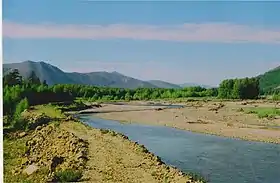
 View of the river | |
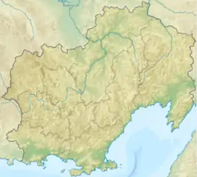
 Mouth location in Magadan Oblast, Russia | |
| Location | |
| Country | Magadan Oblast, Russia |
| Physical characteristics | |
| Source | |
| • location | Confluence of Left Seymchan and Right Seymchan Upper Kolyma Highlands |
| • coordinates | 63.986667°N 154.244722°E |
| Mouth | Kolyma |
• location | Near Seymchan |
• coordinates | 62°55′17″N 152°28′04″E |
| Length | 158 km (98 mi) |
| Basin size | 3,600 km2 (1,400 sq mi) |
| Discharge | |
| • average | 35.24 m3/s (1,244 cu ft/s) |
| Basin features | |
| Progression | Kolyma→ East Siberian Sea |
The name comes from the Yakut language word Kheymchen, which is an area of open water surrounded by sea ice.[3]
Course
The river rises in the Upper Kolyma Highlands, eastern limits of the Chersky Range, at the confluence of Left Seymchan and Right Seymchan. It flows first in a northeast direction, bending along its course until it flows in a southeastern direction. Finally it meets the Kolyma near Seymchan, 158 km (98 mi) from its mouth, downstream from the mouth of the Buyunda on the opposite bank.[4]
Together with the Buyunda that flows roughly northwards on the other side of the Kolyma basin, the Seymchan forms the Seymchan-Buyunda Depression, which limits the Upper Kolyma Highlands from the east.[5]
Its main tributaries are the Medvezhya and the Verina.
 River Verina and Tuonnach Massif in the background. |
 River Medvezhya, another tributary of the Seymchan. |
See also
References
- "Река Сеймчан (в верховье Прав. Сеймчан) in the State Water Register of Russia". textual.ru (in Russian).
- Ceyмчан Great Soviet Encyclopedia in 30 vols. / Ch. ed. A.M. Prokhorov - 3rd ed. - M, 1969-1978. (in Russian)
- W.J. Stringer and J.E. Groves. 1991. Extent of Polynyas in the Bering and Chukchi Seas
- 1,000,000 scale Operational Navigation Chart; Sheet D-8
- "Water of Russia - Buyunda (in Russian)". Retrieved 6 January 2022.