Shawneetown, Illinois
Shawneetown is a city in Gallatin County, Illinois, United States. The population was 1,239 at the 2010 census,[3] down from 1,410 at the 2000 census. It is the county seat of Gallatin County.[4]
Shawneetown, Illinois | |
|---|---|
| City of Shawneetown | |
 | |
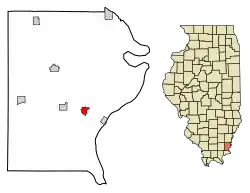 Location of Shawneetown in Gallatin County, Illinois. | |
.svg.png.webp) Location of Illinois in the United States | |
| Coordinates: 37°42′53″N 88°11′0″W | |
| Country | United States |
| State | Illinois |
| County | Gallatin |
| Area | |
| • Total | 0.74 sq mi (1.92 km2) |
| • Land | 0.73 sq mi (1.90 km2) |
| • Water | 0.01 sq mi (0.02 km2) |
| Elevation | 407 ft (124 m) |
| Population (2020) | |
| • Total | 1,054 |
| • Density | 1,435.97/sq mi (554.28/km2) |
| Time zone | UTC-6 (CST) |
| • Summer (DST) | UTC-5 (CDT) |
| ZIP Code(s) | 62984 |
| Area code | 618 |
| FIPS code | 17-69082 |
| GNIS ID | 2395860[2] |
| Wikimedia Commons | Shawneetown, Illinois |
Geography
Shawneetown is located southeast of the center of Gallatin County at 37°42′53″N 88°11′00″W.[5] Illinois Route 13 passes through the city, leading southeast 3 miles (5 km) to the Ohio River and the Kentucky border at Old Shawneetown, and west 20 miles (32 km) to Harrisburg. It is located at the northeast edge of Shawnee National Forest.
According to the 2010 census, Shawneetown has a total area of 0.679 square miles (1.76 km2), of which 0.67 square miles (1.74 km2) (or 98.67%) is land and 0.009 square miles (0.02 km2) (or 1.33%) is water.[6]
History
The present town was established in 1937 after the Ohio River flood of 1937 inundated what is now Old Shawneetown, Illinois.[7]
Demographics
| Census | Pop. | Note | %± |
|---|---|---|---|
| 1940 | 1,963 | — | |
| 1950 | 1,917 | −2.3% | |
| 1960 | 1,280 | −33.2% | |
| 1970 | 1,742 | 36.1% | |
| 1980 | 1,841 | 5.7% | |
| 1990 | 1,575 | −14.4% | |
| 2000 | 1,410 | −10.5% | |
| 2010 | 1,239 | −12.1% | |
| 2020 | 1,054 | −14.9% | |
| U.S. Decennial Census[8] | |||
As of the census[9] of 2000, there were 1,410 people, 632 households, and 389 families residing in the city. The population density was 1,181.8 inhabitants per square mile (456.3/km2). There were 693 housing units at an average density of 580.8 per square mile (224.2/km2). The racial makeup of the city was 96.17% White, 0.50% African American, 2.34% Native American, 0.14% Pacific Islander, 0.28% from other races, and 0.57% from two or more races. Hispanic or Latino of any race were 1.70% of the population.
There were 632 households, out of which 27.1% had children under the age of 18 living with them, 44.5% were married couples living together, 13.6% had a female householder with no husband present, and 38.4% were non-families. 35.1% of all households were made up of individuals, and 18.7% had someone living alone who was 65 years of age or older. The average household size was 2.20 and the average family size was 2.83.
In the city, the population was spread out, with 21.7% under the age of 18, 9.8% from 18 to 24, 23.3% from 25 to 44, 25.5% from 45 to 64, and 19.8% who were 65 years of age or older. The median age was 40 years. For every 100 females there were 88.0 males. For every 100 females age 18 and over, there were 82.5 males.
The median income for a household in the city was $20,789, and the median income for a family was $33,500. Males had a median income of $32,368 versus $20,208 for females. The per capita income for the city was $17,834. About 20.8% of families and 27.8% of the population were below the poverty line, including 47.2% of those under age 18 and 13.8% of those age 65 or over.
Notable people
- John R. Anderson (minister) (1818–1863), an American minister from St. Louis, Missouri, who fought against slavery and for education for his fellow African Americans.
- Chris Edwards, author, publisher and display artist
- Henry Rollman, member of the Wisconsin State Assembly and the Wisconsin State Senate
- William W. Wilshire, U.S. Representative from Arkansas (1873-1874, 1875–1877)
References
- "2020 U.S. Gazetteer Files". United States Census Bureau. Retrieved March 15, 2022.
- U.S. Geological Survey Geographic Names Information System: Shawneetown, Illinois
- "Geographic Identifiers: 2010 Demographic Profile Data (G001): Shawneetown city, Illinois". American Factfinder. U.S. Census Bureau. Retrieved November 30, 2016.
- "Find a County". National Association of Counties. Retrieved June 7, 2011.
- "US Gazetteer files: 2010, 2000, and 1990". United States Census Bureau. February 12, 2011. Retrieved April 23, 2011.
- "G001 - Geographic Identifiers - 2010 Census Summary File 1". United States Census Bureau. Archived from the original on February 13, 2020. Retrieved December 27, 2015.
- Collins, Timothy (October 23, 2012). "Two Fine River Towns Flow Into Uncertainty". Daily Yonder. Archived from the original on May 30, 2016. Retrieved May 30, 2016.
- "Census of Population and Housing". Census.gov. Retrieved June 4, 2015.
- "U.S. Census website". United States Census Bureau. Retrieved January 31, 2008.
Further reading
- 1887. History of Gallatin, Saline, Hamilton, Franklin and Williamson Counties, Illinois. Chicago: Goodspeed Publishing Co.
- Musgrave, Jon, ed. 2002. Handbook of Old Gallatin County and Southeastern Illinois. Marion, Ill.: IllinoisHistory.com. 464 pages.
- Musgrave, Jon. 2004, Rev. ed. 2005. Slaves, Salt, Sex & Mr. Crenshaw: The Real Story of the Old Slave House and America's Reverse Underground R.R.. Marion, Ill.: IllinoisHistory.com. 608 pages.
- Waggoner, Horace Q., interviewer. 1978. "Lucille Lawler Memoir" Shawneetown Bank Project. Sangamon State University. Springfield, Ill.
External links
Municipalities and communities of Gallatin County, Illinois, United States | ||
|---|---|---|
| City | Map of Illinois highlighting Gallatin County | |
| Villages | ||
| Townships | ||
| Unincorporated communities | ||