Municipality of the District of Shelburne
District of Shelburne, officially named the Municipality of the District of Shelburne, is a district municipality comprising the eastern section of Shelburne County, Nova Scotia, Canada, but does not include the Towns of Shelburne or Lockeport. Statistics Canada classifies the district municipality as a municipal district. It is home to the Bowers Meadows Wilderness Area.[3]
District of Shelburne | |
|---|---|
| Municipality of the District of Shelburne | |
 Coat of arms | |
| Motto: From Ocean To Forest | |
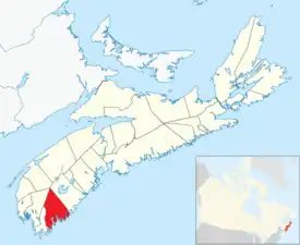 Location of the Municipality of the District of Shelburne | |
| Coordinates: 43.85°N 65.282778°W | |
| Country | Canada |
| Province | Nova Scotia |
| County | Shelburne |
| Incorporated | April 17, 1879 |
| Electoral Districts Federal | South Shore—St. Margaret's |
| Provincial | Shelburne |
| Government | |
| • Type | Council of the Municipality of the District of Shelburne |
| • Warden | Penny Smith[1] |
| Area | |
| • Land | 1,816.71 km2 (701.44 sq mi) |
| Population (2021)[2] | |
| • Total | 4,336 |
| • Density | 2.4/km2 (6/sq mi) |
| • Change 2016-21 | |
| Time zone | UTC-4 (AST) |
| • Summer (DST) | UTC-3 (ADT) |
| Dwellings | 2735 |
| Median Income* | $40,415 CDN |
| Seat | Shelburne, Nova Scotia |
| Website | Official website |
| |
Demographics
In the 2021 Census of Population conducted by Statistics Canada, the Municipality of the District of Shelburne had a population of 4,336 living in 2,059 of its 2,735 total private dwellings, a change of 1.1% from its 2016 population of 4,288. With a land area of 1,816.71 km2 (701.44 sq mi), it had a population density of 2.4/km2 (6.2/sq mi) in 2021.[5]
|
|
Communities
The following communities are included within the Municipality of the District of Shelburne:
- Allendale
- Arnold
- Atlantic
- Birchtown
- Blanche
- Canada Hill
- Carleton Village
- Churchover
- Clyde River
- East Green Harbour
- East Jordan
- East Sable River
- East Side of Ragged Island
- Granite Village
- Greenwood
- Gunning Cove
- Indian Fields
- Ingomar
- Jordan Bay
- Jordan Branch
- Jordan Falls
- Jordan Ferry
- Little Harbour
- Little Port L'Hebert
- Lockeport Station
- Louis Head
- Lower Jordan Bay
- Lower Ohio
- Lower Sandy Point
- Lydgate
- McNutts Island
- Middle Ohio
- North East Harbour
- North West Harbour
- Ohio
- Osborne Harbour
- Pleasant Point
- Port Clyde
- Port L'Hebert
- Port Saxon
- Rockland
- Roseway
- Round Bay
- Sable River
- Sable River Station
- Sable River West
- Sandy Point
- Upper Clyde River
- Upper Ohio
- Welshtown
- West Green Harbour
- West Middle Sable
- Western Head
Access routes
Highways and numbered routes that run through the district municipality, including external routes that start or finish at the municipal boundary:[8]
References
- "New warden for Municipality of Shelburne". Shelburne County Coast Guard. November 4, 2016. Retrieved July 18, 2017.
- Statistics Canada Census Profile, 2021 Census of Population – 100% data
- Environment, Nova Scotia (1 April 2009). "Bowers Meadows Wilderness Area - Protected Areas - Nova Scotia Environment". novascotia.ca.
- 1996, 2001, 2006 census
- "Population and dwelling counts: Canada, provinces and territories, census divisions and census subdivisions (municipalities), Nova Scotia". Statistics Canada. February 9, 2022. Retrieved March 12, 2022.
- 2006 Statistics Canada Community Profile: Shelburne Municipal District, Nova Scotia
- 2006 Statistics Canada Census Topic-Based Tabulations: Shelburne Municipal District, Nova Scotia
- Atlantic Canada Back Road Atlas ISBN 978-1-55368-618-7 Page 89
External links
Places adjacent to Municipality of the District of Shelburne | ||||||||||||||||
|---|---|---|---|---|---|---|---|---|---|---|---|---|---|---|---|---|
| ||||||||||||||||
Subdivisions of Nova Scotia | |
|---|---|
| Counties | |
| County municipalities | |
| Regional municipalities | |
| District municipalities | |
| Towns | |
| Villages | |
| Economic regions | |
| Lists | |
| |