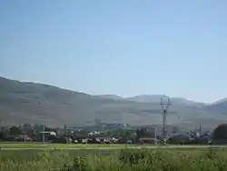
Shirak, Armenia
Shirak
Շիրակ | |
|---|---|
 | |
 Shirak 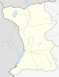 Shirak | |
| Coordinates: 40°50′53″N 43°55′17″E | |
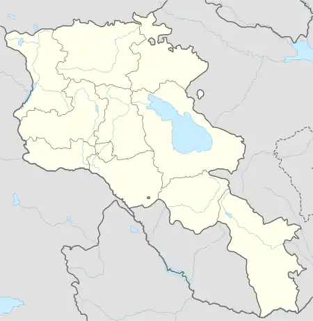
| Country | Armenia |
| Province | Shirak |
| Municipality | Akhuryan |
| Population (2011) | |
| • Total | 1,153 |
| Time zone | UTC+4 |
Shirak (Armenian: Շիրակ) is a village in the Akhuryan Municipality of the Shirak Province of Armenia, belongs to the Marmashen community.
History
It is located 16 km from the district center. Until 1937, it was under Leninakan district. It is mentioned as Gonagghiran[1] in the "Iravan Province Review Book", and in the form of Gonak Gran[2]on the 5 verst map of the Caucasus. In a source from 1728, it is mentioned as the name of a village in Shirakel district[3][4]
Demographics
| Year | Pop. | ±% p.a. |
|---|---|---|
| 1831 | 192 | — |
| 1897 | 1,125 | +2.72% |
| 1926 | 1,158 | +0.10% |
| 1939 | 1,132 | −0.17% |
| 1959 | 847 | −1.44% |
| 1970 | 859 | +0.13% |
| 1979 | 839 | −0.26% |
| 1989 | 548 | −4.17% |
| 2001 | 1,081 | +5.82% |
| 2004 | 1,065 | −0.50% |
| Source: [5] | ||
Toponymy
The toponym Gonagghiran is derived from the combination of the word Gonag (Azerbaijani: qonaq) and Giran (Azerbaijani: Qıran) which literally stand for "guest" and "stop", "resting place", respectively, in the ancient Turkish language[6] and the word "kuren" or "kran", which means "camp", "temporary stopping place for cattlemen".[7] It is a toponym with a complex structure based on relief. The name of the village was changed into Shirak by a decree of the Presidium of the Supreme Soviet of the Armenian SSR dated 2 February 1940. In Turkic languages, it consists of the words kunak, konak "stop", "resting place"[8][9] and kuren "military camp". In the 19th century, Kunag-Tau (mountain name) and Kunak-tepe[10] in Maykop district of Kuban province in the North Caucasus, Kunakh-Ay (mountain and river name) in Zagatala district, and Gonag-Chir (river name) in Batum district of Batum province. is the same. In the Middle Ages, there was a fortress called Kunak Castle (now known as "Karagala" in Turkey) southeast of Sürmeli.
Population
In 1878, the population of Azerbaijani Turks was expelled and Armenians from Turkey were settled there[11][12]
References
- Z.Bünyatov və H.Məmmədov (Qaramanlı) (1996). İrəvan əyalətinin icmal dəftəri (araşdırma, tərcümə, qeyd və əlavələrin müəllifləri. Baku: Science. p. 135.
- Пагиревь, Д.Д. (1913). Алфавитный указатель кь пятиверстной картѣ Кавказскаго края, изданiя Кавказскаго Военно–Топографическaго Отдѣла. Записки Кавказскаго отдѣла Императорскаго Русскаго Географическаго общества. Книжка XXX. Тифлись: Типография К. П. Козловскаго. p. 139.
- İrəvan əyalətinin icmal dəftəri. Baku. 1996.
{{cite book}}: CS1 maint: location missing publisher (link) - Папазян, А.Д. Аграрные отношения в Восточной Армении в ХVI-ХVII вв. Ереван. p. 1972.
- Հայաստանի Հանրապետության բնակավայրերի բառարան [Republic of Armenia settlements dictionary] (PDF) (in Armenian). Yerevan: Cadastre Committee of the Republic of Armenia. 2008. Archived from the original (PDF) on 11 March 2018.
- Древнетюркский словарь, Л., "Наука". 1969. p. 455.
- Мурзаев Э.М. (1984). Словарь народных географических терминов, М., "Мысль". p. 317.
- Древнетюркский словарь. М. 1969.
- Алиев, К. (1987). Античные источники по истории Азербайджана. Баку.
{{cite book}}: CS1 maint: location missing publisher (link) - Сегал, И.Л. Сборник сведений о Елизаветпольской губернии.
- Bayramov A.Ə. (1996). Qədim Oğuz еllərinin-Ağbaba, Şərəyəl və Pəmbək bölgələrinin yеr-yurd adları. Baku.
{{cite book}}: CS1 maint: location missing publisher (link) - Будагов, Б.Ә.; Гејбуллајев, Г.Ә. (1998). Ермәнистанда Азәрбајҹан мәншәли топонимләрин изаһлы лүғәти. Бакы: Оғуз ели. p. 452.
