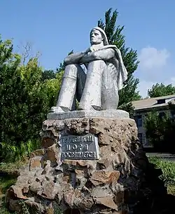
Shyrokyne
Shyrokyne (Ukrainian: Широкине, pronounced [ʃɪˈrɔkɪne]) or Shirokino (Russian: Широкино) is a village in the Mariupol Raion of Donetsk Oblast, Ukraine.
Shyrokyne
Широкине Russian: Широкино | |
|---|---|
 | |
 Coat of arms | |
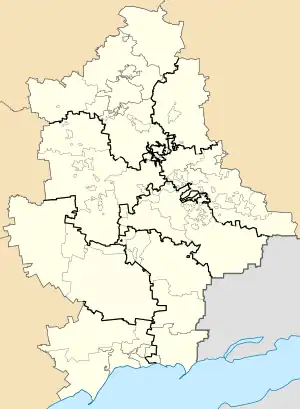 Shyrokyne Location of Shyrokyne in Donetsk Oblast 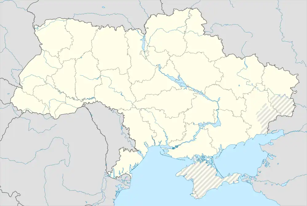 Shyrokyne Shyrokyne (Ukraine) | |
| Coordinates: 47°5′53″N 37°48′37″E | |
| Country | |
| Oblast (Province) | |
| Raion (District) | Mariupol Raion |
| Hromada | Sartana settlement hromada |
| Elevation | 4 m (13 ft) |
| Population | |
| • Total | 1,411 |
| Time zone | UTC+2 (EET) |
| • Summer (DST) | UTC+3 (EEST) |
| Postal code | 87650 |
| Area code | +380 6296 |
The village is situated on the shore of the Sea of Azov, about 23 kilometres (14 mi) east from the centre of Mariupol.
War in Donbas
The village became a battleground in 2014–15 during a war between separatists affiliated with the Donetsk People's Republic and the Ukrainian government.
Prior to the war, the village was situated in Novoazovsk Raion. This was changed on 9 December 2014, when the Ukrainian parliament voted to change the boundaries of the Raion, so as to allow Ukrainian-controlled territories to be separated from DPR-controlled territories. The village and its neighbours were thus placed into an expanded Volnovakha Raion.[1][2]
All civilians were evacuated from the village in February 2015, with up to 80% of the village's houses damaged beyond repair by July of that year.[3][4]
By the end of February 2016 Ukrainian troops took the village under their control as pro-Russian forces withdrew from the settlement.[5]
As of 2022 and 2023, Shyrokyne is under occupation by Russian forces, who have annexed Donetsk Oblast.
References
- Laws of Ukraine. Verkhovna Rada of Ukraine No. 32-VIII: Про зміни в адміністративно-територіальному устрої Донецької області, зміну і встановлення меж Волноваського, Новоазовського та Тельманівського районів Донецької області (On the changes in the administrative and territorial structure of Donetsk Oblast, changing and defining the boundaries of the Volnovakha, Novoazovsk and Telmanove Raions of Donetsk Oblast). Adopted on 11 December 2014. (Ukrainian)
- "In the Donetsk Oblast three district centers removed from the territory seized by militants". Ukrayinska Pravda (in Ukrainian). 8 December 2014. Retrieved 31 December 2014.
- "OSCE: Up to 80% of civilian houses in Shyrokyne damaged beyond repair". Ukrainian Independent News Agency. 9 July 2015. Archived from the original on 12 July 2015. Retrieved 27 July 2015.
- "Militants attack village of Shyrokyne near Mariupol". Ukrainian Independent Information Agency. 12 February 2015. Retrieved 27 July 2015.
- "Ukraine retakes Shyrokyne after Russian proxies abandon it". www.unian.info. UNIAN. 25 February 2016. Retrieved 25 February 2016.