Sikhio district
Sikhiu (Thai: สีคิ้ว, pronounced [sǐː.kʰíw]) is a district (amphoe) in the western part of Nakhon Ratchasima province, Thailand.
Sikhio
สีคิ้ว | |
|---|---|
 Lam Takhong Dam, Sikhio | |
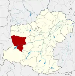 District location in Nakhon Ratchasima province | |
| Coordinates: 14°53′30″N 101°43′24″E | |
| Country | Thailand |
| Province | Nakhon Ratchasima |
| Seat | Sikhio |
| Area | |
| • Total | 1,247.068 km2 (481.496 sq mi) |
| Population (2005) | |
| • Total | 121,356 |
| • Density | 97.3/km2 (252/sq mi) |
| Time zone | UTC+7 (ICT) |
| Postal code | 30140, 30340 |
| Geocode | 3020 |
History
Originally known as Mueang Nakhon Chantuek, Sikhio is an ancient frontier city between the Thai-dominated Chao Phraya valley and the Lao-dominated Khorat Plateau. Nakhon Chantuek was controlled directly by the central government of Siam.
On 1 April 1898 it became a subordinate mueang of Nakhon Ratchasima.[1] The district office was moved to Ban Nong Bua in 1901, and moved again to Ban Sikhio in 1906, both times because the original location was malaria infected.
In 1939 the district was renamed from Chanthuek to Sikhio.[2]
Sikhio has been a human settlement for a long time. There is evidence as paintings on the cave walls on local hill, Khao Chan Ngam. 4,000 years old ancient paintings, the only one in Nakhon Ratchasima province. Even after 4,000 years, they are still coloured and clearly visible. The painters used the mixture of soil and tree resin to pain these works. There are some paintings too but the colour is quite faded. It is assumed that these paintings to be drafted or painted from hematite ore. It gives red colour when being mixed with tree resin. The paintings were painted on the wall of a cave in late prehistoric period.[3]
Geography
The district is in the Dong Phaya Yen mountain range.
Neighbouring districts are (from the north clockwise): Dan Khun Thot, Sung Noen, and Pak Chong of Nakhon Ratchasima; Muak Lek of Saraburi province; and Lam Sonthi of Lopburi province.
Administration
The district is divided into 12 sub-districts (tambons), which are further subdivided into 170 villages (mubans). The town (thesaban mueang) Sikhio covers parts of tambons Sikhio and Mittraphap. There are another four sub-district municipalities (thesaban tambons), Lad Bua Khao covering parts of tambon Lad Bua Khao, and Khlong Phai covering parts of tambon Khlong Phai, Mueang Sikhio. Those parts of tambon Sikhio not covered by the town Sikhio, and Nong Nam Sai the full same-named sub-district. There are another 10 tambon administrative organizations (TAO).
| No. | Name | Thai name | Villages | Pop. | |
|---|---|---|---|---|---|
| 1. | Sikhio | สีคิ้ว | 18 | 17,750 | |
| 2. | Ban Han | บ้านหัน | 11 | 4,479 | |
| 3. | Kritsana | กฤษณา | 12 | 6,681 | |
| 4. | Lat Bua Khao | ลาดบัวขาว | 17 | 19,907 | |
| 5. | Nong Ya Khao | หนองหญ้าขาว | 15 | 9,104 | |
| 6. | Kut Noi | กุดน้อย | 14 | 7,536 | |
| 7. | Nong Nam Sai | หนองน้ำใส | 18 | 12,429 | |
| 8. | Wang Rong Yai | วังโรงใหญ่ | 14 | 7,518 | |
| 9. | Mittraphap | มิตรภาพ | 13 | 13,380 | |
| 10. | Khlong Phai | คลองไผ่ | 10 | 9,353 | |
| 11. | Don Mueang | ดอนเมือง | 16 | 6,998 | |
| 12. | Nong Bua Noi | หนองบัวน้อย | 12 | 6,221 |
References
- พระบรมราชโองการ ประกาศ เปลี่ยนนามมณฑล (PDF). Royal Gazette (in Thai). 16 (11): 140. 1899-06-11. Archived from the original (PDF) on January 27, 2012.
- พระราชกฤษฎีกาเปลี่ยนนามอำเภอ กิ่งอำเภอ และตำบลบางแห่ง พุทธศักราช ๒๔๘๒ (PDF). Royal Gazette (in Thai). 56 (ก): 354–364. April 17, 1939. Archived from the original (PDF) on February 19, 2009.
- "ภาพเขียนสีเขาจันทร์งาม". Princess Maha Chakri Sirindhorn Anthropology Centre (in Thai). 2021-09-19. Retrieved 2023-08-14.