Sint Laurens
Sint Laurens is a village in the Dutch province of Zeeland. It is located in the municipality of Middelburg, about 3 km north of the city.
Sint Laurens | |
|---|---|
Village | |
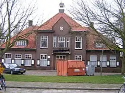
 Former town hall | |
 Coat of arms | |
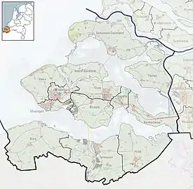
 Sint Laurens Location in the province of Zeeland in the Netherlands  Sint Laurens Sint Laurens (Netherlands) | |
| Coordinates: 51°32′N 3°36′E | |
| Country | |
| Province | Zeeland |
| Municipality | Middelburg |
| Area | |
| • Total | 1.67 km2 (0.64 sq mi) |
| Elevation | 0.0 m (0.0 ft) |
| Population (2021)[1] | |
| • Total | 960 |
| • Density | 570/km2 (1,500/sq mi) |
| Time zone | UTC+1 (CET) |
| • Summer (DST) | UTC+2 (CEST) |
| Postal code | 4333[1] |
| Dialing code | 0118 |
History
The village was first mentioned in the 13th century as "ecclesia sancti Laurentii alias Popkinsburgh". It was first named Popkensburg. The current name refers to Saint Lawrence.[3] Sint Laurens is a road village which developed near the Popkensburg Castle. The castle was demolished in 1863. The linear settlement expanded up to Brigdamme.[4]
The Dutch Reformed church is an aisleless church was built in 1644 to replace the church of the castle. It was restored in 1952.[4]
In 1816, the village of Brigdamme was merged into Sint Laurens.[5] Sint Laurens was home to 203 people in 1840.[6] Sint Laurens remained a separate municipality until 1966, when it was merged with Middelburg.[5]
Gallery
 Church of Sint Laurens
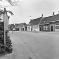
 Street view (1975)
_-_Sint_Laurens_-_20342971_-_RCE.jpg.webp) Former millers house
Former millers house
References
- "Kerncijfers wijken en buurten 2021". Central Bureau of Statistics. Retrieved 20 April 2022.
- "Postcodetool for 4333AA". Actueel Hoogtebestand Nederland (in Dutch). Het Waterschapshuis. Retrieved 20 April 2022.
- "Sint Laurens - (geografische naam)". Etymologiebank (in Dutch). Retrieved 20 April 2022.
- Piet van Cruyningen & Ronald Stenvert (2003). Sint Laurens (in Dutch). Zwolle: Waanders. ISBN 90 400 8830 6. Retrieved 20 April 2022.
- Ad van der Meer and Onno Boonstra, Repertorium van Nederlandse gemeenten, KNAW, 2011.
- "Sint Laurent". Plaatsengids (in Dutch). Retrieved 20 April 2022.