Solis Planum
Solis Planum is a planum on Mars which has a diameter of 1811.23 km. Its center latitude is 26.4 S and its center longitude is 270.33 E. Solis Planum was named after a classic albedo feature name, and its name was approved in 1973.[1]
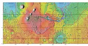
MOLA map showing Solis Planum and other regions. Colors indicate elevations.
Gallery
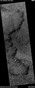 Edge of lava flow, as seen by HiRISE under HiWish program
Interactive Mars map
(See also: Mars Rovers map and Mars Memorial map) (view • discuss)
References
This article is issued from Wikipedia. The text is licensed under Creative Commons - Attribution - Sharealike. Additional terms may apply for the media files.