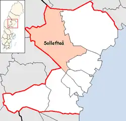
Sollefteå Municipality
Sollefteå Municipality (Swedish: Sollefteå kommun) is a Swedish municipality in Västernorrland County. Its seat is located in Sollefteå.
Sollefteå Municipality
Sollefteå kommun | |
|---|---|
 | |
 Coat of arms | |
 | |
| Coordinates: 63°10′N 17°16′E | |
| Country | Sweden |
| County | Västernorrland County |
| Seat | Sollefteå |
| Area | |
| • Total | 5,761.82 km2 (2,224.65 sq mi) |
| • Land | 5,397.82 km2 (2,084.11 sq mi) |
| • Water | 364 km2 (141 sq mi) |
| Area as of 1 January 2014. | |
| Population (31 December 2021)[2] | |
| • Total | 18,814 |
| • Density | 3.3/km2 (8.5/sq mi) |
| Time zone | UTC+1 (CET) |
| • Summer (DST) | UTC+2 (CEST) |
| ISO 3166 code | SE |
| Province | Ångermanland |
| Municipal code | 2283 |
| Website | www.solleftea.se |
The former City of Sollefteå (instituted in 1917) was amalgamated with the surrounding entities in 1974 to form the present municipality. It consists of fifteen original (1863) units.
Historically, the name is found as early as the 13th century in the form of the Latin De Solatum, which would translate to "The Sunny Place" (or so). A market place was situated here in 1602 on Royal permission. The city's coat of arms depicts a Black Grouse.
Geography
Geographically, the landscape is dominated by woods, and by the Ångerman River and its tributaries Faxälven and Fjällsjöälven, which cross through the municipality.
International relations
References
- "Statistiska centralbyrån, Kommunarealer den 1 januari 2014" (in Swedish). Statistics Sweden. 2014-01-01. Archived from the original (Microsoft Excel) on 2016-09-27. Retrieved 2014-04-18.
- "Folkmängd i riket, län och kommuner 31 december 2021" (in Swedish). Statistics Sweden. February 22, 2022. Retrieved February 22, 2022.
External links
Wikimedia Commons has media related to Sollefteå Municipality.
- Sollefteå - Official site
Places adjacent to Sollefteå Municipality | |
|---|---|
Municipalities and seats of Västernorrland County | ||
|---|---|---|
| Municipalities | ||
| Municipal seats | ||
This article is issued from Wikipedia. The text is licensed under Creative Commons - Attribution - Sharealike. Additional terms may apply for the media files.