Sonde, Uganda
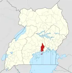
Sonde, also Ssonde, is a settlement in Mukono District, in Uganda's Central Region.[1]
Sonde | |
|---|---|
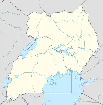
 Sonde Map of Uganda showing the location of Sonde. | |
| Coordinates: 00°23′42″N 32°41′12″E | |
| Country | |
| District | Mukono District |
| Government | |
| • Village Chairman (LC1)[1] | Abubaker Yawe |
| Elevation | 1,120 m (3,670 ft) |
| Time zone | UTC+3 (EAT) |

Location
Sonde lies in Misindye Parish, Goma Sub-county, Mukono District, approximately 17 kilometres (11 mi), northeast of Kampala, Uganda's capital city.[1][2]
Sonde is bordered by Nabusugwe to the north, Bukeerere to the east, Namanve to the south and Namugongo to the west. Its geographical coordinates are:0°23'42.0"N, 32°41'12.0"E (Latitude:0.395000; Longitude:32.686667).[3]
Overview
Previously regarded as "remote", the village began to receive new settlers, following the end of the Ugandan Bush War (1981 - 1986).[1]
In the 2000s, the area has become popular with developers of residential housing estates. The developers buy large chunks of land, subdivide them and build individual houses for sale.[1] The popularity of Sonde increased in popularity when National Water and Sewerage Corporation (NWSC) extended its services to the area, circa 2012.[1]
In 2016, the road between Namugongo to the west and Seeta to the east as tarmacked, easing transportation and reducing the dusty environment.[1]
Points of interest
The following points of interest are found in Sonde or near its boundaries:
1. Namugongo–Seeta Road passes through the town in a general west to east direction.[4]
2. Development Microfinance, a local financial services provider, offers savings opportunities and reasonably priced loans.[5]
3. St. Michael High School and Faith High School are among of the five secondary schools, in addition to about 10 elementary and nursery schools.
4. Nakiyanja River, with the surrounding Nakiyanja wetland lie immediately west of Sonde and separate it from Namugongo.[6]
5. Stod Villas Africa- A Villa franchise in 5 African countries including Uganda[7]
6. Martyrs View Estate Sonde, a two minute drive west of Sonde town, estate overlooking the Church of Uganda Martyrs' Shrine at Namugongo.[7]
See also
References
- Roland D Nasasira (20 July 2017). "Sonde: From killing ground to growing residential area". Daily Monitor. Kampala. Retrieved 20 July 2017.
- Google (28 May 2021). "Road Distance Between Kampala, Uganda And Sonde, Uganda" (Map). Google Maps. Google. Retrieved 28 May 2021.
- Google (20 July 2017). "Location of Sonde, Mukono District, Uganda" (Map). Google Maps. Google. Retrieved 20 July 2017.
- Google (14 August 2021). "Map Showing Namugongo–Seeta Road Going Through Sonde" (Map). Google Maps. Google. Retrieved 14 August 2021.
- Development Microfinance (August 2021). "Branches of Development Microfinance Limited". Developmentmicrofinance.com. Sonde, Uganda. Retrieved 14 August 2021.
- Google (14 August 2021). "Map Showing Namugongo–Seeta Road Crossing Over River Nakiyanja And Nakiyanja Wetland" (Map). Google Maps. Google. Retrieved 14 August 2021.
- Roland D. Nasasira (19 July 2021). "Sonde: From killing ground to growing residential area". Daily Monitor. Kampala. Retrieved 28 May 2021.
