Soperton, Georgia
Soperton is a city in Treutlen County, Georgia, United States. The population was 3,115 at the 2010 census, up from 2,824 in 2000. The city is the county seat of Treutlen County.[4]
Soperton,
Georgia | |
|---|---|
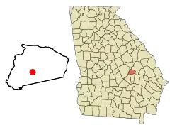 Location in Treutlen County and the state of Georgia | |
| Coordinates: 32°22′34″N 82°35′34″W | |
| Country | United States |
| State | Georgia |
| County | Treutlen |
| Government | |
| • Mayor | Royce Fowler |
| • City Council | Wade Clark / John Koon / Izell Stephens / JB Johnson / Xandra Brown |
| Area | |
| • Total | 4.46 sq mi (11.56 km2) |
| • Land | 4.40 sq mi (11.40 km2) |
| • Water | 0.06 sq mi (0.16 km2) |
| Elevation | 295 ft (90 m) |
| Population (2020) | |
| • Total | 2,889 |
| • Density | 656.29/sq mi (253.38/km2) |
| Time zone | UTC-5 (Eastern (EST)) |
| • Summer (DST) | UTC-4 (EDT) |
| ZIP code | 30457 |
| Area code | 912 |
| FIPS code | 13-71772[2] |
| GNIS feature ID | 0323223[3] |
| Website | City of Soperton |
History
A post office was established at Soperton in 1902.[5] The city was named after Benjamin Franklin Soper, a railroad official.[6]
The Georgia General Assembly incorporated Soperton as a town in 1902.[7]
Geography
Soperton is located at 32°22′34″N 82°35′34″W (32.376067, -82.592724).[8]
According to the United States Census Bureau, the city has a total area of 3.3 square miles (8.5 km2), of which 3.2 square miles (8.3 km2) is land and 0.04 square miles (0.10 km2) (0.61%) is water.
Demographics
| Census | Pop. | Note | %± |
|---|---|---|---|
| 1910 | 469 | — | |
| 1920 | 1,033 | 120.3% | |
| 1930 | 1,081 | 4.6% | |
| 1940 | 1,339 | 23.9% | |
| 1950 | 1,667 | 24.5% | |
| 1960 | 2,317 | 39.0% | |
| 1970 | 2,596 | 12.0% | |
| 1980 | 2,981 | 14.8% | |
| 1990 | 2,797 | −6.2% | |
| 2000 | 2,824 | 1.0% | |
| 2010 | 3,115 | 10.3% | |
| 2020 | 2,889 | −7.3% | |
| U.S. Decennial Census[9] | |||
2020 census
| Race | Num. | Perc. |
|---|---|---|
| White (non-Hispanic) | 1,097 | 37.97% |
| Black or African American (non-Hispanic) | 1,643 | 56.87% |
| Native American | 6 | 0.21% |
| Asian | 6 | 0.21% |
| Other/Mixed | 66 | 2.28% |
| Hispanic or Latino | 71 | 2.46% |
As of the 2020 United States census, there were 2,889 people, 1,088 households, and 699 families residing in the city.
2000 census
As of the census[2] of 2000, there were 2,824 people, 1,096 households, and 737 families residing in the city. The population density was 870.6 inhabitants per square mile (336.1/km2). There were 1,215 housing units at an average density of 374.6 per square mile (144.6/km2). The racial makeup of the city was 46.67% White, 51.84% African American, 0.04% Native American, 0.35% Asian, 0.39% from other races, and 0.71% from two or more races. Hispanic or Latino of any race were 0.92% of the population.
There were 1,096 households, out of which 32.8% had children under the age of 18 living with them, 36.4% were married couples living together, 26.4% had a female householder with no husband present, and 32.7% were non-families. 29.7% of all households were made up of individuals, and 15.1% had someone living alone who was 65 years of age or older. The average household size was 2.49 and the average family size was 3.09.
In the city, the population was spread out, with 28.3% under the age of 18, 9.4% from 18 to 24, 26.6% from 25 to 44, 20.4% from 45 to 64, and 15.4% who were 65 years of age or older. The median age was 34 years. For every 100 females, there were 82.2 males. For every 100 females age 18 and over, there were 73.8 males.
The median income for a household in the city was $20,471, and the median income for a family was $26,042. Males had a median income of $24,643 versus $18,646 for females. The per capita income for the city was $12,367. About 29.3% of families and 31.7% of the population were below the poverty line, including 35.4% of those under age 18 and 34.8% of those age 65 or over.
Education
Treutlen County School District
The Treutlen County School District holds pre-school to grade twelve, and consists of one elementary school and a middle/high school.[11] The district has 74 full-time teachers and over 1,234 students.[12]
- Treutlen Elementary School
- Treutlen Middle/High School
References
- "2020 U.S. Gazetteer Files". United States Census Bureau. Retrieved December 18, 2021.
- "U.S. Census website". United States Census Bureau. Retrieved January 31, 2008.
- "US Board on Geographic Names". United States Geological Survey. October 25, 2007. Retrieved January 31, 2008.
- "Find a County". National Association of Counties. Retrieved June 7, 2011.
- "Post Offices". Jim Forte Postal History. Retrieved June 10, 2019.
- Krakow, Kenneth K. (1975). Georgia Place-Names: Their History and Origins (PDF). Macon, GA: Winship Press. p. 209. ISBN 0-915430-00-2.
- "Treutlen County". GeorgiaInfo. Retrieved June 10, 2019.
- "US Gazetteer files: 2010, 2000, and 1990". United States Census Bureau. February 12, 2011. Retrieved April 23, 2011.
- "Census of Population and Housing". Census.gov. Retrieved June 4, 2015.
- "Explore Census Data". data.census.gov. Retrieved December 18, 2021.
- Georgia Board of Education, Retrieved June 29, 2010.
- School Stats, Retrieved June 29, 2010.
Municipalities and communities of Treutlen County, Georgia, United States | ||
|---|---|---|
| City | 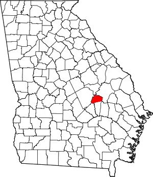 Map of Georgia highlighting Treutlen County | |
| Unincorporated communities | ||