South Sorong Regency
South Sorong Regency (Indonesian: Sorong Selatan) is a regency of Southwest Papua province of Indonesia. It has an area of 6,594.31 km2, and had a population of 37,900 at the 2010 Census[2] and 52,469 at the 2020 Census;[3] the official estimate as at mid 2022 was 53,884.[1] The administrative centre is the town of Teminabuan.
South Sorong Regency
Kabupaten Sorong Selatan | |
|---|---|
 Seal | |
 Location in Indonesian Papua | |
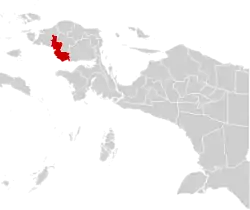
 South Sorong Regency Location in Indonesia | |
| Coordinates: 1.5050°S 132.2864°E | |
| Country | |
| Province | Southwest Papua |
| Capital | Teminabuan |
| Government | |
| • Regent | Samsudin Anggiluli |
| • Vice Regent | Marthinus Salamuk |
| Area | |
| • Total | 6,594.31 km2 (2,546.08 sq mi) |
| Population (mid 2022 estimate)[1] | |
| • Total | 53,884 |
| • Density | 8.2/km2 (21/sq mi) |
| Time zone | UTC+9 (Indonesia Eastern Time) |
| Area code | (+62) 952 |
| Website | sorongselatankab.go.id |
Geography
South Sorong Regency is located in the western part of Papua Island. Geographically, South Sorong Regency at position 131º 421 0” east longitude - 132º 581 12” east longitude and 0º 55' 12” east longitude - 2º 17' 24” east longitude.
- to the north it is bordered by the Tambrauw Regency;
- in the east it is bordered by Teluk Bintuni Regency and Maybrat Regency;
- to the south it is bordered by Bintuni Bay and the Seram Sea;
- to the west it is bordered by the Seram Sea and Sorong Regency.
Languages
Languages spoken in South Sorong Regency include Inanwatan, Yahadian, Kais, Kokoda, Konda, and Puragi.[4]
Administrative Districts
South Sorong Regency comprises fifteen districts (kecamatan), tabulated below with their areas and their populations at the 2010 Census[2] and the 2020 Census,[3] together with the official estimates as at mid 2022.[1] The table also includes the locations of the district administrative centres, the number of administrative villages in each district (totaling 121 rural kampung and 2 urban kelurahan), and its post code.
| Name of District (distrik) | Area in km2 | Pop'n Census 2010 | Pop'n Census 2020 | Pop'n Estimate mid 2022 | Admin centre | No. of villages | Post code |
|---|---|---|---|---|---|---|---|
| Inanwatan | 830.54 | 2,811 | 3,226 | 3,093 | Mate | 9 | 98223 |
| Metemani | 450.49 | 2,115 | 2,996 | 2,923 | Mugim | 16 | 98225 |
| Kokoda | 648.36 | 5,876 | 5,805 | 6,278 | Tarof | 16 | 98221 |
| Kokoda Utara (North Kokoda) | 484.34 | 1,666 | 2,584 | 2,429 | Atori | 9 | 98224 |
| Kais | 354.89 | 2,841 | 2,925 | 2,401 | Kais | 5 | 98222 |
| Kais Darat | 690.96 | (a) | 844 | 989 | Mukamat | 7 | 98226 |
| Moswaren | 402.97 | 2,130 | 2,756 | 2,586 | Moswaren | 7 | 98212 |
| Teminabuan | 386.89 | 11,627 | 19,491 | 19,669 | Kaibus | 16 (b) | 98216 |
| Seremuk | 205.09 | 1,159 | 1,554 | 1,575 | Haha | 8 | 98214 |
| Wayer | 317.89 | 1,455 | 2,395 | 2,250 | Wayer | 8 | 98215 |
| Konda | 427.21 | 1,883 | 2,437 | 2,458 | Bariat | 5 | 98211 |
| Saifi | 645.52 | 1,747 | 2,216 | 2,410 | Sayal | 10 | 98213 |
| Sawiat | 353.62 | 1,831 | 1,344 | 1,423 | Wen | 8 | 98232 |
| Fokour | 305.01 | 759 | 637 | 624 | Pasir Putuh | 4 | 98231 |
| Salkma | 90.53 | (c) | 809 | 853 | Alma | 5 | 98233 |
| Totals | 6,594.31 | 18,564 | 52,469 | 53,884 | Teminabuan | 123 |
Notes: (a) the 2010 population of Kais Darat District are included in the figure for Kais District, from which it was later split.
(b) including 2 kelurahan - Kaibus and Kohoin.
(c) the 2010 population of Salkma District are included in the figure for Sawiat District, from which it was later split.
References
- Badan Pusat Statistik, Jakarta, 2023, Kabupaten Sorong Selatan Dalam Angka 2023 (Katalog-BPS 1102001.9204)
- Biro Pusat Statistik, Jakarta, 2011.
- Badan Pusat Statistik, Jakarta, 2021.
- Eberhard, David M.; Simons, Gary F.; Fennig, Charles D., eds. (2019). "Indonesia languages". Ethnologue: Languages of the World (22nd ed.). Dallas: SIL International.
External links
Regencies and cities of Southwest Papua | ||
|---|---|---|
Capital: Sorong | ||
| Regencies | ||
| Cities | ||