South Fork Grand River (South Dakota)
The South Fork of the Grand River is a tributary of the Grand River, approximately 90 mi (145 km) long, in South Dakota in the United States.
| South Fork Grand River Tributary to Grand River | |
|---|---|
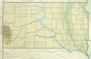 Location of South Fork Grand River mouth  South Fork Grand River (South Dakota) (the United States) | |
| Location | |
| Country | United States |
| State | South Dakota |
| Counties | Perkins Harding |
| Physical characteristics | |
| Source | Buffalo Creek divide |
| • location | about 12 miles southwest of Buffalo, South Dakota |
| • coordinates | 45°27′14.98″N 103°43′1.72″W[1] |
| • elevation | 3,500 ft (1,100 m)[1] |
| Mouth | Grand River |
• location | Shadehill Reservoir |
• coordinates | 45°43′29.98″N 102°17′1.57″W[1] |
• elevation | 2,274 ft (693 m)[1] |
| Length | 143.15 mi (230.38 km)[2] |
| Basin size | 2,283.21 square miles (5,913.5 km2)[3] |
| Discharge | |
| • location | Grand River |
| • average | 115.36 cu ft/s (3.267 m3/s) at mouth with Grand River[3] |
| Basin features | |
| Progression | Grand River → Missouri River → Mississippi River → Gulf of Mexico |
| River system | Grand River |
| Tributaries | |
| • left | Big Creek, Little Grand River, Jerry Creek, Pine Spring Creek, Graves Creek, Brush Creek, Rush Creek, Slick Creek, Sheep Creek, Boxelder Creek, Jones Creek, Bull Creek, Coal Creek, Horse Creek, Brush Creek, Skull Creek, Olean Creek, Middle Creek, Big Nasty Creek, Duck Creek, Little Nasty Creek, Lodgepole Creek |
| • right | Clarks Fork Creek, Eggland Creek, Prairie Dog Creek, Fisher Creek, Bar H Creek, White Hill Creek, Murphy Creek, Snake Creek, Defenbull Creek, Timber Draw Creek, Box Spring Creek, Butcher Creek |
| Bridges | Gilbert-Hett Road, US 85, E6 Road (x2), SD 79, White Hill Road, Divide Road, SD 75, White Butte Road |
It rises in the Badlands of northwestern South Dakota, south of the Cave Hills in western Harding County, and flows east past Buffalo, then past several units of the Grand River National Grassland in northern Perkins County. It joins the North Fork in the Shadehill Reservoir near to form the Grand, which is a tributary of the Missouri.
See also
References
- "Geographic Names Information System". edits.nationalmap.gov. US Geological Survey. Retrieved January 15, 2023.
- "ArcGIS Web Application". epa.maps.arcgis.com. US EPA. Retrieved January 15, 2023.
- "Watershed Report | Office of Water | US EPA". watersgeo.epa.gov. US EPA. Retrieved January 15, 2023.
External links
- "South Fork Grand River". Geographic Names Information System. United States Geological Survey. Retrieved 2014-01-01.
This article is issued from Wikipedia. The text is licensed under Creative Commons - Attribution - Sharealike. Additional terms may apply for the media files.