Spatial Query Server
The Boeing Company's Spatial Query Server is a commercially available product which enables a Sybase database to contain spatial features.
 | |
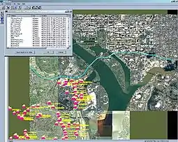
 Screenshot of SQS Viewer running under Windows | |
| Developer(s) | The Boeing Company |
|---|---|
| Initial release | December 2001 |
| Stable release | 3.6
/ November 2007 |
| Operating system | SGI, Solaris, Linux, Windows 2000, 2003 & XP |
| Type | Geodatabase |
| License | Pay Licensed Closed Source/Proprietary |
| Website | Boeing SQS |
Geometric types
- Circle
- Ellipse
- Point - a point in 2D space. (x,y) plane.
- Voxel - a point in 3D space. (x,y,z) volume.
- Polygon
- Polygon(n)
- Polygon set
- Gpolygon
- Gpolygon(n)
- Gpolygon_set
- Line
- Line(n)
- Line_set
- Rectangle
- Rectangle_set
- Llbox
- Llbox_set
See also
External links
This article is issued from Wikipedia. The text is licensed under Creative Commons - Attribution - Sharealike. Additional terms may apply for the media files.