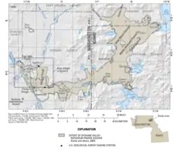
Spokane Valley–Rathdrum Prairie Aquifer
The Spokane Valley–Rathdrum Prairie Aquifer is an aquifer in the northwest United States, located in eastern Washington and northern Idaho.[1]
| Spokane Valley–Rathdrum Prairie Aquifer | |
|---|---|
 Map of the Aquifer | |
 Spokane Valley–Rathdrum Prairie Aquifer Location in the United States 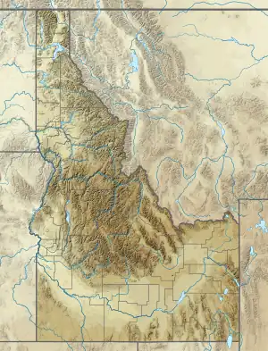 Spokane Valley–Rathdrum Prairie Aquifer Location in Idaho | |
| Location | Inland Northwest, United States |
| Coordinates | 47.7°N 117°W |
| Primary inflows |
|
| Primary outflows | Spokane River |
| Basin countries | United States |
| Surface area | 370 square miles (960 km2) |
| Water volume | 10 trillion gallons (12,000 km3) |
The aquifer is centralized under Spokane Valley and the Rathdrum Prairie, hence the name; it contains ten trillion gallons (38 trillion liters) of water, and is part of the Columbia River drainage basin. The only watercourse that remains above the surface for an extended distance is the Spokane River. The area surrounding it receives an average of 15–30 inches (38–76 cm) of rain annually. The aquifer is the primary water source for the greater Spokane area, which is home to over 700,000 people in the Inland Empire.[2][3]
References
- "Spokane-Rathdrum Prairie aquifer". Spokesman-Review. (Spokane, Washington). (map). February 24, 1980. p. B6.
- "The Spokane Valley–Rathdrum Prairie Aquifer Atlas" (PDF). Spokane Aquifer Joint Board. Retrieved 2016-09-05.
- King, Anna (August 22, 2021). "What's to become of this water-rich Northwest ranch?". OPB. Retrieved 2021-08-23.
External links
This article is issued from Wikipedia. The text is licensed under Creative Commons - Attribution - Sharealike. Additional terms may apply for the media files.