Stóra-Eldborg undir Geitahlíð
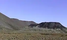
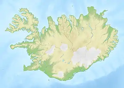
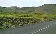
Stóra-Eldborg undir Geitahlíð (Icelandic pronunciation: [ˈstouːra-ˌɛltˌpɔrk ˈʏntɪr ˈceiːtaˌl̥iːθ]; also Stóra-Eldborg við Geitahlíð [...vɪð...]) is a small Holocene volcano in Iceland, on Reykjanes peninsula, 50 m high,[1] with a 30 m deep crater.[2] It is located at about 5 km from Krýsuvík and as the name says at the foot of a bigger mountain, the tuya of Geitahlíð.[3]
| Stóra-Eldborg undir Geitahlíð | |
|---|---|
 Stóra-Eldborg | |
| Highest point | |
| Elevation | 50 m (160 ft)(Íslandshandbókin. Náttúra, saga og sérkenni. Reykjavík 1989, p. 45) |
| Coordinates | 63°51′21″N 21°59′54″W |
| Naming | |
| English translation | Big rock of fire under the goat slope |
| Language of name | Icelandic |
| Geography | |
 Stóra-Eldborg undir Geitahlíð Iceland | |
| Geology | |
| Age of rock | Holocene |
| Mountain type | Pyroclastic cone |
| Last eruption | Holocene |
| Climbing | |
| Easiest route | marked hiking trail |
Volcanism
Eruption fissures of the Brennisteinsfjöll volcanic system
Despite its location, just some 5 km from the high temperature area of Seltún, the volcano and its counterparts, the crater rows, fissures, as well as the tuya Geitahlíð (385 m[1]) with the crater Æsubúðir [ˈaiːsʏˌpuːðɪr̥] on its top,[2] are not part of the Krýsuvík volcanic system, but of the volcanic system of Brennisteinsfjöll as its southernmost outpost.[4]
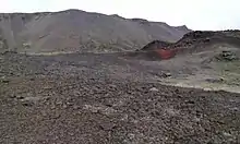
Eldborgir erupted about 2400 BP.[2] The crater row also includes some lava channels. The lava at time of eruption run 2,5 km to the sea.[1]
The pyroclastic cones
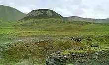
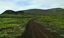
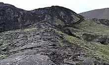
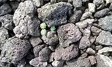
Stóra-Eldborg undir Geitahlíð is a pyroclastic cone,[1] built up mostly from spatter and scoria it forms part of a crater row.
Another such eruption fissure is to be found nearby, therefore Icelanders prefer the plural Eldborgir undir Geitahlíð.[5] One of the eruption fissures dissects the older tuya Geitahlíð.
The Litla-Eldborg crater is part of the parallel crater row and eruption fissure.[1] The eruption products of both fissures are petrologically different when compared. For this reason, it has been thought, that the fissures are not from the same eruption series.[6]
Litla-Eldborg regrettably is rather damaged by quarrying.[6]
Tuya Geitahlíð
The pyroclastic cones bear their name, because they are located very near to the tuya Geitahlíð (386 m), and one of the fissures even can be seen dissecting the side of the older volcano. The tuya has its origin in subglacial eruptions under a Pleistocene glacier during a cold spell of the Ice Age. A Holocene crater is located up on summit plateau of the tuya which produced the lava field Krýsuvíkurhraun. It entered the sea to the south and formed the upper layers at Krýsuvíkurbjarg.[7]
Fólk tales
The location is connected to the fólk tale about the cousins Krýsa and Herdís. The old women, who could use witchcraft, had a hefty discussion about the borders of their respective lands. One wanted to cast a spell so that all the fish in a nearby lake would be hairy, the other intended to bring up a storm and let all fishermen die. But this did not happen. Instead, the dispute ended with the death of both of them.[1] The fólk tale says that they were buried side by side and the place of the graves is still known to locals.[2]
Nature protection
The crater and its surroundings were placed under nature protection in 1987 [1] as a natural monument inside of Reykjanesfólkvangur.[8]
Hiking
There are some – partially marked - hiking trails on the eruption fissure, up to the rim of the Stóra-Eldborg-Crater and in the vicinity. Reynir Ingibjartsson also proposes a tour up on the tuya through a small valley behind Stóra-Eldborg to visit the crater up on the tuya and because of the view over all of the south coast of Reykjanes as well as over other parts of Iceland's south coast up to Eyjafjallajökull.[2]
External links
- Stóra-Eldborg next to Geitahlíð. Visit Reykjanes. Official Travel Guide.
- The Environment Agency of Iceland. Umhverfisstofnunn. (in Icelandic)
References
- Íslandshandbókin. Náttúra, saga of sérkenni. Reykjavík 1989, p. 45
- Reynir Ingibjartsson: 25 Gönguleiðir á Reykjanesskaga. Náttúrann við Bæjarveggin. Reykjavík , p.112 - 117
- For maps see eg: The Environmental Agency of Iceland and Reynir Ingibjartsson: 25 Gönguleiðir á Reykjanesskaga. Náttúrann við Bæjarveggin. Reykjavík 2014, p.113
- Daníel Páll Jónasson: Hraunflæði á höfuðborgarsvæðinu Saga hraunflæðis á svæðinu á nútíma og kortlagning mögulegra farvega til byggða. BS ritgerð. Leiðbeinandi:Ármann Höskuldsson. Háskóli Íslands, Reykjavík 2012. Retrieved 30 July 2020.
- For Icelandic grammar, see eg. https://en.wikibooks.org/wiki/Icelandic/Grammar/Nouns
- Helgi Páll Jónsson: Eldfjallagarður og jarðminjasvæði á Reykjanesskaga. Jarðvísindadeild Háskóli Íslands 2011. MS ritgerð. Leiðbeinendur Ólafur Ingólfsson. Skoðað 17. ágúst 2020.
- Reynir Ingibjartsson: 25 Gönguleiðir á Reykjanesskaga. Náttúrann við Bæjarveggin. Reykjavík , p. 112
- Circumpolar protected areas monitoring. CAFF Monitoring Meeting No. 5, Report, March 2011. Retrieved 30 July 2020.