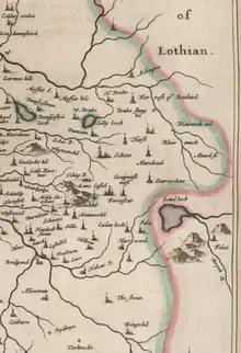
Shotts
Shotts is a small town [2] in North Lanarkshire, Scotland. It is located almost halfway between Glasgow (17 miles or 27 kilometres) and Edinburgh (26 miles or 42 kilometres). The town has a population of about 8,840.[3][4] A local story has Shotts being named after the legendary giant highwayman Bertram de Shotts,[5] though toponymists give the Anglo-Saxon scēots ("steep slopes") as the real source of the name.[6] Shotts is the home of the 2015 world champion pipe band, Shotts and Dykehead Caledonia Pipe Band.[7]
| Shotts | |
|---|---|
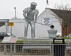 Metalworker statue in town centre. | |
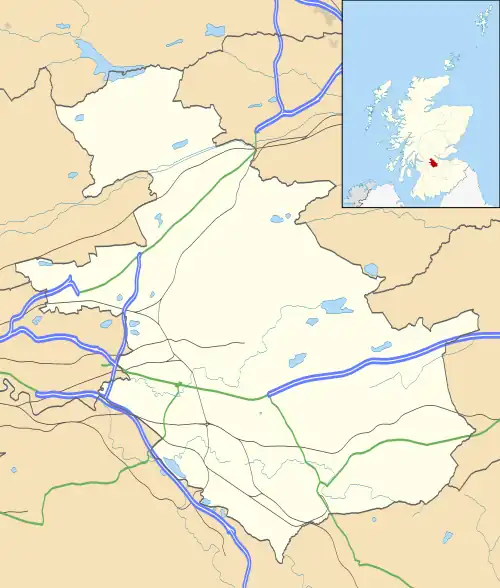 Shotts Location within North Lanarkshire | |
| Population | 8,630 (mid-2020 est.)[1] |
| Council area | |
| Lieutenancy area | |
| Country | Scotland |
| Sovereign state | United Kingdom |
| Post town | Shotts |
| Postcode district | ML7 |
| Police | Scotland |
| Fire | Scottish |
| Ambulance | Scottish |
| UK Parliament | |
| Scottish Parliament | |
History
Until 1457[8] Shotts was part of the Lanarkshire parish of Bothwell.[9] Groome related that the pre-reformation church of Bertramshotts is mentioned in a Papal bull in 1476.[10] The parish, one of the largest in Lowland Scotland, was sometimes called Shotts[11] but officially it was known as Bertram Shotts.[12]
In 1831 the Duke of Hamilton owned most of the land.[13]
Shotts was known for its mining and ironworks. The Shotts Iron Company was first established in 1801 and provided employment for Shotts and the surrounding area for 150 years, and was eventually wound up in 1952.[14][15] These were developed when transport by canal and railway became possible.[16] By the late 1800s the ironworks had grown to the extent that the village slogan was "Shotts lights the world", as gas lamp standards made here were exported throughout the British Empire and beyond.[17] In the years leading up to World War II there were 22 coal mines in the area, but Northfield Colliery, the last of these, closed in the 1960s.
Geography
Shotts is south of the M8 in North Lanarkshire between Wishaw and Harthill. Historically the Shotts Iron Works were between Calderhead, source of the South Calder Water, and Stane.[20] Shotts parish was originally made up of five villages: Dykehead,[21] Calderside, Stane, Springhill and Torbothie; all growing up around the old coach roads between Glasgow and Edinburgh that expanded and merged during the 18th and 19th centuries following the growth in mining.[22]
Nearby is Kirk o' Shotts transmitting station.
Knowhoble Hill
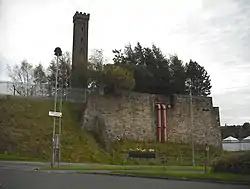
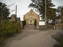
Knowhoble Hill, lying beside Teilling Burn, was the site of adwelling belonging to the Cleland (Clevland) family.
Sport

Shotts has a number of sports facilitated in the local community. Shotts Golf Club, an 18-hole course founded in 1895, is to the North-East of the town.[23] On the first Saturday in June each year, Shotts hosts its own Highland Games in Hannah Park.[24]
Football Teams
- AFC Hartwood
- Shotts Bon Accord
- Shotts Vics
- Shotts YMCA
- Springhill AFC
- Dykehead F.C.
- Torbothie Rose
- Shotts Albion
- Shotts Thistle
HMP Shotts
HMP Shotts, a high security prison holding male prisoners with maximum security classification, is located between Shotts and Salsburgh. It opened in 1978 and provided a new source of employment after the closure of the mines.
Transport
The town is served by Shotts railway station, which is connected on the Shotts Line between Glasgow and Edinburgh.
Schools within Shotts
- St.Patrick's Primary
- Stane Primary
- Dykehead Primary
- Calderhead High School
Notable Shotts people

- Mick McGahey Scottish miners' leader
- Matthew Baillie anatomist
- Michelle Barr, Scotland women's international footballer.[25]
- Hugh Dallas Scottish and international football referee
- William Grossart, Esq., Surgeon. — wrote "Historic Notices and Domestic History of the Parish of Shotts" in 1880.[26]
- Gavin Hamilton
- Margaret Herbison, Member of Parliament
- Andrew Keir, actor
- George MacBeth, writer
- Col Donald James MacKintosh FRSE, soldier and physician
- Louise Murphy Councillor
- Catriona Shearer, newsreader, journalist and television presenter.[27]
- James “Gentleman Jim” Rodger, former pit worker and famous for being a football journalist and “Scottish footballs ‘Mr Fixit’”. Renowned for facilitating player transfers and helping managers into jobs. Described by Alex Ferguson as his “mentor”.
References
- "Mid-2020 Population Estimates for Settlements and Localities in Scotland". National Records of Scotland. 31 March 2022. Retrieved 31 March 2022.
- Cochrane, Thomas. "Town Status for Shotts | 38 Degrees". you.38degrees.org.uk.
- "Key Facts 2016 - Demography". North Lanarkshire Council. Retrieved 3 January 2018.
- "Estimated population of localities by broad age groups, mid-2012" (PDF). Retrieved 3 January 2018.
- Lewis, Samuel (1851). A topographical dictionary of Scotland, comprising the several counties, islands, cities, burgh and market towns, parishes, and principal villages, with historical and statistical descriptions: embellished with engravings of the seals and arms of the different burghs and universities. London: S. Lewis and co. pp. 125–127. Retrieved 2 January 2018.
- Mackay, George (2002). Scottish Place Names
- "Scotland celebrates 'outstanding' World Pipe Band Championships". BBC News. 15 August 2015.
- Pomphrey's directory of Wishaw and handbook of the parish of Cambusnethan: with Shotts supplement (3rd ed.). Wishaw: W. Pomphrey. 1893. p. 16. Retrieved 5 January 2018.
- "County Maps". National Library of Scotland. Retrieved 2 January 2018.
- Groome, Francis Hindes (1882). Ordnance gazetteer of Scotland : a survey of Scottish topography, statistical, biographical, and historical (Vol 6 ed.). Edinburgh: T.C. Jack. pp. 349–351. Retrieved 13 January 2018.
- Bruce, Archibald (1791). The statistical account of Scotland. Drawn up from the communications of the ministers of the different parishes. [electronic resource] (Vol XV ed.). Edinburgh: William Creech. pp. 49–64. Retrieved 6 January 2018.
- Colvin, Walter L. (1845). The new statistical account of Scotland (Vol 6 ed.). Edinburgh and London: William Blackwood and Sons. pp. 624–635. Retrieved 3 January 2018.
- Dillion, John; Fullartoun, John (1831). Descriptions of the Sheriffdoms of Lanark and Renfrew Compiled about M.DCC.X by William Hamilton. Hutchison and Brookman.
- Muir, Augustus (1954). The Story of Shotts. W. Heffer & Sons Ltd.
- Bilsland, John (21 March 1952). "The Shotts Iron Company Limited". The Edinburgh Gazette.
- Grossart, William (1880). Historic Notices and Domestic History of the Parish of Shotts. from Shotts Parish Coal & Ironworks on the Scottish Mining site. Retrieved 13 January 2018.
- "Shotts Feature Page on Undiscovered Scotland". www.undiscoveredscotland.co.uk. Retrieved 4 October 2020.
- Blaeu, Joan. "Glottiana Praefectura Inferior". National Library of Scotland. Retrieved 30 December 2017.
- "Glasgow and the county of Lanark - Pont 34". Maps of Scotland. Timothy Pont (16th century). Retrieved 31 December 2017.
- "25 inch O.S. Map with zoom and Bing overlay". National Library of Scotland. Ordnance Survey. Retrieved 30 December 2017.
- "History of Dykehead in North Lanarkshire | Map and description". www.visionofbritain.org.uk. Retrieved 4 October 2020.
- "Shotts". VisitLanarkshire. Retrieved 4 October 2020.
- "Shotts Golf Club". Retrieved 10 March 2015.
- "Shotts Highland Games".
- "Michelle Barr Bio". Dartmouth Sports. 12 May 2010. Retrieved 20 March 2013.
- Pickering, Peter; Shaw-jones, John. "Mining Review 4th Year No. 12". British Film Industry. Retrieved 3 February 2018.
- Brian McIver (6 July 2009). "Newsreader Catriona Shearer prepares to make big time bow on Reporting Scotland". Daily Record. Retrieved 27 May 2012.
External links
 Media related to Shotts at Wikimedia Commons
- Shotts Bon Accord FC
- Shotts History Group
- A brief history of Shotts
- Shotts and Dykehead Caledonia Pipe Band
- Video footage of Shotts railway station.
- Video footage of the Fortissat or Covenanters' Stone.
