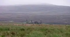
Stines Moss
Stines Moss is an elevated bog in the southwest upland area of the Orkney Mainland, Scotland.[1]

Stines Moss with North Dales in the background.
Prehistory and history
This moss is located a few miles south of very significant Neolithic and Iron Age archaeological sites. A few miles to the north are the Standing Stones of Stenness and the Ring of Brodgar.[2] About four miles to the northeast is the Iron Age Maes Howe site.
The Burn of Ayreland flows through this moss, and thence proceeds in a northwesterly direction to power the Mill of Ayreland before discharging to the Clestrain Sound. The mill functioned from the Late Middle Ages until at least the late 1880s and is now a country inn.
References
- United Kingdom Ordnance Survey Map Landranger 6, Orkney Mainland, 1:50,000 scale, 2003
- J. Gunn (1932). Orkney, the Magnetic North. Edinburgh: Thomas Nelson and Sons.
This article is issued from Wikipedia. The text is licensed under Creative Commons - Attribution - Sharealike. Additional terms may apply for the media files.