Enoch Cree Nation 135
Enoch Cree Nation 135, (Cree: ᒪᐢᑫᑯᓯᐦᐠ, romanized: maskêkosihk /məsˈkeɪɡoʊsiːk/) previously known as Stony Plain No. 135, is an Indian reserve of the Enoch Cree Nation #440 in Alberta.[5] It is adjacent to the City of Edmonton to the east and Parkland County to the north, west, and south.[7]
Enoch Cree Nation 135
| |
|---|---|
| Enoch Cree Nation Indian Reserve No. 135 | |
 Welcome sign | |
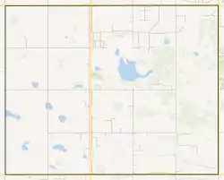 Boundaries of Enoch Cree Nation 135 | |
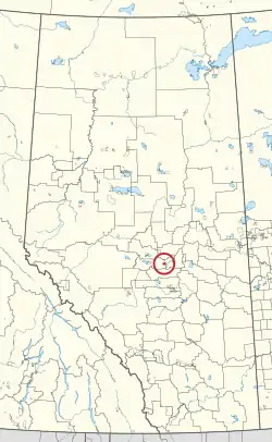 Location in Alberta | |
| Coordinates: 53°28′59″N 113°45′06″W[2] | |
| First Nation | Enoch Cree |
| Treaty | 6 |
| Country | Canada |
| Province | Alberta |
| Municipal district | Parkland |
| Government | |
| • Chief | William (Billy) Morin |
| • Governing body | Enoch Cree Nation |
| Area | |
| • Total | 5,306.2 ha (13,111.9 acres) |
| Population (2016)[6] | |
| • Total | 1,690 |
| • Density | 32.8/km2 (85/sq mi) |
| Time zone | UTC−7 (MST) |
| • Summer (DST) | UTC−6 (MDT) |
| Postal Code | |
| Area code(s) | 780, 587 and 825 |
| Highways | 60, 628 |
| Website | enochnation |
Demographics
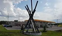
River Cree Crossing is a commercial development in the northeast corner of the reserve, adjacent to the City of Edmonton.
In 2016 Enoch Cree Nation 135 had a population of 1,690 living in 576 dwellings, a 71.2% increase from 2011. The Indian reserve has a land area of 51.55 km2 (19.90 sq mi) and a population density of 32.8/km2 (85/sq mi).[6]
According to the Canada 2016 Census:
- Population: 1,690
- % Change (2011-2016): +71.2%
- Dwellings: 576
- Area (km2): 51.55
- Density (persons per km2): 32.8
See also
- List of communities in Alberta
- List of Indian reserves in Alberta
- Tsuut'ina 145, a reserve similarly adjacent to the City of Calgary
References
- Ogg, Arden (November 6, 2017). "Indigenous Mapping Workshop 2017: Supporting Cree as a 21st Century Language". Cree Literacy Network. Retrieved July 26, 2021.
- "Enoch Cree Nation 135". Geographical Names Data Base. Natural Resources Canada.
- "Enoch Cree Nation 135". Geographical Names Data Base. Natural Resources Canada.
- "Municipal Officials Search". Alberta Municipal Affairs. May 9, 2019. Retrieved October 1, 2021.
- "Reserve/Settlement/Village Detail". Crown–Indigenous Relations and Northern Affairs Canada. Government of Canada. April 9, 2019. Retrieved April 10, 2021.
- "Stony Plain 135-Census Profile". Statistics Canada. Statistics Canada. 2016. Retrieved July 11, 2019.
- Government of Alberta (May 25, 2019). Municipal Boundaries (Map). AltaLIS.
- Geo-Administrative Areas (Hamlet, Locality and Townsite Culture Points) (Geodatabase layer) (Map). AltaLIS. October 26, 2020. Retrieved October 2, 2021.
{{cite map}}: CS1 maint: date and year (link)
Wikimedia Commons has media related to Enoch Cree Nation 135.
Places adjacent to Enoch Cree Nation 135 | ||||||||||||||||
|---|---|---|---|---|---|---|---|---|---|---|---|---|---|---|---|---|
| ||||||||||||||||
| Ethnolinguistic groups (by language family) | |||||||||||||||||||||||||||||
|---|---|---|---|---|---|---|---|---|---|---|---|---|---|---|---|---|---|---|---|---|---|---|---|---|---|---|---|---|---|
| Historical polities | |||||||||||||||||||||||||||||
| Numbered Treaties | |||||||||||||||||||||||||||||
| Tribal councils and band governments |
| ||||||||||||||||||||||||||||
This article is issued from Wikipedia. The text is licensed under Creative Commons - Attribution - Sharealike. Additional terms may apply for the media files.