Stopan
Stopan (Serbian Cyrillic: Стопан) is a village in the Bosnia and Herzegovina, Kotor Varoš Municipality, Šiprage local community. At the census in 1991, Stopan had a population of 346. According to preliminary results of the census 2013 there were 119 citizens.[1]
Stopan | |
|---|---|
Village | |
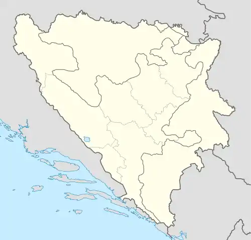
 Stopan Location in Bosnia and Herzegovina | |
| Coordinates: 44.4839°N 17.5636°E | |
| Country | Bosnia and Herzegovina |
| Entity | Republika Srpska |
| Municipality | Kotor Varoš |
| Highest elevation | 680 m (2,230 ft) |
| Lowest elevation | 660 m (2,170 ft) |
| Population (1991) | |
| • Total | 346 |
Geography
Stopan is located on the pass (altitude about 680 m) sandwiched between Crkvenica and Stopanski river, right tributaries of Vrbanja river. From this village to Šiprage there is a mostly gravel local road, length of about 8 km.[2]
Stopan used to be a relatively big village in Šiprage's area, with drinking water and orchards, domestic fruit products and hospitality.
History
During World War II, the village took part in the defense forces and was a significant partisan jump refuge. In January 1944, it received a large number of wounded partisans, who were evacuated from the Divisional Hospital in the gorge of Demićka, near Šiprage, during the sixth enemy offensive. Because of the distance of the main local communications, Stopan was a safer refuge for the civilian inhabitants of surrounding localities.[3]
During the War in Bosnia (1992-1995), army, police and paramilitary forces of the Republika Srpska destroyed the surrounding Bosniak villages, especially those upstream of Vrbanja to Kruševo Brdo as well as those downstream to Banja Luka.[4] Local inhabitants were being killed, and the majority were expelled. After 1996, most Bosniak villages in Šiprage community were partly restored, thanks to the BELUGA battalion of the EUFOR-SFOR Mission.[5] The only mosque in the wide area was renewed.[6]
Population
| Stopan[7] | ||||||
| Census year | 1991 | 1981 | 1971 | |||
| Bosniaks | 211 (60.98%) | 177 (46.46%) | 194 (47.67%) | |||
| Serbs | 133 (38.44%) | 174 (45.67%) | 204 (50.12%) | |||
| Croats | 1 (0.29%) | 1 (0.26%) | 1 (0.25) | |||
| Yugoslavians | 29 (7.61) | |||||
| Slovenians | 2 (0.49) | |||||
| Other and unknown | 1 (0.29%) | 6 (1.47%) | ||||
| Total | 346 | 381 | 407 | |||
References
- "Općina Kotor Varoš". nasbih.com. Archived from the original on 22 September 2015.
- Vojnogeografski institut, Izd. (1961): Šiprage (List karte 1:25,000 - Izohipse na 10 m). Vojnogeografski institut, Beograd.
- Spahić M. et al. (2000): Bosna i Hercegovina (1:250.000). Izdavačko preduzeće „Sejtarija“, Sarajevo.
- Mučibabić B., Ur. (1998): Geografski atlas Bosne i Hercegovine. Geodetski zavod BiH, Sarajevo, ISBN 9958-766-00-0. - Samardžija S. (1983): Četrnaesta srednjobosanska NOU brigada. Skupština opštine Prnjavor, Banja Luka.
- Gutman R. (1993): A witness to genocide: The 1993 Pulitzer Prize-Winning Dispatches on the "Ethnic Cleansing" of Bosnia. Macmillan Publishing Company, Inc., New York, ISBN 9780020329954, pp 150-175.
- Beč J. (1997): Pucanje duše. Samizdat B92, Beograd, ISBN 86-7208-010-6.
- http://www.slobodnaevropa.org/a/negiranje-genocida-ne-menja-cinjenice/27423754%5B%5D. - http://news.bbc.co.uk/2/hi/europe/country_profiles/1066886.stm. Archived 2015-09-06 at the Wayback Machine
- "Šiprage". miz-kotorvaros.net. Archived from the original on 13 September 2014. Retrieved 14 January 2022.
- Book: "Nacionalni sastav stanovništva – Rezultati za Republiku po opštinama i naseljenim mjestima 1991.", statistički bilten br. 234, Izdanje Državnog zavoda za statistiku Republike Bosne i Hercegovine, Sarajevo.
- Internet – Source: "Popis po mjesnim zajednicama" – "Archived copy" (PDF). Archived from the original (PDF) on 5 October 2013. Retrieved 5 October 2013.{{cite web}}: CS1 maint: archived copy as title (link)