Strouden Park
Strouden Park is an area of Bournemouth, Dorset, England.[1]
History
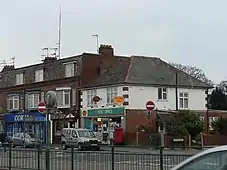
On 17 April 2021, the local post office and convenience store was destroyed in a fire.[2]
Geography
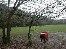
Strouden Park is north of Queen's Park, west of Townsend and east of Redhill. Woodbury is an area of Strouden Park. Woodbury Roundabout is a major intersection of the A3060 road.

Facilities
Strouden Park is served by a National Health Service surgery[3] and the Castlepoint Shopping Centre.[4]
Bournemouth North Cemetery and Bournemouth Crematorium is off Strouden Avenue.[5]
Politics
Strouden Park is part of the Muscliff and Strouden Park ward for elections to Bournemouth, Christchurch and Poole Council which elect three councillors.[6][7] It is part of the Bournemouth East parliamentary constituency, for elections to the House of Commons of the United Kingdom.
References
- "Information for Strouden Park in Bournemouth". www.geopunk.co.uk. Retrieved 6 October 2020.
- "Post office and store gutted in devastating early hours blaze". Bournemouth Echo. Retrieved 21 April 2021.
- "South Coast Medical Group | NHS Doctors in Dorset". www.stroudenpark.co.uk. Retrieved 6 October 2020.
- "Home Page - Castlepoint Shopping Park". www.castlepointshopping.com. Retrieved 6 October 2020.
- "Bournemouth Crematorium". www.bcpcouncil.gov.uk. Retrieved 22 January 2023.
- "Muscliff and Strouden Park". www.bcpcouncil.gov.uk. Retrieved 9 May 2021.
- "Local elections 2019: the count for Bournemouth, Christchurch and Poole as it happened". Bournemouth Echo. Retrieved 6 October 2020.
