Tanda, Ivory Coast
Tanda is a town in eastern Ivory Coast. It is a sub-prefecture and the seat of Tanda Department in Gontougo Region, Zanzan District. Tanda is also a commune. In 2021, the population of the sub-prefecture of Tanda was 69,597.[1]
Tanda | |
|---|---|
Town, sub-prefecture, and commune | |
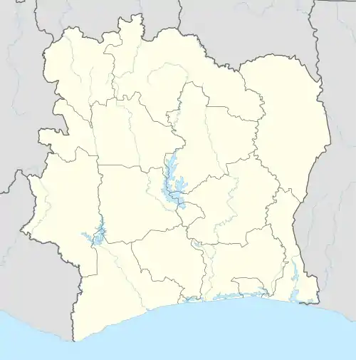 Tanda Location in Ivory Coast | |
| Coordinates: 7°48′N 3°10′W | |
| Country | |
| District | Zanzan |
| Region | Gontougo |
| Department | Tanda |
| Area | |
| • Total | 714 km2 (276 sq mi) |
| Population (2021 census)[1] | |
| • Total | 69,597 |
| • Density | 97/km2 (250/sq mi) |
| • Town | 27,659[2] |
| (2014 census) | |
| Time zone | UTC+0 (GMT) |
Villages
The thirty four villages of the sub-prefecture of Tanda and their population in 2014 are:[3]
- Abokouma (1 129)
- Ahibango (414)
- Bakoutié-Yao-Fiéni (568)
- Béléoulé (699)
- Bokoré (1 585)
- Sépé (386)
- Sokouadou (348)
- Tanda (27 659)
- Tangamourou (1 705)
- Téhui (1 197)
- Tèko (492)
- Toundiani (1 273)
- Yanvo (534)
- Amata (349)
- Assafo (88)
- Brouko (1 060)
- Dibibango (368)
- Djani-Yao (749)
- Fodja (170)
- Guiendé (1 506)
- Iguéla (930)
- Karabegné (371)
- Kiétan (561)
- Kongodja (521)
- Korobo (1 702)
- Koroko 2 (224)
- Korokobango (417)
- Korokofoumassa (204)
- Kouatoutou (791)
- Lécocodi (326)
- Lomo (1 294)
- Nagafou (1 066)
- Nao (1 050)
- Yaobouo (222)
Notes
- Citypopulation.de Population of the regions and sub-prefectures of Ivory Coast
- Citypopulation.de Population of cities & localities in Ivory Coast
- Citypopulation.de Population of the localities of the sub-prefecture of Tanda
Regional seat: Bondoukou | ||
| Bondoukou Department |  | |
| Koun-Fao Department | ||
| Sandégué Department | ||
| Tanda Department | ||
| Transua Department | ||
* also a commune | ||
This article is issued from Wikipedia. The text is licensed under Creative Commons - Attribution - Sharealike. Additional terms may apply for the media files.