Tendu Gewog
Tendu or Tendruk Gewog (Dzongkha: བསྟང་འབྲུག་, romanized: bstang 'brug) is a gewog (village block) of Samtse District, Bhutan.[2] The Tendruk Gewog comprises part of Sipsu Dungkhag (sub-district), together with Bara, Biru, Lehereni, and Sipsu Gewogs.
Tendu
བསྟང་འབྲུག་ Tendruk | |
|---|---|
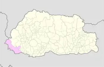 Tendu Tendu in the Samtse District of Bhutan | |
| Coordinates: 27°07′20″N 88°52′23″E | |
| Country | |
| District | Samtse District |
| Area | |
| • Total | 132.52 km2 (51.17 sq mi) |
| Population (2012)[1] | |
| • Total | 6,175 |
| Time zone | UTC+6 (BTT) |
The Tendruk village is on a ridge near the confluence of the Bindu River with the Dichu (or Jaldhaka) River. The Indo-Bhutan border meets the Dichu near this point, with the west bank of Dichu being in India (Kalimpong district) and the east bank being in Bhutan. Thus, part of the Tendruk gewog lies on the border with India. A little below the confluence is the Bindu Dam over Dichu, which is said to be the second oldest dam in the Indian subcontinent. There is a border crossing to India over the dam.
The Tendruk Gewog occupies an area of 132.52 square kilometres (51.17 sq mi).[3] It has 21 villages in 5 chiwogs. In 2012, it had a population of 6,175.[1]
References
- Eleventh Five-Year Plan, Samtse Dzongkhag, Gross National Happiness Commission, Royal Government of Bhutan, 2013, ISBN 978-99936-55-01-5. Sec. 4 (Dzonkhag at a glance, 2012).
- "Chiwogs in Samtse" (PDF). Election Commission, Government of Bhutan. 2011. p. 24. Archived from the original (PDF) on 2011-10-02.
- Tendruk Gewog, Dzonkhag Administration, Samtse. Retrieved 4 December 2021.
External links
- Tendruk Gewog marked on OpenStreetMap, retrieved 25 October 2021.