Tha Takiap district
Tha Takiap (Thai: ท่าตะเกียบ, pronounced [tʰâː tā.kìa̯p]) is the easternmost district (amphoe) of Chachoengsao province, central Thailand.
Tha Takiap
ท่าตะเกียบ | |
|---|---|
 | |
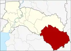 District location in Chachoengsao province | |
| Coordinates: 13°26′41″N 101°36′40″E | |
| Country | Thailand |
| Province | Chachoengsao |
| Seat | Tha Takiap |
| Area | |
| • Total | 1,054.8 km2 (407.3 sq mi) |
| Population (2017) | |
| • Total | 46,603 |
| • Density | 44.18/km2 (114.4/sq mi) |
| Time zone | UTC+7 (ICT) |
| Postal code | 24160 |
| Geocode | 2410 |
History
The minor district (king amphoe) Tha Takiap was established on 1 April 1991 by splitting off two tambons from Sanam Chai Khet district.[1] It was upgraded to a full district on 5 December 1996.[2]
Geography
Neighboring districts are (from the north clockwise): Sanam Chai Khet of Chachoengsao Province; Khao Chakan, Wang Nam Yen, and Wang Sombun of Sa Kaeo province; Kaeng Hang Maeo of Chanthaburi province; and Bo Thong and Ko Chan of Chonburi province.
Administration
Central administration
Tha Takiap is divided into two sub-districts (tambons), which are further subdivided into 47 administrative villages (mubans).
| No. | Name | Thai | Villages | Pop.[3] |
|---|---|---|---|---|
| 1. | Tha Takiap | ท่าตะเกียบ | 22 | 19,357 |
| 2. | Khlong Takrao | คลองตะเกรา | 25 | 27,246 |
Local administration
There are two sub-district administrative organizations (SAO) in the district:
- Tha Takiap (Thai: องค์การบริหารส่วนตำบลท่าตะเกียบ) consisting of sub-district Tha Takiap.
- Khlong Takrao (Thai: องค์การบริหารส่วนตำบลคลองตะเกรา) consisting of sub-district Khlong Takrao.
References
- ประกาศกระทรวงมหาดไทย เรื่อง แบ่งเขตท้องที่อำเภอสนามชัยเขต จังหวัดฉะเชิงเทรา ตั้งเป็นกิ่งอำเภอท่าตะเกียบ (PDF). Royal Gazette (in Thai). 108 (15 ง): 1063. January 31, 1991. Archived from the original (PDF) on April 6, 2012.
- พระราชกฤษฎีกาตั้งอำเภอเหนือคลอง อำเภอนายายอาม อำเภอท่าตะเกียบ อำเภอขุนตาล อำเภอแม่ฟ้าหลวง อำเภอแม่ลาว อำเภอรัษฎา อำเภอพุทธมณฑล อำเภอวังน้ำเขียว อำเภอเจาะไอร้อง อำเภอชำนิ อำเภอโนนดินแดง อำเภอปางมะผ้า อำเภอสนธิ อำเภอหนองม่วง อำเภอเบญจลักษ์ อำเภอโพนนาแก้ว อำเภอบุ่งคล้า อำเภอดอนมดแดง และอำเภอลืออำนาจ พ.ศ. ๒๕๓๙ (PDF). Royal Gazette (in Thai). 113 (62 ก): 5–8. November 20, 1996. Archived from the original (PDF) on May 21, 2009.
- "Population statistics 2017" (in Thai). Department of Provincial Administration. Retrieved 2018-04-04.