Thap Krit Tai
Thap Krit Tai (Thai: ทับกฤชใต้) is a tambon (subdistrict) in Chum Saeng district, Nakhon Sawan province, Thailand.
Thap Krit Tai
ทับกฤชใต้ | |
|---|---|
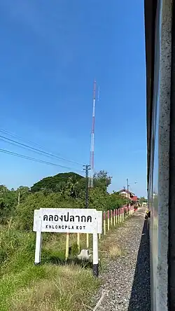 Khlong Pla Kot railway station in 2022 | |
| Etymology: "South Thap Krit" | |
| Coordinates: 15°44′51.8″N 100°14′37.2″E | |
| Country | Thailand |
| Province | Nakhon Sawan |
| District | Chum Saeng |
| Named for | Former Village |
| Government | |
| • Type | Subdistrict Administrative Organization (SAO) |
| • Mayor | Wichian Chumjit |
| Area | |
| • Total | 31.54 km2 (12.18 sq mi) |
| Population | |
| • Total | 3,394[1] |
| • Density | 107.61/km2 (278.7/sq mi) |
| Time zone | UTC+7 (ICT) |
| Postcode | 60250 |
| Area code | (+66) 02 |
| Website | https://www.thapkrittai.go.th/home |
History
Originally, Thap Krit Tai (lit "south Thap Krit") was a muban (village) in Thap Krit subdistrict, which consists of Thap Krit Nuea ("north Thap Krit), Thap Krit Klang ("central Thap Krit"), and Thap Krit Tai.
Later in the year 1997, when there is a lot more population, therefore officially split into a subdistrict.[1]
Geography
Thap Krit Tai is a northern part of Nakhon Sawan province. It is located 21 km (13.0 mi) from downtown Chum Saeng and about 19 km (11.8 mi) from downtown Nakhon Sawan.
Nan river and Bueng Thap Krit Tai are important sources of water.
Neighbouring subdistricts are, clockwise from the north, Khok Mo and Thap Krit in its district, Kriangkrai and Bang Phra Luang in Mueang Nakhon Sawan district.[1]
Administration
Central administration
The entire area is under the administration of Subdistrict Administrative Organization (SAO) Thap Krit Tai.
The emblem of SAO Thap Krit Tai features paddy field and freshwater lake with mountains in the background inside the ears of rice frame.
Local administration
The area also consists of eight administrative villages.[1]
| No. | Name | Thai |
|---|---|---|
| 1. | Ban Krit Thong | บ้านกฤชทอง |
| 2. | Ban Yan Sawai | บ้านย่านสวาย |
| 3. | Ban Map Chum Saeng Phatthana | บ้านมาบชุมแสงพัฒนา |
| 4. | Ban Dong Sawat | บ้านดงสวาท |
| 5. | Ban Khlong Sanuan | บ้านคลองสนวน |
| 6. | Ban Don Sanuan | บ้านดอนสนวน |
| 7. | Ban Thap Krit Tai | บ้านทับกฤชใต้ |
| 8. | Ban Tha Chang | บ้านท่าช้าง |
Transportation
Thap Krit Tai is served by the Thap Krit and Khlong Pla Kot railway stations of the State Railway of Thailand (SRT), whose northern line runs through the area.[2][3]
References
- "สภาพทั่วไป" [Typically condition]. Thapkrittai (in Thai).
- feelthai (2013-09-20). "สถานีรถไฟทับกฤช ตำบลทับกฤชใต้ อ ชุมแสง" [Thap Krit railway station, Thap Krit Tai subdistrict, Chum Saeng district]. YouTube (in Thai). Retrieved 2023-06-26.
- feelthai (2013-09-20). "สถานีรถไฟคลองปลากด ตำบลทับกฤชใต้ นครสวรรค์" [Khlong Pla Kot railway station, Thap Krit Tai subdistrict, Nakhon Sawan]. YouTube (in Thai). Retrieved 2023-06-26.