The Sphinx (Kings Canyon National Park)
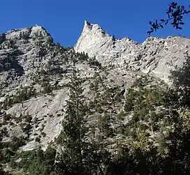
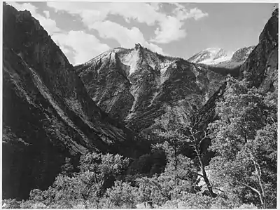
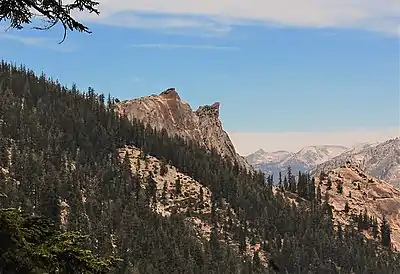
The Sphinx is a 9,143-foot-elevation (2,787-meter) double summit granitic pillar located west of the crest of the Sierra Nevada mountain range, in Kings Canyon National Park, in Fresno County of northern California.[3] This landmark is situated at the northern end of the Great Western Divide, two miles southeast of Kanawyers, five miles northwest of North Guard, and immediately south of the confluence of Bubbs Creek and South Fork Kings River. Topographic relief is significant as the north aspect rises 4,000 feet (1,200 meters) above the canyon in one mile. This geographical feature was named in 1891 by John Muir.[4] This feature's name has been officially adopted by the United States Board on Geographic Names.[3] The Sphinx formation is the further north and slightly lower of the two peaks, and was the first rock climb done in the Kings Canyon region.[5] The first ascent of the summit was made July 26, 1940, by Art Argiewicz and Bob Jacobs.[6] The North Buttress was first climbed October 18, 1970, by Fred Beckey, Greg Donaldson, and Walt Vennum.[7]
| The Sphinx | |
|---|---|
 | |
| Highest point | |
| Elevation | 9,143 ft (2,787 m)[1] |
| Prominence | 23 ft (7.0 m)[1] |
| Parent peak | Sphinx Crest (11,580 ft)[2] |
| Isolation | 1.91 mi (3.07 km)[2] |
| Coordinates | 36°46′16″N 118°33′03″W[3] |
| Naming | |
| Etymology | Sphinx |
| Geography | |
 The Sphinx Location in California  The Sphinx The Sphinx (the United States) | |
| Location | Kings Canyon National Park Fresno County, California, U.S. |
| Parent range | Sierra Nevada Great Western Divide[1] |
| Topo map | USGS The Sphinx |
| Geology | |
| Type of rock | granitic |
| Climbing | |
| First ascent | 1940 |
| Easiest route | class 5.6[2] |
Climate
According to the Köppen climate classification system, The Sphinx is located in an alpine climate zone.[8] Most weather fronts originate in the Pacific Ocean, and travel east toward the Sierra Nevada mountains. As fronts approach, they are forced upward by the peaks, causing them to drop their moisture in the form of rain or snowfall onto the range (orographic lift). Precipitation runoff from the peak drains into the South Fork Kings River.

References
- "The Sphinx, California". Peakbagger.com. Retrieved 2021-05-30.
- "Sphinx, The - 9,143' CA". listsofjohn.com. Retrieved 2021-05-30.
- "The Sphinx". Geographic Names Information System. United States Geological Survey, United States Department of the Interior. Retrieved 2021-05-30.
- Peter Browning, Place Names of the Sierra Nevada: From Abbot to Zumwalt, Wilderness Press, 1986, ISBN 9780899970479, page 206.
- Steve Roper, The Climber's Guide to the High Sierra, 1976, Sierra Club Books, ISBN 9780871561473, page 240.
- Robert L. Smith, A Climber’s Guide to the High Sierra (1954)
- Fred Beckey, The Sphinx, North Buttress, American Alpine Journal, 1972.
- Climate of the Sierra Nevada, Britannica.com
External links
- Weather forecast: National Weather Service
