Thirumanimutharu River (tributary of Kaveri)
The Thirumanimutharu River originates form Manjavadi village in the Shevaroy Mountain Range and flows through the Salem and Namakkal districts of the Indian state of Tamil Nadu. It rises in the Yercaud hills.[1] Thirumanimutharu River joins the Cauvery at the Nanjai Edayar village in Namakkal.
| Thirumanimutharu river | |
|---|---|
| Native name | திருமணிமுத்தாறு (Tamil) |
| Location | |
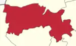
| Country | Salem District, Namakkal district India |
| Physical characteristics | |
| Source | |
| • location | Manjavadi , Shevaroy Mountain at Yercaud |
| • coordinates | 11°46′45″N 78°12′12″E |
| • elevation | 1,515 meters (4,970 ft) |
| Mouth | |
• location | Nanjai Edayar at Namakkal district |
• coordinates | 11°05′58″N 78°02′04″E |
• elevation | 121 meters (397 ft) |
| Length | 120 kilometers (75 mi) |
Places on the river bank
Manjavadi, Yercaud hills, Salem City, Vennandur, Aathumedu, Serukalai, Melsathamboor, Ramadevam, Koodacheri, Pillur, Paramathi Nanjai Edayar.
See also
References
- "Thirumanimutharu River". Archived from the original on 28 September 2011.
This article is issued from Wikipedia. The text is licensed under Creative Commons - Attribution - Sharealike. Additional terms may apply for the media files.