Tian'e County
Tian'e (Chinese: 天峨; pinyin: Tiān'é; Zhuang: Denhngoz Yen) is a county of northwestern Guangxi, China, located on the upper reaches of the Hongshui River and bordering Guizhou province to the northwest. It is under the administration of the prefecture-level city of Hechi.
Tian'e County
天峨县 · Denhngoz Yen | |
|---|---|
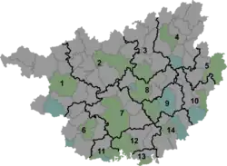 Tian'e Location of the seat in Guangxi | |
| Coordinates: 24°59′56″N 107°10′26″E | |
| Country | People's Republic of China |
| Autonomous region | Guangxi |
| Prefecture-level city | Hechi |
| Township-level divisions | 2 towns 6 townships 1 ethnic township |
| County seat | Liupai (六排镇) |
| Area | |
| • Total | 3,696 km2 (1,427 sq mi) |
| Elevation | 259 m (850 ft) |
| Population (2010) | |
| • Total | 160,440 |
| • Density | 43/km2 (110/sq mi) |
| Time zone | UTC+8 (China Standard) |
| Website | www |
Administrative divisions
There are 2 towns, 6 townships and 1 ethnic township in the county:[1]
Towns:
- Liupai (六排镇), Xiangyang (向阳镇)
Townships:
- Bamu Township (岜暮乡), Nazhi Township (纳直乡), Gengxin Township (更新乡), Xialao Township (下老乡), Pojie Township (坡结乡), Sanbao Township (三堡乡), Bala Yao Ethnic Township (八腊瑶族乡)
Transport and infrastructure
- Longtan Dam on the Hongshui River.
Biodiversity
Sinocyclocheilus furcodorsalis is a species of cave fish that is only known from an underground stream in Tian'e County.[2]
Climate
| Climate data for Tian'e (1991–2020 normals, extremes 1981–2010) | |||||||||||||
|---|---|---|---|---|---|---|---|---|---|---|---|---|---|
| Month | Jan | Feb | Mar | Apr | May | Jun | Jul | Aug | Sep | Oct | Nov | Dec | Year |
| Record high °C (°F) | 29.6 (85.3) |
34.6 (94.3) |
37.4 (99.3) |
38.1 (100.6) |
38.6 (101.5) |
38.2 (100.8) |
38.6 (101.5) |
38.6 (101.5) |
38.7 (101.7) |
35.6 (96.1) |
32.8 (91.0) |
30.5 (86.9) |
38.7 (101.7) |
| Average high °C (°F) | 15.5 (59.9) |
18.3 (64.9) |
21.9 (71.4) |
27.0 (80.6) |
29.9 (85.8) |
31.3 (88.3) |
32.7 (90.9) |
33.1 (91.6) |
31.2 (88.2) |
26.9 (80.4) |
22.9 (73.2) |
17.8 (64.0) |
25.7 (78.3) |
| Daily mean °C (°F) | 11.5 (52.7) |
13.8 (56.8) |
17.1 (62.8) |
21.7 (71.1) |
24.6 (76.3) |
26.4 (79.5) |
27.3 (81.1) |
27.1 (80.8) |
25.2 (77.4) |
21.5 (70.7) |
17.5 (63.5) |
13.0 (55.4) |
20.6 (69.0) |
| Average low °C (°F) | 9.1 (48.4) |
11.0 (51.8) |
14.1 (57.4) |
18.3 (64.9) |
21.2 (70.2) |
23.6 (74.5) |
24.3 (75.7) |
23.9 (75.0) |
21.9 (71.4) |
18.5 (65.3) |
14.5 (58.1) |
10.3 (50.5) |
17.6 (63.6) |
| Record low °C (°F) | 0.6 (33.1) |
2.1 (35.8) |
3.0 (37.4) |
8.3 (46.9) |
11.8 (53.2) |
16.8 (62.2) |
19.0 (66.2) |
19.8 (67.6) |
15.1 (59.2) |
9.6 (49.3) |
4.8 (40.6) |
0.7 (33.3) |
0.6 (33.1) |
| Average precipitation mm (inches) | 24.7 (0.97) |
25.6 (1.01) |
53.7 (2.11) |
80.8 (3.18) |
209.8 (8.26) |
284.3 (11.19) |
259.6 (10.22) |
175.7 (6.92) |
118.3 (4.66) |
77.6 (3.06) |
34.6 (1.36) |
20.8 (0.82) |
1,365.5 (53.76) |
| Average precipitation days (≥ 0.1 mm) | 9.8 | 9.2 | 13.3 | 14.1 | 16.3 | 18.2 | 18.6 | 16.0 | 10.8 | 9.5 | 7.7 | 7.1 | 150.6 |
| Average snowy days | 0.6 | 0.1 | 0 | 0 | 0 | 0 | 0 | 0 | 0 | 0 | 0 | 0.2 | 0.9 |
| Average relative humidity (%) | 75 | 74 | 75 | 76 | 79 | 83 | 83 | 82 | 80 | 79 | 77 | 74 | 78 |
| Mean monthly sunshine hours | 45.9 | 57.0 | 71.5 | 98.1 | 111.9 | 97.1 | 137.4 | 157.0 | 130.9 | 100.2 | 92.3 | 72.0 | 1,171.3 |
| Percent possible sunshine | 14 | 18 | 19 | 26 | 27 | 24 | 33 | 39 | 36 | 28 | 28 | 22 | 26 |
| Source: China Meteorological Administration[3][4] | |||||||||||||
References
- 2011年统计用区划代码和城乡划分代码:天峨县 (in Chinese). National Bureau of Statistics of the People's Republic of China. Retrieved 2013-01-02.
- Froese, Rainer; Pauly, Daniel (eds.) (2016). "Sinocyclocheilus furcodorsalis" in FishBase. January 2016 version.
- 中国气象数据网 – WeatherBk Data (in Simplified Chinese). China Meteorological Administration. Retrieved 28 May 2023.
- 中国气象数据网 (in Simplified Chinese). China Meteorological Administration. Retrieved 28 May 2023.
This article is issued from Wikipedia. The text is licensed under Creative Commons - Attribution - Sharealike. Additional terms may apply for the media files.