Tongtian River
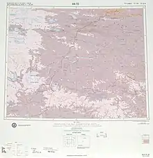
The Zhi Qu (Tibetan) or Tongtian River (Chinese: 通天河; pinyin: Tōngtiān Hé) is a 1,012 km (629 mi) long river in Qinghai Province, northwest China. It begins at the confluence of Tuotuo River and Dangqu River, before flowing southeast and meeting the Jinsha River near the border of Qinghai and Sichuan. It is within the Yangtze River drainage basin.

Name
The Chinese name comes from a fabled river in the Journey to the West. In antiquity, it was called the Yak River. In Mongolian, this section is known as the Murui-ussu (lit. "Winding Stream")[1] and is sometimes confused with the nearby Baishui.[2]
Geography
The three principal headwaters—the Chumaer, Muluwusu, and Akedamu rivers—join to form the Tongtian River, which flows southeast to Zhimenda near the frontier between Qinghai and Sichuan provinces, where it becomes the Jinsha River (Jinsha Jiang). The Jinsha River is a primary tributary of the Yangtze River (Chang Jiang).
The Tongtian River is one of the five large rivers flowing from headwaters on the Qinghai-Tibet Plateau.[3] Its length is 1,012 kilometres, draining an area of 138,000 square kilometres. Pilgrims go to the river because it is mythical, but also it is known for its "sutra bridge" and "Gyiana Mani stones".[4]
Dams
The Tongtian is planned for heavy development, primarily for hydroelectric power. As of March 2014 a total of 10 dams are planned for the river. Those dams are listed below from downstream to upstream.[5][6]
- Sewu Dam – Planned, 176.8 MW
- Xirong Dam – Planned, 160.5 MW
- Cefang Dam – Planned, 158 MW
- Genzhe Dam – Planned, 612 MW
- Leyi Dam – Planned, 112.8 MW
- Dequkou Dam – Planned, 276.5 MW
- Ruoqin Dam – Planned, 200 MW
- Lumari Dam – Planned, 72 MW
- Yage Dam – Planned, 63.6 MW
- Marigei Dam – Planned, 10.4 MW
See also
- Index: Tributaries of the Yangtze River
- List of rivers in China
References
- Ravenstein, Ernest & al. (ed.). The Earth and Its Inhabitants, Vol. VII: "East Asia: Chinese Empire, Corea, and Japan," p. 199 Archived April 24, 2016, at the Wayback Machine. D. Appleton & Co. (New York), 1884. Retrieved August 14, 2013.
- Yule, Henry. The River of Golden Sand: The Narrative of a Journey Through China and Eastern Tibet to Burmah, Vol. 1, p. 35 Archived May 11, 2016, at the Wayback Machine. "Introductory Essay." 1880. Reprint: Cambridge University Press, 2010. Retrieved August 14, 2013.
- Baying Dongzhub Cerang (4 September 2004). "River discharge changes in the Qinghai-Tibet Plateau". Chinese Science Bulletin. 51 (5): 594–600. doi:10.1007/s11434-006-0594-6. S2CID 96348969. Retrieved 2007-12-02.
- "The Tongtian River, a mythical tributary". China Daily. Retrieved 2007-12-02.
- Dong, Luan. "INTERACTIVE: Mapping China's "Dam Rush"". Wilson Center. Retrieved 15 June 2014.
- "The Last Report on China's Rivers". China's Rivers Report. March 2014. Retrieved 15 June 2014.