Tors Cove, Newfoundland and Labrador
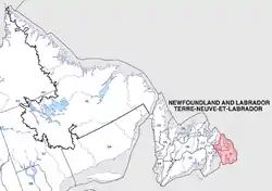
Tors Cove is a local service district and designated place in the Canadian province of Newfoundland and Labrador. It is on the east coast of the Avalon Peninsula of the island of Newfoundland, approximately 40 kilometres south of the St. John's, the provincial capital, along Route 10 (Irish Loop Drive/Southern Shore Highway). It was formerly named Toads Cove.[1]
Geography
Tors Cove is in Newfoundland within Subdivision U of Division No. 1.[2]
Demographics
As a designated place in the 2016 Census of Population conducted by Statistics Canada, Tors Cove recorded a population of 300 living in 136 of its 257 total private dwellings, a change of -33.2% from its 2011 population of 449. With a land area of 9.17 km2 (3.54 sq mi), it had a population density of 32.7/km2 (84.7/sq mi) in 2016.[3]
Economy
Throughout its history, its economy was sustained through the cod fishery and was the site of a codfish processing plant until the moratorium in 1991. It is also the site of a hydroelectric dam (located on Tors Cove pond) and power plant.
Attractions
Tors Cove is on the East Coast Trail.[4]
Government
Tors Cove is a local service district (LSD)[5] that is governed by a committee responsible for the provision of certain services to the community.[6] The chair of the LSD committee is Hannah Power.[5]
See also
References
- "Tors Cove". Co-production of Memorial University Folklore and Language Archive and the Research Centre for the Study of Music, Media and Place. Retrieved 23 April 2020.
- "Population and dwelling counts, for Canada, provinces and territories, census divisions, census subdivisions (municipalities) and designated places, 2016 and 2011 censuses – 100% data (Newfoundland and Labrador)". Statistics Canada. February 7, 2018. Retrieved December 23, 2021.
- "Population and dwelling counts, for Canada, provinces and territories, and designated places, 2016 and 2011 censuses – 100% data (Newfoundland and Labrador)". Statistics Canada. February 7, 2018. Retrieved December 22, 2021.
- "17. La Manche Village Path". East Coast Trail Association. Retrieved 23 April 2020.
- "Directory of Local Service Districts" (PDF). Government of Newfoundland and Labrador. October 2021. Retrieved January 1, 2022.
- "Local Service Districts – Frequently Asked Questions". Government of Newfoundland and Labrador. Retrieved January 1, 2022.
External links
- 18-minute video showing 11-year-old Julie O'Brien describing old times in the village National Film Board of Canada 1981
