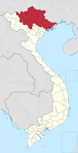
Tràng Định district
Tràng Định is a rural district of Lạng Sơn province in the Northeastern region of Vietnam. As of 2003, the district had a population of 62,869.[1] The district covers an area of 995 km2 (384 sq mi). The district capital lies at Thất Khê.[1]
Tràng Định District
Huyện Tràng Định | |
|---|---|
| Country | |
| Region | Northeast |
| Province | Lạng Sơn |
| Capital | Thất Khê |
| Area | |
| • Total | 384 sq mi (995 km2) |
| Population (2003) | |
| • Total | 62,869 |
| Time zone | UTC+7 (Indochina Time) |
Administrative divisions
1 town: Thất Khê
22 communes: Khánh Long, Đoàn Kết, Cao Minh, Tân Yên, Vĩnh Tiến, Tân Tiến, Bắc Ái, Kim Đồng, Chí Minh, Chi Lăng, Đề Thám, Hùng Sơn Hùng Việt, Kháng Chiến, Đại Đồng, Tri Phương, Quốc Khánh, Đội Cấn, Tân Minh, Trung Thành, Quốc Việt, Đào Viên
Climate
| Climate data for Thất Khê , Tràng Định District | |||||||||||||
|---|---|---|---|---|---|---|---|---|---|---|---|---|---|
| Month | Jan | Feb | Mar | Apr | May | Jun | Jul | Aug | Sep | Oct | Nov | Dec | Year |
| Record high °C (°F) | 31.0 (87.8) |
35.6 (96.1) |
36.8 (98.2) |
38.5 (101.3) |
39.6 (103.3) |
39.3 (102.7) |
38.7 (101.7) |
38.7 (101.7) |
37.5 (99.5) |
34.5 (94.1) |
33.8 (92.8) |
31.1 (88.0) |
39.6 (103.3) |
| Average high °C (°F) | 18.0 (64.4) |
19.5 (67.1) |
22.5 (72.5) |
27.3 (81.1) |
31.2 (88.2) |
32.4 (90.3) |
32.7 (90.9) |
32.4 (90.3) |
31.3 (88.3) |
28.4 (83.1) |
24.5 (76.1) |
20.6 (69.1) |
26.7 (80.1) |
| Daily mean °C (°F) | 13.6 (56.5) |
15.3 (59.5) |
18.6 (65.5) |
22.9 (73.2) |
26.0 (78.8) |
27.4 (81.3) |
27.6 (81.7) |
27.2 (81.0) |
25.8 (78.4) |
22.9 (73.2) |
18.9 (66.0) |
15.0 (59.0) |
21.8 (71.2) |
| Average low °C (°F) | 10.9 (51.6) |
12.8 (55.0) |
16.1 (61.0) |
19.9 (67.8) |
22.6 (72.7) |
24.2 (75.6) |
24.5 (76.1) |
24.2 (75.6) |
22.6 (72.7) |
19.6 (67.3) |
15.5 (59.9) |
11.6 (52.9) |
18.7 (65.7) |
| Record low °C (°F) | −1.8 (28.8) |
2.6 (36.7) |
3.4 (38.1) |
9.6 (49.3) |
13.9 (57.0) |
16.2 (61.2) |
19.2 (66.6) |
19.5 (67.1) |
14.4 (57.9) |
6.3 (43.3) |
2.4 (36.3) |
−1.4 (29.5) |
−1.8 (28.8) |
| Average precipitation mm (inches) | 39.1 (1.54) |
35.7 (1.41) |
57.3 (2.26) |
98.7 (3.89) |
193.4 (7.61) |
250.0 (9.84) |
250.8 (9.87) |
261.0 (10.28) |
142.5 (5.61) |
82.8 (3.26) |
49.1 (1.93) |
29.9 (1.18) |
1,487.8 (58.57) |
| Average rainy days | 10.9 | 10.5 | 13.2 | 12.5 | 12.3 | 14.7 | 15.1 | 15.3 | 10.7 | 8.0 | 7.2 | 7.2 | 139.4 |
| Average relative humidity (%) | 83.2 | 83.8 | 84.6 | 84.2 | 83.0 | 84.1 | 85.0 | 85.8 | 84.7 | 83.4 | 82.8 | 81.9 | 83.9 |
| Mean monthly sunshine hours | 60.4 | 53.5 | 54.6 | 93.1 | 152.3 | 148.7 | 168.2 | 173.7 | 164.6 | 139.4 | 120.3 | 108.6 | 1,435.8 |
| Source: Vietnam Institute for Building Science and Technology[2] | |||||||||||||
References
- "Districts of Vietnam". Statoids. Retrieved March 23, 2009.
- "Vietnam Institute for Building Science and Technology" (PDF). Retrieved 16 August 2023.
This article is issued from Wikipedia. The text is licensed under Creative Commons - Attribution - Sharealike. Additional terms may apply for the media files.
