1892 Atlantic hurricane season
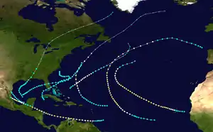
The 1892 Atlantic hurricane season occurred during summer and fall 1892. The season accumulated nine tropical storms, five hurricanes, but no major hurricanes. Three tropical storms made landfall on the United States. However, due to scarce technology and the fact that only storms that affected land or ships were recorded, the actual total could be higher.
| 1892 Atlantic hurricane season | |
|---|---|
 Season summary map | |
| Seasonal boundaries | |
| First system formed | June 9, 1892 |
| Last system dissipated | October 29, 1892 |
| Strongest storm | |
| Name | Three, Five, and Seven |
| • Maximum winds | 100 mph (155 km/h) (1-minute sustained) |
| Seasonal statistics | |
| Total storms | 9 |
| Hurricanes | 5 |
| Major hurricanes (Cat. 3+) | 0 |
| Total fatalities | 16 |
| Total damage | Unknown |
| Related article | |
Timeline

Systems
Tropical Storm One
| Tropical storm (SSHWS) | |
 | |
| Duration | June 9 – June 16 |
|---|---|
| Peak intensity | 50 mph (85 km/h) (1-min); ≤1005 mbar (hPa) |
The first tropical storm developed about 45 mi (70 km) south of Isla de la Juventud on June 9. Initially moving northwestward, the storm made landfall later that day on the south coast of Pinar del Río Province in Cuba. The storm recurved northward and entered the Gulf of Mexico early the following morning, where it intensified and peaked with maximum sustained winds of 50 mph (85 km/h). Around that time, it turned to the northeast and made landfall at 23:00 UTC on June 10 in northern Monroe County, Florida, at the same intensity. The cyclone crossed Florida and emerged into the Atlantic Ocean near modern-day Deerfield Beach early the following day. Thereafter, the system headed out to sea for a few days, before re-approaching the Southeastern United States. Late on June 16, it was last noted about 80 mi (130 km) south-southeast of Cape Lookout, North Carolina.[1]
In Cuba, moderately gusty winds and torrential rainfall were reported from Santa Clara to Pinar del Río, with the worst impact conditions being experienced in Matanzas. There, the San Juan and Yumurí rivers overflowed, causing water to rise 10 ft (3.0 m) above most houses. Civil guards and troops assisted rescue work and evacuation of residents.[2] Furniture in 325 houses were swept away by the floodwaters. About 450 head of cattle drowned. Additionally, 600,000 bags of sugar stored in warehouses were lost.[3] The storm left at least 16 deaths and approximately $1.5 million in damage.[2] The storm also brought winds and rains to Florida. In just a few hours, Hypoluxo recorded 3.6 in (91 mm), while Titusville measured 12.95 in (329 mm) over a period lasting six days.[4] In Jupiter, multiple trees were downed and severe damage was inflicted on crops.[2]
Hurricane Two
| Category 1 hurricane (SSHWS) | |
 | |
| Duration | August 15 – August 21 |
|---|---|
| Peak intensity | 75 mph (120 km/h) (1-min); |
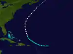
On August 15, a tropical storm was first seen in the open Atlantic east of the Leeward Islands. It tracked northwestward, becoming a hurricane on August 19 before becoming extratropical on August 21. The extratropical storm hit Newfoundland, and completely lost its identity on August 24.
Hurricane Three
| Category 2 hurricane (SSHWS) | |
 | |
| Duration | September 3 – September 17 |
|---|---|
| Peak intensity | 100 mph (155 km/h) (1-min); |
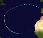
The third hurricane of the year was a long-lasting storm that formed southwest of the Cape Verde islands on September 3. The unnamed storm did not affect land, peaking at 100 mph (160 km/h) before dissipating northeast of the Azores islands near Spain on September 17.
Tropical Storm Four
| Tropical storm (SSHWS) | |
 | |
| Duration | September 8 – September 13 |
|---|---|
| Peak intensity | 60 mph (95 km/h) (1-min); |
On September 8, the fourth tropical storm formed in the southwestern Gulf of Mexico northwest of Campeche. After tracking to the northeast, it made landfalls near New Orleans, Louisiana, and near the Louisiana-Mississippi state lines as a moderate tropical storm. On September 13 the storm became extratropical over Tennessee, and lost its identity on September 17 near Greenland.
Hurricane Five
| Category 2 hurricane (SSHWS) | |
 | |
| Duration | September 12 – September 23 |
|---|---|
| Peak intensity | 100 mph (155 km/h) (1-min); |
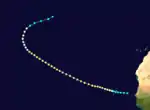
First recorded east of the Cape Verde Islands on September 12, the hurricane directly affected the islands without officially making landfall before dissipating in the open Atlantic near 37°N, 40°W on September 23. The next time a hurricane would affect the islands was in 2015, when Hurricane Fred made landfall.
Tropical Storm Six
| Tropical storm (SSHWS) | |
 | |
| Duration | September 25 – September 27 |
|---|---|
| Peak intensity | 60 mph (95 km/h) (1-min); |
The sixth tropical storm of the season was a very short-lived storm that was first recorded northwest of Ciudad del Carmen on September 25. The storm travelled northwest across the Bay of Campeche before making landfall near the Mexico-Texas border, dissipating inland on September 27.
Hurricane Seven
| Category 2 hurricane (SSHWS) | |
 | |
| Duration | October 5 – October 16 |
|---|---|
| Peak intensity | 100 mph (155 km/h) (1-min); |
Observations suggest the presence of a tropical storm about 290 mi (470 km) east of Tobago on October 5.[2] The storm moved generally westward and intensified into a hurricane as it passed just south of the island late the following day. Remaining over the far southern Caribbean, the hurricane passed near the ABC islands and then struck Paraguaná in Venezuela as a Category 2 hurricane with winds of 100 mph (155 km/h) on October 8. After briefly re-emerging into the Caribbean, the cyclone made landfall on the Guajira Peninsula several hours later. Thereafter, the system moved in a more west-northwesterly direction and then struck near Cabo Gracias a Dios on the Nicaragua–Honduras border on October 11. The storm weakened to a Category 1 hurricane while crossing Honduras, but re-strengthened into a Category 2 hurricane on October 12 after re-emerging into the Caribbean. Around 18:00 UTC that day, the hurricane made landfall just south of Belize City, British Honduras. Rapidly weakening to a tropical storm, the system soon re-strengthened into a hurricane after emerging into the Bay of Campeche about 24 hours later. The storm re-intensified into a Category 2 hurricane, but weakened to a Category 1 prior to making landfall south of Tampico, Tamaulipas, late on October 15. High terrain over eastern Mexico caused the system to dissipate early the next day.[1]
Heavy rainfall and strong winds lashed Trinidad on October 6 and October 7. Several interior streams overflowed,[2] causing a suspension of railroad service and leaving roads impassable. Port of Spain experienced a disruption of water services, while one death occurred in the city.[5] Offshore, five lighters sank.[2] The hurricane impacted Venezuela in the immediate aftermath of the Legalist Revolution, with the ousted former president hiding on Curaçao,[6] which reported rough seas.[2] La Guaira reportedly experienced its worst storm in 40 years due to landslides, destroying many homes. A railroad was also destroyed, while the city also lost communications with Caracas.[6] Approximately 800 men worked to remove dirt and other debris left by the landslide along the railroad tracks.[7] In Honduras, the storm caused significant damage to crops and banana plantations and demolished a number of residences. Several vessels capsized or went ashore,[8] including the schooner Stranger offshore Cabo Gracias a Dios, causing 16 deaths.[2] Some other ships sank at the Bay Islands, while many dwellings were destroyed on Roatán.[8] In Mexico, several ships went missing offshore Veracruz, where the storm also demolished many buildings.[2]
Hurricane Eight
| Category 1 hurricane (SSHWS) | |
 | |
| Duration | October 13 – October 17 |
|---|---|
| Peak intensity | 90 mph (150 km/h) (1-min); |
Ships encountered this cyclone between the Bahamas and Bermuda starting on October 13,[2] with the official track beginning about 240 mi (390 km) northeast of San Salvador Island. Several hours later, the storm intensified into a hurricane while moving northeastward. The hurricane peaked with maximum sustained winds of 90 mph (150 km/h) on October 14. While the system passed southeast of Bermuda on the following day,[1] wind gusts reached 73 mph (117 km/h) at Gibbs Hill Lighthouse. A tornado touched down on the eastern side of St. George's Island.[2] On October 16, the cyclone weakened to a tropical storm and gradually lost tropical characteristics, becoming extratropical late on the next day about 665 mi (1,070 km) south of Cape Race, Newfoundland.[1] The extratropical remnants generally continued northeastward until merging with another storm on October 20.[2]
Tropical Storm Nine
| Tropical storm (SSHWS) | |
 | |
| Duration | October 21 – October 29 |
|---|---|
| Peak intensity | 50 mph (85 km/h) (1-min); |
While weather reports first noted a low-pressure area over the central Gulf of Mexico on October 22,[2] the official track for this storm begins one day earlier. The storm intensified slightly while moving northeastward, peaking with maximum sustained winds of 50 mph (85 km/h) on October 22. Around 19:00 UTC on October 24, the cyclone made landfall just north of Bradenton, Florida, at the same intensity. The system then tracked east-northeastward and emerged into the Atlantic earlier on the following day near Melbourne. On October 26, the storm resumed a northeastward motion until being last noted approximately 340 mi (545 km) southeast of Nantucket, Massachusetts, early on October 29.[1]
The cyclone produced wind gusts of 50 mph (85 km/h) in New Orleans, Louisiana, and 45 mph (72 km/h) in Pensacola, Florida. Heavy rains also fell along portions of the South Atlantic coast.[2]
References
- "Atlantic hurricane best track (HURDAT version 2)" (Database). United States National Hurricane Center. April 5, 2023. Retrieved October 25, 2023.
 This article incorporates text from this source, which is in the public domain.
 - Jose Fernandez-Partagas (1996). Year 1892 (PDF). Atlantic Oceanographic and Meteorological Laboratory (Report). National Oceanic and Atmospheric Administration. Retrieved August 31, 2015.
- "Great Damage by Floods in Cuba". Chicago Tribune. Matanzas, Cuba. June 13, 1892. Retrieved August 31, 2015.
- Observed Rainfall in Florida, Monthly Totals from Beginning of Records to 31 December 1947. Tallahassee, Florida: Division of Water Survey and Research, State of Florida, State Board of Conservation. 1948.
- "Telegrams". St. Croix Avis. Christiansted, United States Virgin Islands. October 12, 1892. p. 3. Retrieved September 6, 2023 – via Newspapers.com.

- "Venezeula News". The Gazette. Montreal, Quebec. October 12, 1892. p. 1. Retrieved September 6, 2023 – via Newspapers.com.

- Rogelio Altez (March 2005). "Historia sin memoria: la cotidiana recurrencia de eventos desastrosos en el estado Vargas-Venezuela" (PDF). Revista Geográfica Venezolana (in Spanish). Mérida, Venezuela: Universidad de los Andes: 327. ISSN 1012-1617. Retrieved September 6, 2023.
- "Storm-Swept Honduras". The Helena Independent. October 24, 1892. p. 1. Retrieved September 6, 2023 – via Newspapers.com.
