Troy, Missouri
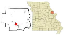
Troy is a city in Lincoln County, Missouri, United States. As of 2019, the estimated population was 12,820. It is the county seat of Lincoln County.[4] Troy is an exurb of St. Louis, and is part of the St. Louis Metropolitan Statistical Area.
Troy, Missouri | |
|---|---|
 Downtown Troy Historic District, August 2012 | |
 | |
| Coordinates: 38°58′15″N 90°58′17″W[1] | |
| Country | |
| State | |
| County | Lincoln |
| Government | |
| • Mayor | Ron Sconce |
| Area | |
| • Total | 7.76 sq mi (20.10 km2) |
| • Land | 7.72 sq mi (19.99 km2) |
| • Water | 0.04 sq mi (0.11 km2) |
| Elevation | 515 ft (157 m) |
| Population (2020) | |
| • Total | 12,686 |
| • Density | 1,643.48/sq mi (634.53/km2) |
| Time zone | UTC-6 (CST) |
| • Summer (DST) | UTC-5 (CDT) |
| ZIP code | 63379 |
| Area code | 636 |
| FIPS code | 29-73942[3] |
| GNIS feature ID | 2397062[1] |
| Website | cityoftroymissouri |
History
Troy was platted in 1819.[5] Some say the community was named after Troy, New York, while others believe the name is a transfer from Troy, Vermont.[6] An early variant name was Woods Fort.[7] A post office called Troy has been in operation since 1823.[8]
Historic sites
Fort Cap au Gris, a War of 1812 fortification, was built near Troy in 1814. Lincoln County Medical Center was established in Troy in 1953 under the Hill-Burton Memorial Hospitals Act, as Lincoln County Memorial Hospital. Cuivre River State Park, one of the largest of Missouri's state parks, lies approximately three miles to the northeast of Troy, across the Cuivre River valley.
The Downtown Troy Historic District was listed on the National Register of Historic Places in 2013.[9]
Geography
Troy is located two miles west of the Cuivre River. U.S. 61 passes the east side of the city and Missouri Route 47 passes through the north side.[10]
According to the United States Census Bureau, the city has a total area of 7.34 square miles (19.01 km2), of which 7.30 square miles (18.91 km2) is land and 0.04 square miles (0.10 km2) is water.[11]
Demographics
| Census | Pop. | Note | %± |
|---|---|---|---|
| 1860 | 611 | — | |
| 1870 | 703 | 15.1% | |
| 1880 | 703 | 0.0% | |
| 1890 | 971 | 38.1% | |
| 1900 | 1,153 | 18.7% | |
| 1910 | 1,120 | −2.9% | |
| 1920 | 1,116 | −0.4% | |
| 1930 | 1,419 | 27.2% | |
| 1940 | 1,493 | 5.2% | |
| 1950 | 1,738 | 16.4% | |
| 1960 | 1,779 | 2.4% | |
| 1970 | 2,538 | 42.7% | |
| 1980 | 2,624 | 3.4% | |
| 1990 | 3,811 | 45.2% | |
| 2000 | 6,737 | 76.8% | |
| 2010 | 10,540 | 56.4% | |
| 2020 | 12,686 | 20.4% | |
| U.S. Decennial Census | |||
2010 census
As of the census[12] of 2010, there were 10,542 people, 3,843 households, and 2,727 families living in the city. The population density was 1,443.8 inhabitants per square mile (557.5/km2). There were 4,141 housing units at an average density of 567.3 per square mile (219.0/km2). The racial makeup of the city was 92.5% White, 3.1% African American, 0.4% Native American, 0.7% Asian, 0.8% from other races, and 2.4% from two or more races. Hispanic or Latino of any race were 3.0% of the population.
There were 3,843 households, of which 43.6% had children under the age of 18 living with them, 50.5% were married couples living together, 14.8% had a female householder with no husband present, 5.6% had a male householder with no wife present, and 29.0% were non-families. 24.4% of all households were made up of individuals, and 10.1% had someone living alone who was 65 years of age or older. The average household size was 2.67 and the average family size was 3.16.
The median age in the city was 32.2 years. 30.5% of residents were under the age of 18; 7.7% were between the ages of 18 and 24; 30.4% were from 25 to 44; 19.6% were from 45 to 64; and 11.8% were 65 years of age or older. The gender makeup of the city was 47.4% male and 52.6% female.
2000 census
As of the census[3] of 2000, there were 6,737 people, 2,521 households, and 1,747 families living in the city. The population density was 1,134.5 inhabitants per square mile (438.0/km2). There were 2,661 housing units at an average density of 448.1 per square mile (173.0/km2). The racial makeup of the city was 93.87% White, 2.86% African American, 0.39% Native American, 0.13% Asian, 0.01% Pacific Islander, 0.80% from other races, and 1.93% from two or more races. Hispanic or Latino of any race were 1.71% of the population.
There were 2,521 households, out of which 39.8% had children under the age of 18 living with them, 51.6% were married couples living together, 14.6% had a female householder with no husband present, and 30.7% were non-families. 26.6% of all households were made up of individuals, and 12.5% had someone living alone who was 65 years of age or older. The average household size was 2.56 and the average family size was 3.10.
In the city, the population was spread out, with 29.8% under the age of 18, 9.2% from 18 to 24, 30.6% from 25 to 44, 16.4% from 45 to 64, and 14.0% who were 65 years of age or older. The median age was 32 years. For every 100 females, there were 87.1 males. For every 100 females age 18 and over, there were 83.7 males.
The median income for a household in the city was $40,332, and the median income for a family was $46,818. Males had a median income of $34,750 versus $24,440 for females. The per capita income for the city was $17,666. About 7.6% of families and 11.0% of the population were below the poverty line, including 13.4% of those under age 18 and 14.6% of those age 65 or over.
Education
Troy is home to Troy Buchanan High School, Troy Middle School, Troy South Middle School, Main Street Elementary, Boone Elementary School, Claude Brown Elementary, Cuivre Park Elementary, Lincoln County R-III Early Childhood Education Center, William Cappel Elementary School, and Lincoln Elementary School, all of which are part of the Lincoln County R-III School District
Troy does not have a public library. The Powell Memorial Library, is owned and operated by the Troy R-III School District.[13]
Notable people
- Frederick Gilmer Bonfils (1860–1933), publisher of the Denver Post
- Emily Crane (b. 1994) softball player
- Pendleton Dudley (1876-1966), journalist
- Pat Elzie (b. 1960) basketball coach
- David Hungate (b. 1948), musician, bass player
- William L. Hungate (1922–2007), congressman and federal judge
- Richard Alonzo Jaccard (1918–1942), Navy ensign who was awarded the Navy Cross
- Wilson McCoy (1902–1961), illustrator and painter
- Richard Henry Norton (1849-1918) Politician
- Randy Pietzman (b. 1961) politician
- DeAnna Price (b. 1993) American record holder in track and field in the hammer throw.
- Harley Race (1943–2019), retired professional wrestler
- Ed Schieffer (b. 1949) politician
- Nathaniel Simonds (1775–1850), state treasurer of Missouri (1821–1829)
- May Bonfils Stanton (1883-1962) heiress and philanthropist
- Dennis Tankersley (b. 1979), baseball player
References
- U.S. Geological Survey Geographic Names Information System: Troy, Missouri
- "ArcGIS REST Services Directory". United States Census Bureau. Retrieved August 28, 2022.
- "U.S. Census website". United States Census Bureau. Retrieved January 31, 2008.
- "Find a County". National Association of Counties. Retrieved June 7, 2011.
- Eaton, David Wolfe (1916). How Missouri Counties, Towns and Streams Were Named. The State Historical Society of Missouri. pp. 186.
- "Lincoln County Place Names, 1928–1945 (archived)". The State Historical Society of Missouri. Archived from the original on June 24, 2016. Retrieved October 29, 2016.
- "Disappearing Missouri Names". The Kansas City Star. March 19, 1911. p. 15. Retrieved August 15, 2014 – via Newspapers.com.

- "Post Offices". Jim Forte Postal History. Retrieved October 29, 2016.
- "National Register of Historic Places Listings". Weekly List of Actions Taken on Properties: 10/28/13 through 11/01/13. National Park Service. November 8, 2013.
- Missouri Atlas & Gazetteer, DeLorme, 1998, First edition, p. 40, ISBN 0-89933-224-2
- "US Gazetteer files 2010". United States Census Bureau. Archived from the original on July 2, 2012. Retrieved July 8, 2012.
- "U.S. Census website". United States Census Bureau. Retrieved July 8, 2012.
- "Missouri Public Libraries". PublicLibraries.com. Archived from the original on June 10, 2017. Retrieved June 5, 2019.
External links
- Official website
- Historic maps of Troy in the Sanborn Maps of Missouri Collection at the University of Missouri
Municipalities and communities of Lincoln County, Missouri, United States | ||
|---|---|---|
| Cities | 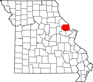 Map of Missouri highlighting Lincoln County | |
| Villages | ||
| Townships | ||
| Unincorporated communities | ||
| Ghost towns | ||