Trường Sa district
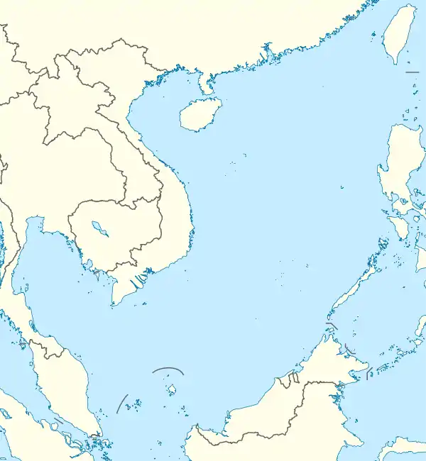
Trường Sa is an island district of Khánh Hòa province in the South Central Coast region of Vietnam.[2] It was established on the basis of the Spratly Islands (except Louisa Reef, Luconia Shoals and James Shoal),[3][4][5][6][7] which is also claimed wholly or in part by Brunei, China, Malaysia, the Philippines and Taiwan. According to the 2009 census, the district has a population of 195 people.[8]
Trường Sa district
Huyện đảo Trường Sa | |
|---|---|
| Trường Sa Island District | |
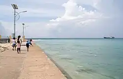
 Children playing on the beach of Trường Sa | |
 Trường Sa district | |
| Coordinates: 8°38′30″N 111°55′55″E | |
| Country | |
| Region | South Central Coast |
| Province | Khánh Hòa |
| Government | |
| • Chairman of People's Committee | Nguyễn Viết Thuân[1] |
| Area | |
| • Total | 192 sq mi (496 km2) |
| Population (2009) | |
| • Total | 195 |
| • Density | 1.0/sq mi (0.39/km2) |
| Time zone | UTC+7 (Indochina Time) |
| Area code | 58 |
Geography
Trường Sa district was established on the basis of small coral islands/cays, reefs and banks of the Spratly Islands which are 248 nautical miles (459 km; 285 mi) south east of Cam Ranh. As the islands contain a large number of scattered geographic entities, the district is divided into eight clusters including Song Tử, Thị Tứ, Loại Ta, Nam Yết, Sinh Tồn, Trường Sa, Thám Hiểm and Bình Nguyên by Vietnam.[9]
Administrative history in the 20th century
- By the early 1930s, France had claimed the Spratly Islands. On 21 December 1933, Cochinchina's governor Jean-Félix Krautheimer signed Decree No. 4702-CP annexing Spratly Island, Amboyna Cay, Itu Aba Island, Northeast Cay, Southwest Cay, Thitu Island, Loaita Island and subsidiary islands into Bà Rịa province.[10]
- On 22 October 1956, Republic of Vietnam's President Ngô Đình Diệm signed Decree No. 143-NV renaming provinces of South Vietnam. According to this decree, Bà Rịa–Vũng Tàu was renamed to Phước Tuy province under which the Spratly Islands was administered.[9]
- On 6 September 1973, the Republic of Vietnam's Ministry of the Interior signed Decree No. 420-BNV/HCĐP/26 merging Spratly Island, Amboyna Cay, Itu Aba Island, Northeast Cay, Southwest Cay, Loaita Island, Thitu Island, Namyit Island, Sin Cowe Island and the surrounding islands into Phước Hải Commune, Đất Đỏ district, Phước Tuy province.[11]
- On 9 December 1982, the Council of Ministers of the Socialist Republic of Vietnam issued Decision No. 193/HĐBT establishing Trường Sa District as an administrative unit of Đồng Nai Province.[12] On December 28, 1982, The Seventh National Assembly decided to incorporate Trường Sa District into Phú Khánh Province.[13]
- On 1 July 1989, the National Assembly split Phú Khánh Province into Phú Yên province and Khánh Hòa province. Trường Sa district has been under the direct administration of Khánh Hòa since then.
Administration
According to Decree No. 65/2007/NĐ-CP of 11 April 2007 issued by the Government of the Socialist Republic of Vietnam, Trường Sa district has three administrative units including one commune-level town (Trường Sa) and two rural communes (Song Tử Tây and Sinh Tồn).
- Trường Sa Township was established on the basis of Trường Sa Island (Spratly Island) and surrounding islands, reefs and banks.
- Song Tử Tây Commune was established on the basis of Song Tử Tây island (Southwest Cay) and surrounding islands, reefs and banks.
- Sinh Tồn Commune was established on the basis of Sinh Tồn Island (Sin Cowe Island) and surrounding islands, reefs and banks.
In reality, Trường Sa district is effectively administering only 21 islets and reefs of the Spratly Islands:
| Cluster | Coral islands/cays | Reefs | Map |
|---|---|---|---|
| Song Tử | Southwest Cay (đảo Song Tử Tây) | South Reef (đá Nam) |  |
| Thị Tứ | - | - | |
| Loại Ta | - | - | |
| Nam Yết | Namyit Island (đảo Nam Yết), Sand Cay (đảo Sơn Ca) | Discovery Great Reef (đá Lớn), Petley Reef (đá Núi Thị) | |
| Sinh Tồn | Sin Cowe Island (đảo Sinh Tồn), Grierson Reef (đảo Sinh Tồn Đông)[Notes 1] | Collins Reef/Johnson North Reef (đá Cô Lin), Lansdowne Reef (đá Len Đao) | |
| Trường Sa | Spratly Island (đảo Trường Sa), Pearson Reef (đảo Phan Vinh),[Notes 2] Central London Reef (đảo Trường Sa Đông)[Notes 3] | East London Reef (đá Đông), Ladd Reef (đá Lát), Cornwallis South Reef (đá Núi Le), West London Reef (đá Tây), Pigeon Reef/Tennent Reef (đá Tiên Nữ), Alison Reef (đá Tốc Tan) | |
| Thám Hiểm | Amboyna Cay (đảo An Bang) | Barque Canada Reef (đá Thuyền Chài) | |
| Bình Nguyên | - | - |

_S2-2022.jpg.webp)

_S2-2023.jpg.webp)
Population
According to statistics on April 1, 2009, the population of Truong Sa district is 195 people, of which Truong Sa town area is 82 people.[14]
According to statistics dated April 1, 2019, the population of Truong Sa district is 93 people, of which Truong Sa town area is 30 people.[15]
In the Spratly Islands (the part controlled by Vietnam), there are only 4 islands with permanent inhabitants, which are Spratly Island, West Reef East Island, Sin Cowe Island, and Southwest Cay. The remaining islands reward only naval troops stationed.
Transport
The Truong Sa District is served by Truong Sa Airport located on Spratly Island (Truong Sa Lon Island). It was originally 550 m long, then expanded to 1,200 m as it is today.
In Truong Sa town (district capital), island communes, island points have piers. The islands inhabited by civilians such as Spratly Island (Truong Sa Lon Island), West Reef East Island (Da Tay A Island), Southwest Cay (Song Tu Tay Island), Sin Cowe Island (Sinh Ton Island) all have large locks for ships to anchor to avoid storms. New locks are also being built on the islands in the accretion phase from the end of 2021, including Namyit Island (Nam Yet Island), Sand Cay (Son Ca Island), and Phan Vinh Island.
Education
Truong Sa island district has 4 primary schools on the islands: Spratly Island, Southwest Cay, Sin Cowe Island and West Reef East Island accepting students from kindergarten to grade 5. Students who want to study at higher levels must enter the school. mainland for further study.[16]
Telecommunication
Viettel Group has installed a number of broadcasting stations in Truong Sa island district. The coverage of the stations is 20 km from the islands/atolls and also allows wireless Internet access with 2.75G EDGE technology.[17]
See also
Notes
References
- (in Vietnamese) Chủ tịch huyện đảo Trường Sa vào bệnh viện chăm vợ con
- (in Vietnamese) "Nghị định số 65/2007/NĐ-CP". Ministry of Justice's Portal (Vietnam). Archived from the original on June 22, 2013. Retrieved December 20, 2012.
- Dzurek, Daniel J. (1996). The Spratly Islands Dispute: Who's on First?. Maritime Briefings. Vol. 2. International Boundaries Research Unit, University of Durham. p. 4. ISBN 978-1897643235.
- Bản đồ Hành chính Việt Nam (tỉ lệ xích 1:2200000). Nhà xuất bản Bản đồ (2008)
- "Bản đồ hành chính. Phần bản đồ hành chính tỉnh Khánh Hoà, huyện Trường Sa". Cổng Thông tin điện tử Chính phủ (Việt Nam).
- Hancox, David; Prescott, Victor (1995). A Geographical Description of the Spratly Islands and an Account of Hydrographic Surveys amongst Those Islands. Maritime Briefings. Vol. 1. International Boundaries Research Unit, University of Durham. p. 21. ISBN 9781897643181.
- "Tập hợp kết quả giải quyết, trả lời kiến nghị của cử tri gửi tới kỳ họp thứ hai - Quốc hội khóa XIV. 11 - Ủy ban Đối ngoại". 24 May 2017. Retrieved 28 August 2018.
- "The 2009 Vietnam Population and Housing census: Completed results". General Statistics Office of Vietnam. Retrieved December 20, 2012.
- (in Vietnamese) Nguyễn, Nhã (2002). Quá trình xác lập chủ quyền của Việt Nam tại quần đảo Hoàng Sa và Trường Sa [The Process of Establishing the Sovereignty of Vietnam over the Hoang Sa and Trường Sa Islands] (Thesis). University of Social Science and Humanities (Vietnam National University, Ho Chi Minh City). p. 109.
- "Truong Sa archipelago belongs to Ba Ria province (1933)". Website on Viet Nam's sovereign boundaries, The National Boundary Commission, Ministry of Foreign Affairs (Vietnam). December 21, 1933. Archived from the original on March 17, 2012. Retrieved December 20, 2012.
- "A number historical and juridical documents on Vietnam's sovereignty over the Trường Sa and Hoang Sa archipelagoes- Part 3". Authority of Foreign Information Service, Ministry of Information and Communications (Vietnam). October 21, 2011. Archived from the original on November 27, 2012. Retrieved December 20, 2012.
- (in Vietnamese) "Quyết định của Hội đồng Bộ trưởng số 193/HĐBT ngày 9 tháng 12 năm 1982 về việc thành lập huyện Trường Sa thuộc tỉnh Đồng Nai". Dong Nai Province's Electronic Portal (Vietnam). Retrieved December 20, 2012.
- (in Vietnamese) "Nghị quyết của Quốc hội Nước CHXHCN Việt Nam ngày 28 tháng 12 năm 1982 về việc sáp nhập huyện Trường Sa thuộc tỉnh Đồng Nai vào tỉnh Phú Khánh". Ministry of Justice's Portal (Vietnam). Retrieved December 20, 2012.
- "Kết quả toàn bộ Tổng điều tra Dân số và Nhà ở Việt Nam năm 2009". Tổng cục Thống kê (Việt Nam). Retrieved 2012-09-02.
- Ban chỉ đạo Tổng điều tra dân số và nhà ở trung ương. "Dân số đến 01 tháng 4 năm 2019 - tỉnh Khánh Hòa". Retrieved 2020-08-19.
- "Trồng người nơi muôn trùng sóng". Báo điện tử Đảng Cộng Sản Việt Nam (in Vietnamese). 2023-05-30. Retrieved 2023-07-05.
- Văn Phong (2011-04-25). "Sóng di động nối gần Trường Sa với đất mẹ". Báo điện tử Quân đội Nhân dân. Archived from the original on 2012-10-27. Retrieved 2012-10-25.Lưu trữ bởi WebCite® tại.
