Dakpa Sheri
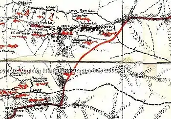
Dakpa Sheri[lower-alpha 2] (Tibetan: དག་པ་ཤེལ་རི, Wylie: dag pa shel ri, THL: dak pa shel ri,[6] Chinese: 达瓜西热; pinyin: Dá guā xī rè), explained as "Pure Crystal Mountain" and also known as Tsari (Tibetan: རྩ་རི, Wylie: rtsa ri), is a mountain in the eponymously named Tsari region in Lhöntse County of Tibet's Shannan Prefecture. The mountain is considered sacred for Tibetans and the pilgrimage route circumambulates the mountain.[3][7] Takpa Siri ridge consists of four hills/ passes and four water bodies.[3][8]
| Dakpa Sheri | |
|---|---|
| Tsari, Pure Crystal Mountain | |
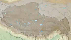
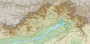
 Dakpa Sheri Location in Tibet AR  Dakpa Sheri Dakpa Sheri (Arunachal Pradesh) | |
| Highest point | |
| Elevation | 5,735 m (18,816 ft)[1] |
| Coordinates | 28°36′03″N 93°13′35″E[lower-alpha 1] |
| Naming | |
| Native name |
|
| Geography | |
| Country | China |
| Region | Tibet |
| Parent range | Himalayas |

Following border tensions between China and India, the pilgrimage was stopped after 1956.[9]
Etymology
Dakpa Sheri is usually classified as a néri (né–ri, abode–mountain) with the word "abode" being used in reference to deities. The Néri can be seen as the focus of Tibetan worship or kora.[10]
The word Tsari (Tsa-ri) has been used for both the geographical area surrounding Dakpa Sheri as well as the mountain itself. Tsa is a consonant of the Tibetan script while ri means 'mountain'.[11]
Variations include rTsá-ri which is explained as "Psychic Energy Channel Mountain", rTsa-ba which is explained as ''Foundation Mountain", Tswa-ri is explained as "Herb Mountain" and Tsa-ri rTswa-gon is "Superior Herb Psychic Energy Channel Mountain". The variation Tsa-ri-tra is a transliteration of the Sanskrit word Cáritra.[11]
Exploration
F. M.Bailey, H. T. Morshead, F. Ludlow, F. Kingdon-Ward have written about the mountain and the pilgrimage. In 1999, Toni Huber published his thesis on The Cult of the Pure Crystal Mountain.[9]
Geography
According to the Indian official T. S. Murty, Dakpa Sheri is located on the water-parting line of the Yume Chu and Pindigo rivers.[12] Both the rivers are tributaries of the Subansiri River near the China–India Line of Actual Control, with Yume Chu being on the Chinese side and the Pindigo river on the Indian side.
Ningkor and Ringkor pilgrimages
Tibetan Buddhists consider Tsari sacred, in the same league with Mount Kailash.[13] Dakpa Sheri is regarded so sacred that its circumambulation is believed to derive as much merit as the circumambulation of Mount Kailas.[14]
The circumambulation of the Dakpa Sheri (Takpa Siri or Tsari) is of two types: the Tsari Ningkor (transl. Tsari pilgrimage) and the Tsari Ringkor. Tsari Ningkor is annual while the longer Tsari Ringkor (also called the Rongkor Chenmo[15]) is twelve yearly. The Dakpa Sheri mountain attracts annual pilgrims who circle it over 3 days, passing through seven steep mountain passes. In addition, there is a larger pilgrimage that takes place once every 12 years that goes through the tribal territory of Assam Himalaya. It goes down to the confluence with the Subansiri river (Chayul Chu river). Then it follows Chayul Chu upstream and later Yume Chu, to return to the starting point at Chösam. The last Ringkor was in 1956. The next one due in 1968 as well as successive pilgrimages have not occurred due to border tensions between China and India. The pilgrimage is sometimes done along with a visit to the Tso Karpo or the Tsari Sarpa. These are respectively called the Tsari Nyingpa (transl. old Tsari) and the Tsari Sarpa (transl. new Tsari).[4][16] Before Tibet was anneed by China, the Migyitun (presently administered by China) town use to play a central role in the longer 12 year-pilgrimage. Tibetan officials and pilgrims numbering about 20,000 assembled in the town to make arrangements for the pilgrimage.[17]
In order to induce the Assam Himalayan tribes (Tagin tribe) to allow unmolested passage to the pilgrims, the Tibetan government use to give lavish presents to them.[14] Before the annexation of Tibet by China, Longju was outside of Tibet, it was south of the Tibetan frontier town of Migyitun, along the Tsari Chu river valley. The area was historically populated by the Mara clan of the Tagin tribe of Arunachal Pradesh.[18] The border between Tibet and tribal territory was at the Mandala Plain just outside the town of Migyitun.[19] There was a crossing on the river from its left bank to the right bank near Longju,[20] which was needed to enter the Tagir tribal territory from the Tibetan. When Bailey and Morshead visited the area in 1905, they found the bridge broken. The Tibetans were unable to repair it because it was built using the tribal materials and techniques. Evidently the Tibetan authority stopped at Migyitun.[21][22]
Notes
References
- Huber 1999, p. 95.
- Rose & Fisher (1967), p. 9.
- Kapadia, Harish (2006). "Secrets of Subansiri: Himalayan Journal vol.62/7". Himalayan Journal. Archived from the original on 2016-03-22. Retrieved 2021-01-23.
- Murthy 1971, p. 536–537.
- Huber 1999, p. 22.
- Huber (1999), p. 222.
- Sondheimer, Ernst (2006). "Tsari: Himalayan Journal vol.62/6". Himalayan Journal. Archived from the original on 2016-03-22. Retrieved 2021-01-23.
- Arpi, Claude (21 January 2021). "Chinese village in Arunachal: India must speak up!". Rediff. Retrieved 23 January 2021.
- "In Search of the old Pilgrimage Route to Takpa Siri 2005". Indian Mountaineering Foundation. 2004. Archived from the original on 2021-01-29. Retrieved 2021-01-23.
- Huber 1999, p. 22–23.
- Huber (1999), p. 82–83.
- Murthy 1971, p. 537. Takpo Shar-ri is a peak on the Yume-Pindigo water-parting.
- Arpi 2020, p. 9–10.
- Claude Arpi, The Pure Crystal Mountain Pilgrimage of Tsari, extract from 1962: The McMahon Line Saga, posted 25 June 2014.
- Arpi 2020, p. 10.
- Rose & Fisher, The North-East Frontier Agency of India (1967), p. 9.
- Mehra, The McMahon Line and After (1974), p. 229.
- The Chinese Village in Arunachal: India Must Speak Up!, Indian Defence Review, 22 January 2021.
- Huber (1999), p. 170: "It was there on August 26, 1959, that the very first violent conflict in the Sino-Indian dispute over the McMahon line erupted, as a Chinese force of two to three hundred crossed the traditional border at mandala Plain and drove out Indian frontier troops stationed at the advance post of Longju in the lower Tsari valley."
- Rose & Fisher (1967), p. 10.
- Rose & Fisher (1967), p. 9: "Bailey has left no doubt that Tibetan authority stopped at the frontier town of Migyitun. He wished to cross to the Indian side but was unable to do so. The cane bridge across the Tsari had been destroyed, and when he asked the Tibetans to rebuild it, they insisted that they lacked the skill for a bridge of that type"
- Bailey (1957), p. 203: "Morshead went further down the river to see what prospect there was of exploring the No Man's Land. But four miles down he came on the ruins of a foot-bridge over to the right bank and could get no further. It was one of the Mishmi type, five long strands of cane bound at intervals with hoops. The Tibetans had tried to build another, but they lacked the skill of the Lopas."
- Bibliography
- Bailey, F. M. (1957). No Passport To Tibet.
- Huber, Toni (1999), The Cult of Pure Crystal Mountain: Popular Pilgrimage and Visionary Landscape in Southeast Tibet, Oxford University Press, ISBN 978-0-19-535313-6
- Rose, Leo E.; Fisher, Margaret W. (1967), The North-East Frontier Agency of India, Near and Middle Eastern Series, vol. 76, Office of Public Affairs, Department of State
- Mehra, Parshotam (1974), The McMahon Line and After: A Study of the Triangular Contest on India's North-eastern Frontier Between Britain, China and Tibet, 1904-47, Macmillan
- Murthy, T. S. (April–June 1971). "The Eastern Himalayas in Sino-Indian Relations" (PDF). IDSA Journal: 536–538. Retrieved 9 February 2021.
Murty was Political Officer of Tawang during 1956–61
- Arpi, Cluade (2020), Tibet in the India-China Relations: A possible way ahead. The Monkey Year and the Pure Crystal Mountain Pilgrimage. (PDF), pp. 9–17
- Rose, Leo E.; Fisher, Margaret W. (1967), The North-East Frontier Agency of India, Near and Middle Eastern Series, vol. 76, Office of Public Affairs, Department of State