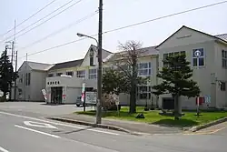
Tsubetsu, Hokkaido
Tsubetsu (津別町, Tsubetsu-chō) is a town located in Okhotsk Subprefecture, Hokkaido, Japan.
Tsubetsu
津別町 | |
|---|---|
Town | |
 Tsubetsu town | |
 Flag  Seal | |
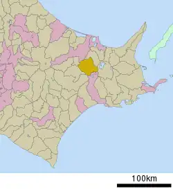 Location of Tsubetsu in Hokkaido (Okhotsk Subprefecture) | |
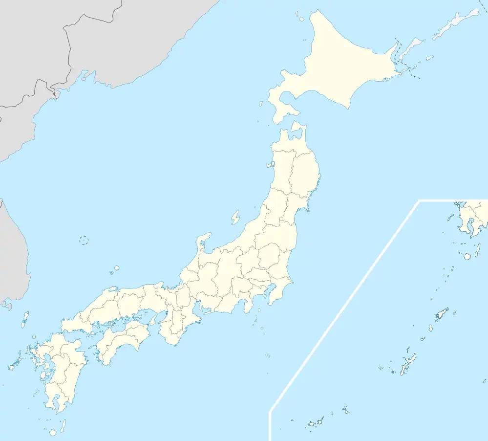 Tsubetsu Location in Japan | |
| Coordinates: 43°42′N 144°2′E | |
| Country | Japan |
| Region | Hokkaido |
| Prefecture | Hokkaido (Okhotsk Subprefecture) |
| District | Abashiri |
| Government | |
| • Mayor | Taichi Satō |
| Area | |
| • Total | 716.60 km2 (276.68 sq mi) |
| Population (September 30, 2016) | |
| • Total | 5,011 |
| • Density | 7.0/km2 (18/sq mi) |
| Time zone | UTC+09:00 (JST) |
| City hall address | 41 Aza Sachimachi, Tsubetsu-chō, Abashiri-gun, Hokkaidō 092-0292 |
| Climate | Dfb |
| Website | www |
| Symbols | |
| Flower | Lily of the Valley |
| Tree | Jezo Spruce |
As of September 2016, the town has an estimated population of 5,011 and a population density of 7 persons per km2. The total area is 716.60 km2.
History
- 1919: Tsubetsu Village founded, split from Bihoro Village (now Town).
- 1921: Part of Bihoro Village incorporated.
- 1946: Tsubetsu Village becomes Tsubetsu Town.
Climate
| Climate data for Tsubetsu (1991−2020 normals, extremes 1988−present) | |||||||||||||
|---|---|---|---|---|---|---|---|---|---|---|---|---|---|
| Month | Jan | Feb | Mar | Apr | May | Jun | Jul | Aug | Sep | Oct | Nov | Dec | Year |
| Record high °C (°F) | 9.5 (49.1) |
11.7 (53.1) |
16.4 (61.5) |
31.1 (88.0) |
38.0 (100.4) |
36.7 (98.1) |
37.1 (98.8) |
37.7 (99.9) |
32.7 (90.9) |
26.7 (80.1) |
20.8 (69.4) |
15.3 (59.5) |
38.0 (100.4) |
| Average high °C (°F) | −2.3 (27.9) |
−1.5 (29.3) |
3.2 (37.8) |
10.8 (51.4) |
17.5 (63.5) |
21.2 (70.2) |
24.6 (76.3) |
25.4 (77.7) |
21.7 (71.1) |
15.6 (60.1) |
7.8 (46.0) |
0.5 (32.9) |
12.0 (53.7) |
| Daily mean °C (°F) | −8.5 (16.7) |
−7.9 (17.8) |
−2.3 (27.9) |
4.7 (40.5) |
10.8 (51.4) |
15.0 (59.0) |
18.8 (65.8) |
19.8 (67.6) |
15.7 (60.3) |
9.1 (48.4) |
2.2 (36.0) |
−5.4 (22.3) |
6.0 (42.8) |
| Average low °C (°F) | −15.3 (4.5) |
−15.3 (4.5) |
−8.6 (16.5) |
−1.2 (29.8) |
4.6 (40.3) |
9.5 (49.1) |
14.0 (57.2) |
15.2 (59.4) |
10.4 (50.7) |
3.2 (37.8) |
−3.1 (26.4) |
−11.5 (11.3) |
0.2 (32.3) |
| Record low °C (°F) | −28.0 (−18.4) |
−28.7 (−19.7) |
−21.6 (−6.9) |
−14.4 (6.1) |
−4.1 (24.6) |
−0.7 (30.7) |
4.1 (39.4) |
5.9 (42.6) |
0.6 (33.1) |
−5.8 (21.6) |
−17.0 (1.4) |
−24.0 (−11.2) |
−28.7 (−19.7) |
| Average precipitation mm (inches) | 41.6 (1.64) |
28.5 (1.12) |
33.4 (1.31) |
48.0 (1.89) |
56.3 (2.22) |
65.7 (2.59) |
90.7 (3.57) |
126.7 (4.99) |
122.2 (4.81) |
79.4 (3.13) |
45.2 (1.78) |
49.5 (1.95) |
787.1 (30.99) |
| Average snowfall cm (inches) | 126 (50) |
108 (43) |
99 (39) |
22 (8.7) |
2 (0.8) |
0 (0) |
0 (0) |
0 (0) |
0 (0) |
0 (0) |
15 (5.9) |
107 (42) |
480 (189) |
| Average rainy days | 9.6 | 7.4 | 9.3 | 9.3 | 9.8 | 10.2 | 11.4 | 12.2 | 11.4 | 9.2 | 8.0 | 9.4 | 117.2 |
| Average snowy days | 12.5 | 11.5 | 11.1 | 2.2 | 0.2 | 0 | 0 | 0 | 0 | 0 | 1.8 | 10.2 | 49.5 |
| Mean monthly sunshine hours | 124.2 | 134.5 | 164.2 | 164.5 | 173.6 | 160.6 | 157.5 | 152.1 | 150.8 | 160.7 | 137.1 | 130.9 | 1,810.9 |
| Source 1: JMA[1] | |||||||||||||
| Source 2: JMA[2] | |||||||||||||
Mascot

Maruta-kun, the town's mascot
Tsubetsu's mascot is Maruta-kun (まる太くん). He is an honest and energetic mizunara wood log bear kamuy who likes to play rugby. As such, he trains rugby players from all over the world.[3][4]
References
- 観測史上1~10位の値(年間を通じての値). JMA. Retrieved February 18, 2022.
- 気象庁 / 平年値(年・月ごとの値). JMA. Retrieved February 18, 2022.
- "まる太くん班 成果報告" (PDF). Tsubetsu.
- "まる太くん (北海道)". Yuru-Chara Grand Prix.
External links
 Media related to Tsubetsu, Hokkaidō at Wikimedia Commons
- Official Website (in Japanese)
| ||||||||||||
| ||||||||||||
| ||||||||||||
| ||||||||||||
| ||||||||||||
| ||||||||||||
| ||||||||||||
| ||||||||||||
| ||||||||||||
| ||||||||||||
| ||||||||||||
| ||||||||||||
| ||||||||||||
| ||||||||||||
This article is issued from Wikipedia. The text is licensed under Creative Commons - Attribution - Sharealike. Additional terms may apply for the media files.