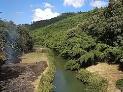
Tuirini
The Tuirini is a river of Mizoram, northeastern India.[1] a 42 MW Hydel project is being planned in Tuirini River.[2]
| Tuirini River | |
|---|---|
 | |
| Location | |
| Country | India |
| State | Mizoram, Assam |
| Cities | Aizawl, Lunglei |
| Physical characteristics | |
| Source | |
| • elevation | 1,060 m (3,480 ft) |
| Mouth | |
• location | Hmangkawn |
• elevation | 1,060 m (3,480 ft) |
| Length | 54.5 km (33.9 mi) |
Geography
The river is about 54.5 kilometres (33.9 mi) long. It originates from Hmangkawn Village in Aizawl District. It flows northward to join the Tuirial River Northwest of Seling. It is about 55 km from Aizawl.[3]
References
- Prasad, Ram Narayan; Agarwal, Ashok Kumar (2003). Modernisation of the Mizo Society: Imperatives and Perspectives. Mittal Publications. p. 86. ISBN 978-81-7099-889-1. Retrieved 8 August 2012.
- "Independence Day ropui taka lawm a ni". Vanglaini. Retrieved 3 December 2018.
- "3.1.2 Tuirini watershed" (PDF). Shodhganga. Retrieved 27 November 2018.
This article is issued from Wikipedia. The text is licensed under Creative Commons - Attribution - Sharealike. Additional terms may apply for the media files.