Ty'n-y-bryn quarry
Ty'n-y-bryn quarry (also known as Bwlch y Llan quarry or Lledr Vale quarry) was a slate quarry that was worked from the 1840s to about 1914.[4] It stands on the south-east edge of Dolwyddelan.
 The lower slate tips of Ty'n-y-bryn quarry | |
| Location | |
|---|---|
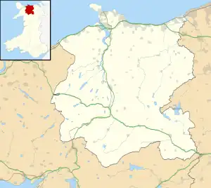
 Ty'n-y-bryn Location in Conwy | |
| Location | near Dolwyddelan |
| County | Carnarvonshire[1] (now Conwy County Borough) |
| Country | Wales, UK |
| Coordinates | 53.051124°N 3.877559°W[2] SH 742 521 |
| Production | |
| Products | Slate |
| Type | Quarry |
| History | |
| Opened | 1840s |
| Active | 1840s–?; 1861–1914; 1920–1924 |
| Closed | 1924 |
History


The original workings at Ty'n-y-bryn were started in the 1840s. In 1861, the quarry was restarted and a large mill was built just behind the Pentre-bont houses on the edge of Dolwyddelan. The mill had a large waterwheel which was fed from the Llyn Cwm-penamnen reservoir about 1 mile (1.6 km) to the south.[5]
In 1875, the Penllyn quarry was taken over by the company. Penllyn had been worked on a small scale since at least 1873,[6] and was immediately to the east of Ty'n-y-bryn. The Ty'n-y-bryn mill processed slate from both quarries. In 1879, an incline was built down from the mill level to exchange sidings at Dolwyddelan railway station. Unusually, the incline was laid as standard gauge, allowing wagons from the London and North Western Railway to be taken up to the mill. It was one of only four slate quarries in North Wales that had standard gauge railway laid directly to its mill.[5]
Quarrying at the quarry ended in 1914.[4] There was an attempt to restart Penllyn, again using the Ty'n-y-bryn mill, in 1920. This lasted until 1924, when all work ceased.[5]
Geology
The quarry worked slate from the Nod Glas Formation, which outcrops along the Lledr Valley. Through most of its length, the Nod Glas is black shale, but in the area around Dolwyddelan a syncline compressed the shales and it developed enough cleavage to be worked as slate.[7]
References
- "'53.051,-3.878' search on Wikishire". wikishire.co.uk. Retrieved 19 December 2020.
- "Ty'n-y-bryn Slate Quarry (420114)". Coflein. RCAHMW. Retrieved 6 October 2019.
- "Ty'n-y-bryn Slate Quarry (420114)". Coflein. RCAHMW. Retrieved 6 October 2019.
- Richards, Alun John (1999). The Slate Regions of North and Mid Wales and Their Railways. Gwasg Carreg Gwalch. ISBN 978-0-86381-552-2.
- Robinson, Iain (8 March 2013). "Ty'n y Bryn - A Gwydir Slate Quarry". Robinson Maps. Retrieved 14 September 2019.
- "Dolyddelen quarries". North Wales Journal. 21 March 1873.
- Brenchley, P. J. (2006). The Geology of England and Wales. Geological Society of London. pp. 68–. ISBN 978-1-86239-200-7.